
| ||||||||||||||||||||||||||||||||||||||||||||||||||||||||||||||||||||
| ||||||||||||||||||||||||||||||||||||||||||||||||||||||||||||||||||||
| ||||||||||||||||||||||||||||||||||||||||||||||||||||||||||||||||||||
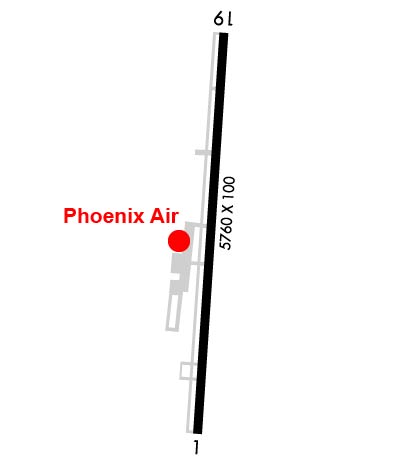
| Rwy | Rwy | |||||||
| 5760x100 | 5020' | 5760x100 | 5760' | 110.35 - 187° | ||||
| Runway ID | Single Wheel | Double Wheel | Double Tandem Wheel | Dual Double Wheel |
| 01/19 | 26,000 | N/A | N/A | N/A |
| These numbers are Advisory and are not limits. The Airport Manager should have more accurate Weight Limits | ||||
 Airport Diagram might not be current. | |
| Facility Name: | CARTERSVILLE |
| City Name: | CARTERSVILLE |
| County: | BARTOW |
| State abbrev: | GA |
| State Name: | GEORGIA |
| Ownership: | PUBLICLY OWNED |
| Use: | OPEN TO THE PUBLIC |
| Owner's Name: | CITY OF CARTERSVILLE |
| Address: | PO BOX 1390 |
| CARTERSVILLE, GA 30120 | |
| Owner's Phone: | 770-387-5672 |
| Manager's Name: | FREDDY MORGAN; ASST CITY MGR. |
| Address: | PO BOX 1390 |
| CARTERSVILLE, GA 30120 | |
| Phone: | 770-387-5672; FBO PHONE NR 770-382-9800. |
| FAA Region: | SOUTHERN |
| FAA Field Office: | ATL |
| Date | Sunrise | Sunset |
|---|---|---|
| 04/23/24 Tuesday | 6:58 | 20:18 |
| 04/24/24 Wednesday | 6:57 | 20:19 |
| 04/25/24 Thursday | 6:56 | 20:19 |
| 04/26/24 Friday | 6:55 | 20:20 |
| 04/27/24 Saturday | 6:53 | 20:21 |
| 04/28/24 Sunday | 6:52 | 20:22 |
| 04/29/24 Monday | 6:51 | 20:22 |
| 04/30/24 Tuesday | 6:50 | 20:23 |
| 05/01/24 Wednesday | 6:49 | 20:24 |
| 05/02/24 Thursday | 6:48 | 20:25 |
| 05/03/24 Friday | 6:47 | 20:26 |
| 05/04/24 Saturday | 6:46 | 20:26 |
| 05/05/24 Sunday | 6:45 | 20:27 |
| 05/06/24 Monday | 6:44 | 20:28 |
| Airport Attendance Schedule | 7 Days A Week 0600-2000 |
| Airport Status | OPERATIONAL (This Status can change at any time - please check NOTAMS) |
| Airport Lighting Schedule | REIL RWY 19; PAPI RWY 01 & 19; HIRL RWY 01/19 OPER DUSK-2200. AFT 2200 ACTVT - CTAF. |
| Airport Storage Available | Tie Downs |
| Extra Services Available | Air Freight, Charter, Flight Instruction, Aircraft Rental, Aircraft Sales |
| Wind Indicator | YES - (lighted) |
| Control Tower | NO |
| CTAF Frequency | 122.700 |
| Unicom Frequency | 122.700 |
| Rotating Beacon Color | WG |
| Segmented Circle | NO |
| Landing Fee | NO |
| Airport Inspected | STATE - performed by STATE AERONAUTICAL PERSONNEL |
| Inspection Date | 03/23/2023 |
| Type of Fuel Available | Grade 100LL, JET A |
| Airframe Repair Service | MAJOR |
| Power Plant Repair Service | MAJOR |
| Latitude | N3407.4 |
| Longitude | W08450.9 (ESTIMATED) |
| Arpt Elevation | 758ft (SURVEYED) |
| Magnetic Variation | 04W |
| 3 miles SW | of CARTERSVILLE |
| Traffic Pattern Altitude | 1041; TPA FOR LGT ACFT 1041 FT AGL, TPA FOR JET & TURBOPROP ACFT 1541 FT AGL, TPA FOR ULTRALIGHT ACFT 541 FT AGL. |
| Sectional Chart | ATLANTA |
| Operations (Reported) | Yearly | Avg. Daily |
|---|---|---|
| General Aviation Transient | 20000 | 55 |
| General Aviation Local | 25000 | 68 |
| Air Taxi | 5000 | 14 |
| Commerical | 0 | 0 |
| Commuter | 0 | 0 |
| Military | 500 | 1 |
| Aircraft based on Field | |
|---|---|
| General Aviation Singles | 41 |
| General Aviation Multi | 5 |
| Jet Aircraft | 21 |
| General Aviation Helicopters | 1 |
| Military Aircraft | 0 |
| Gliders | 0 |
| Ultralights | 0 |
| FSS on field | NO |
| FSS tie-in | MACON |
| FSS Phone | 1-800-WX-BRIEF |
| Who issues Notams | VPC |
| Notam D service at airport | YES |
| ARTCC Name | ATLANTA |
| Airport Certification | |
| Aircraft Rescue & Firefighting Index | None |
| Airport of Entry | No |
| Custom Landing Rights | No |
| Joint Civil/Military | No |
| Military Landing rights | YES |
| NATIONAL PLAN OF INTEGRATED AIRPORT SYSTEMS (NPIAS) |
| GRANT AGREEMENTS UNDER FAAP/ADAP/AIP |
| ASSURANCES PURSUANT TO TITLE VI, CIVIL RIGHTS ACT OF 1964 |
| FOR APCH/DEP SVC CTC ATLANTA APCH AT 678-364-6131. |
| FOR CD CTC ATLANTA APCH AT 678-364-6131. |
| ULTRALIGHT/LSA ACT ON AND INVOF ARPT. |
| DEER ON & INVOF ARPT. |
| ULTRALIGHT/LSA TFC PAT INSIDE NORMAL PAT WITH CENTRAL THIRD OF RWY 01/19 DSGND ULTRALIGHT/LSA LNDG & TKOF AREA. ULTRALIGHT/LSA PAT ENTRY CROSSES FIELD APRXLY 2000 FT FROM EITHER APCH END AT 541 FT AGL. |
| GRASS STRIP 4.9 NM NW OF ARPT. |
| RWY/TWY SEPN APPROX 200 FT. SOUTH END TWY/PARKED ACFT SEPN APPROX 75 FT. |
| RAMP FEES FOR TURBINE ACFT. |
Airport Communications & Frequencies:
| ||||||||||||||
| Runway: 01 | Runway: 19 | ||
| Mag heading: | 7° | Mag heading: | 187° |
| Rwy Slope: | -.48% Down | Rwy Slope: | .48% Up |
| Approach: | Approach: | LOC/DME | |
| Pattern: | Left Traffic | Pattern: | Left Traffic |
| Markings: | NONPRECISION INSTRUMENT | Markings: | NONPRECISION INSTRUMENT |
| Marking Condition: | GOOD | Marking Condition: | GOOD |
| Arresting Dev: | Arresting Dev: | ||
| Lat & Long: | N3406.9 W08451.0 | Lat. & Long.: | N3407.9 W08450.9 |
| Elev: | 758.6 ft. MSL | Elev: | 730.7 ft. MSL |
| TCH: | 31 ft. AGL | TCH: | 44 ft. AGL |
| Visual Glide Path: | 3.00 degrees | Visual Glide Path: | 3.00 degrees |
| Displaced Threshold: | 740 feet | Displaced Threshold: | No |
| Touchdown Zone: | YES | Touchdown Zone: | YES |
| Touchdown Elev.: | 754.8 feet | Touchdown Elev.: | 748.3 feet |
| Visual Glide Slope: | 2-Light PAPI on LEFT side of Runway | Visual Glide Slope: | 2-Light PAPI on LEFT side of Runway |
| RVR Equipment: | RVR Equipment: | ||
| RVV Equipment: | NO | RVV Equipment: | NO |
| Approach Lights: | Approach Lights: | ||
| REIL: | NO | REIL: | YES |
| Centerline Lights: | NO | Centerline Lights: | NO |
| Touchdown lights: | NO | Touchdown lights: | NO |
| Runway Category: | Runway with a Non-precision Approach having visibility minimums greater than 3/4 mile | Runway Category: | Runway with a Non-precision Approach having visibility minimums greater than 3/4 mile |
| Declared Distances: | Declared Distances: | ||
| Obstructions: | TREES | Obstructions: | TREES |
| Marked: | NOT Marked/Lighted | Marked: | NOT Marked/Lighted |
| Clearance slope: | 12:1; APCH SLP IS 25:1 TO DSPLCD THR, 50 FT TREES 1450 FT OUT AND 329 FT RIGHT. | Clearance slope: | 10:1 |
| Obstruction height: | 93 feet AGL | Obstruction height: | 41 feet AGL |
| Dist. from runway: | 1324 feet | Dist. from runway: | 610 feet |
| Centerline offset: | 121 left of centerline | Centerline offset: | 307 feet right of centerline |
| Comments: | Comments: |


