Click here for more info on on SMS!

KVES

DARKE COUNTY
VERSAILLES
OH
Time Zone: Eastern
Lat: N 4012.3
Long: W 08431.9
Elev: 1007
Var: +04
Longest Runway: 4802
AWOS: 125.9
CTAF: 122.8

FBO & Flight Services info for KVES

FBOs: Update your Fuel Prices

  click here  
Providing high quality fuel and services to you and your customers from Phillips 66 Aviation.
Ph: 937-526-9126
-
Freq: 122.8WebsiteE-Mail
                          
Service
Jet
100LL
SAF
MoGas
Fuel Avail: PRIST PREMIXED. 8A- 4:30P. AFTER HRS SERVICE AVAILABLE
Full        Last Update: 03/30/2024 13:22

Self5.715.79    
Misc. Info: Address: 9724 STATE ROUTE 121   VERSAILLES OH 45380

AWOSPh: 937-526-3154
-
Freq: 125.9  
If you are an FBO, call 1-203-262-1700 to update your info or email: FltPlan.Advertising@garmin.com
Advertise your FBO on FltPlan.com

Runway & Approach Info for KVES
Rwy
Length
Land Dist**
Approach*
  Rwy
Length
Land Dist**
Approach*
09
4802x75  4802'          
 
  
27
  4802x75  4802'          
 
 * only ILS, LOC, LDA, and SDF approaches to a specific runway are shown
** For any Declared Landing Distance Available, please see A/FD or Approach plates
Runway Weight Capability (lbs.) Help
Runway IDSingle WheelDouble WheelDouble Tandem WheelDual Double Wheel
09/2712,500N/AN/AN/A
These numbers are Advisory and are not limits.   The Airport Manager should have more accurate Weight Limits
Approach Charts
Approaches    
Current Weather/Notams
Customs Information Send updates to Support@FltPlan.com
Customs Not Available
Database effective 05/16/2024
Airport Diagram of KVES
Airport Diagram might not be current.

Facility Name: DARKE COUNTY
City Name: VERSAILLES
County: DARKE
State abbrev: OH
State Name: OHIO
   
Ownership: PUBLICLY OWNED
Use: OPEN TO THE PUBLIC
Owner's Name: DARKE CO COMMISSIONERS
Address: DARKE CO COURTHOUSE
 GREENVILLE, OH 45331-1993
Owner's Phone:
  
Manager's Name: SCOTT NAAS; SNAAS@CO.DARKE.OH.US.
Address: 9724 STATE ROUTE 121
 VERSAILLES, OH 45380-9513
Phone: 937-467-9360
   
FAA Region: GREAT LAKES
FAA Field Office: DET


Sunrise / Sunset times for DARKE COUNTY

DateSunriseSunset
04/22/24 Monday6:4920:25
04/23/24 Tuesday6:4720:26
04/24/24 Wednesday6:4620:27
04/25/24 Thursday6:4520:28
04/26/24 Friday6:4320:29
04/27/24 Saturday6:4220:30
04/28/24 Sunday6:4120:31
04/29/24 Monday6:3920:32
04/30/24 Tuesday6:3820:33
05/01/24 Wednesday6:3720:34
05/02/24 Thursday6:3620:35
05/03/24 Friday6:3420:36
05/04/24 Saturday6:3320:37
05/05/24 Sunday6:3220:38

Airport Facilities

Airport Attendance ScheduleMON-FRI 0800-1630
Airport Status OPERATIONAL (This Status can change at any time - please check NOTAMS)
Airport Lighting ScheduleACTVT REIL RWY 09 & 27; MIRL RWY 09/27 - CTAF. PAPI RWY 09 & 27 OPR CONSLY.
Airport Storage AvailableTie Downs, Hanger
Extra Services AvailableNONE
Wind IndicatorYES - (lighted)
Control TowerNO
CTAF Frequency122.800
Unicom Frequency122.800
Rotating Beacon ColorWG
Segmented CircleNO
Landing FeeNO

Airport Inspection Data

Airport InspectedSTATE - performed by STATE AERONAUTICAL PERSONNEL
Inspection Date09/29/2021

Airport Services

Type of Fuel AvailableGrade 100LL, JET A; -10100LL & JET A+ AVBL H24 VIA CREDIT CARD.
Airframe Repair ServiceNONE
Power Plant Repair ServiceNONE

Geographic Data

LatitudeN4012.3
LongitudeW08431.9 (ESTIMATED)
Arpt Elevation1007ft (SURVEYED)
Magnetic Variation04W
2 miles SWof VERSAILLES
Traffic Pattern Altitude
Sectional ChartDETROIT

Aircraft Data

Operations (Reported)YearlyAvg. Daily
General Aviation Transient 30008
General Aviation Local 800022
Air Taxi 19005
Commerical 00
Commuter 00
Military 120
Aircraft based on Field
General Aviation Singles 25
General Aviation Multi 2
Jet Aircraft 1
General Aviation Helicopters 1
Military Aircraft 0
Gliders 0
Ultralights 0

FAA Services

FSS on field NO
FSS tie-in DAYTON
FSS Phone 1-800-WX-BRIEF
Who issues Notams DAY
Notam D service at airport YES
ARTCC Name INDIANAPOLIS

Federal Status

Airport Certification
Aircraft Rescue & Firefighting IndexNone
Airport of EntryNo
Custom Landing RightsNo
Joint Civil/MilitaryNo
Military Landing rightsNo

Federal Agreements

NATIONAL PLAN OF INTEGRATED AIRPORT SYSTEMS (NPIAS)

Remarks

OCNL DEER, BIRDS, & OTR WILDLIFE ON & INVOF ARPT.
FOR CD CTC COLUMBUS APCH AT 614-338-8537.
Airport Communications & Frequencies:
CTAF Frequency:
122.800
Unicom Frequency:
122.800
COLUMBUS Primary Approach Frequencies:  
134.45
352.05
COLUMBUS Primary Departure Frequencies:  
134.45
352.05
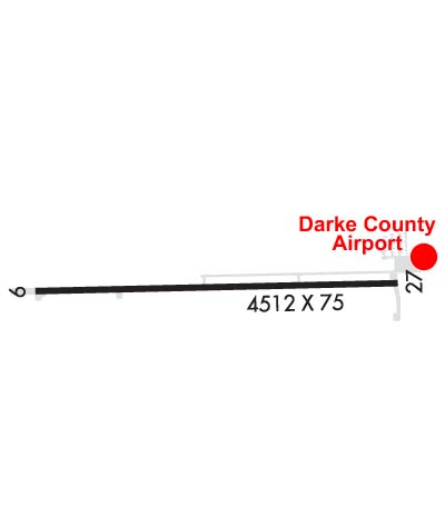
Runway Identifications
Runway Identification: 09/27
Length: 4802 ft
Width: 75 ft
Surface: ASPHALT-GOOD CONDITION
Edge lights: Medium Intensity

Treatment: NONE

 Runway: 09   Runway: 27
Mag heading: 93°Mag heading: 273°
Rwy Slope: -.02% DownRwy Slope: .02% Up
Approach: Approach:
Pattern: Left TrafficPattern: Left Traffic
Markings: NONPRECISION INSTRUMENTMarkings: NONPRECISION INSTRUMENT
Marking Condition: GOODMarking Condition: GOOD
Arresting Dev: Arresting Dev:
Lat & Long: N4012.3  W08432.5Lat. & Long.: N4012.3  W08431.4
Elev: 1004.8 ft. MSLElev: 1004.0 ft. MSL
TCH: 38 ft. AGLTCH: 45 ft. AGL
Visual Glide Path: 3.00 degreesVisual Glide Path: 3.00 degrees
Displaced Threshold: NoDisplaced Threshold: No
Touchdown Zone: YESTouchdown Zone: YES
Touchdown Elev.: 1007.0 feetTouchdown Elev.: 1007.0 feet
Visual Glide Slope: 2-Light PAPI on LEFT side of RunwayVisual Glide Slope: 2-Light PAPI on LEFT side of Runway
RVR Equipment: RVR Equipment:
RVV Equipment: NORVV Equipment: NO
Approach Lights: Approach Lights:
REIL: YESREIL: YES
Centerline Lights: NOCenterline Lights: NO
Touchdown lights: NOTouchdown lights: NO
Runway Category: Runway with a Non-precision ApproachRunway Category: Runway with a Non-precision Approach
Declared Distances: Declared Distances:
Obstructions: Obstructions: CROPS
Marked: Marked: NOT Marked/Lighted
Clearance slope: 20:1Clearance slope:
Obstruction height: Obstruction height: 11 feet AGL
Dist. from runway: Dist. from runway: 201 feet
Centerline offset: Centerline offset: 105 feet left of centerline
Comments: Comments: +6-14 FT ACFT PRKG, 0-200 FT DIST, 150 FT R; +11 FT CROPS, 0-200 FT DIST, 105 FT L.
C:2/P: