Click here for more info on on SMS!

KVBT

MUNICIPAL/LOUISE THADDEN
BENTONVILLE
AR
Time Zone: Central
Lat: N 3620.7
Long: W 09413.2
Elev: 1298
Var: -01
Longest Runway: 4426
Clr Del: 121.05
AWOS: 134.97
CTAF: 122.97

FBO & Flight Services info for KVBT

FBOs: Update your Fuel Prices

SUMMIT AVIATIONPh: 479-254-0817 Fax: 479-254-9407 Freq: 122.97
Service
Jet
100LL
SAF
MoGas
Fuel Avail: PRIST PREMIXED. Call 479-254-0817 after hrs, fee may apply
Full5.575.83    Caution: Fuel prices have not been updated in 33 days.
Last Update: 03/16/2024 14:08

Self        
 Address: 2440 SW AVIATION ST.   BENTONVILLE, AR 72712
AWOSPh: 479-273-9198
-
Freq: 134.97  
If you are an FBO, call 1-203-262-1700 to update your info or email: FltPlan.Advertising@garmin.com
Advertise your FBO on FltPlan.com
FBOs at nearby airports who want your business:
KROG


  click here  
A full service FBO located in Northwest Arkansas. A subsidiary of Wal-Mart Stores, Inc. we are located only 8 miles from the Wal-Mart/Sam's Club Office Complex. Customs and Border Protection, Cafe, and Car Rental on site. No Ramp or Landing Fees. Volume discount for fuel with a Phillips Card. Full crew and passenger amenities.
Ph: 1-479-636-9400WebsiteFax: 1-479-621-248Freq: 122.87

Runway & Approach Info for KVBT
Rwy
Length
Land Dist**
Approach*
  Rwy
Length
Land Dist**
Approach*
17
2448x75  2448'          
 
  
35
  2448x75  2448'          
 
18
4426x75  4196'          
 
  
36
  4426x75  4426'          
 
 * only ILS, LOC, LDA, and SDF approaches to a specific runway are shown
** For any Declared Landing Distance Available, please see A/FD or Approach plates
Runway Weight Capability (lbs.) Help
Runway IDSingle WheelDouble WheelDouble Tandem WheelDual Double Wheel
17/35N/AN/AN/AN/A
18/3630,00059,000N/AN/A
These numbers are Advisory and are not limits.   The Airport Manager should have more accurate Weight Limits
Approach Charts
Approaches    
Current Weather/Notams
Customs Information Send updates to Support@FltPlan.com
Customs Not Available
Database effective 04/18/2024
Airport Diagram of KVBT
Airport Diagram might not be current.

Facility Name: BENTONVILLE MUNI/LOUISE M THADEN FLD
City Name: BENTONVILLE
County: BENTON
State abbrev: AR
State Name: ARKANSAS
   
Ownership: PUBLICLY OWNED
Use: OPEN TO THE PUBLIC
Owner's Name: CITY OF BENTONVILLE
Address: 305 SW A STREET
 BENTONVILLE, AR 72712
Owner's Phone: 479-271-3112
  
Manager's Name: DEBBIE GRIFFIN
Address: 305 SW A ST
 BENTONVILLE, AR 72712
Phone: 479-254-2028
   
FAA Region: SOUTHWEST
FAA Field Office: AOK
Photo courtesy of Pedro Antonio Huerta Dubois


Click here for full scale & interactive Sectional view of KVBT


Sunrise / Sunset times for BENTONVILLE MUNI/LOUISE M THADEN FLD

DateSunriseSunset
04/17/24 Wednesday6:4019:53
04/18/24 Thursday6:3819:54
04/19/24 Friday6:3719:55
04/20/24 Saturday6:3619:56
04/21/24 Sunday6:3519:57
04/22/24 Monday6:3319:58
04/23/24 Tuesday6:3219:59
04/24/24 Wednesday6:3119:59
04/25/24 Thursday6:3020:00
04/26/24 Friday6:2920:01
04/27/24 Saturday6:2720:02
04/28/24 Sunday6:2620:03
04/29/24 Monday6:2520:04
04/30/24 Tuesday6:2420:05

Airport Facilities

Airport Attendance ScheduleOCT-MAR 7 Days A Week 0800-1700, APR-SEP 7 Days A Week 0700-1900; FOR SVC AFT HRS CALL 479-367-9800.
Airport Status OPERATIONAL (This Status can change at any time - please check NOTAMS)
Airport Lighting ScheduleACTVT MIRL RWY 18/36, PAPI RWY 18/36 - CTAF.
Airport Storage AvailableTie Downs, Hanger
Extra Services AvailableCharter, Flight Instruction, Aircraft Rental, Aircraft Sales
Wind IndicatorYES - (lighted)
Control TowerNO
CTAF Frequency122.975
Unicom Frequency122.975
Rotating Beacon ColorWG
Segmented CircleNO
Landing FeeNO

Airport Inspection Data

Airport InspectedSTATE - performed by STATE AERONAUTICAL PERSONNEL
Inspection Date03/28/2023

Airport Services

Type of Fuel AvailableGrade 100LL, JET A (freeze point -40C)
Airframe Repair ServiceMAJOR
Power Plant Repair ServiceMAJOR

Geographic Data

LatitudeN3620.7
LongitudeW09413.2 (ESTIMATED)
Arpt Elevation1298ft (SURVEYED)
Magnetic Variation01E
2 miles Sof BENTONVILLE
Traffic Pattern Altitude
Sectional ChartKANSAS CITY

Aircraft Data

Operations (Reported)YearlyAvg. Daily
General Aviation Transient 1100030
General Aviation Local 2100058
Air Taxi 2001
Commerical 00
Commuter 00
Military 1000
Aircraft based on Field
General Aviation Singles 42
General Aviation Multi 4
Jet Aircraft 1
General Aviation Helicopters 2
Military Aircraft 0
Gliders 0
Ultralights 0

FAA Services

FSS on field NO
FSS tie-in JONESBORO
FSS Phone 1-800-WX-BRIEF
Who issues Notams VBT
Notam D service at airport YES
ARTCC Name MEMPHIS

Federal Status

Airport Certification
Aircraft Rescue & Firefighting IndexNone
Airport of EntryNo
Custom Landing RightsNo
Joint Civil/MilitaryNo
Military Landing rightsNo

Federal Agreements

NATIONAL PLAN OF INTEGRATED AIRPORT SYSTEMS (NPIAS)
GRANT AGREEMENT HAS EXPIRED; HOWEVER, AGREEMENT REMAINS IN EFFECT FOR THIS FACILITY AS LONG AS IT IS PUBLIC USE.

Remarks

BEGINNING 60 FT BYD NORTH END OF RY 18 PAVEMENT, GND HAS APROXLY 12 FT DROP OVER 60 FT LENGTH TO POND.
FOR CD CTC RAZORBACK APCH 479-649-2416, WHEN APCH CLSD CTC MEMPHIS ARTCC AT 901-368-8453/8449.
MIGRATORY BIRDS ON & INVOF ARPT
RWY 17/35 VFR DALGT OPNS ONLY.
SIMUL USE OF RWYS 17/35 AND 18/36 NA.
RWY 18/3 6 PCR VALUE: 214/F/D/X/T
Airport Communications & Frequencies:
Clearance Delivery Frequencies:
121.05
263.125
CTAF Frequency:
122.975
Unicom Frequency:
122.975
Remarks
  • APCH/DEP SVC PRVDD BY MEMPHIS ARTCC ON FREQS126.1/269.0 (FAYETTEVILLE RCAG) WHEN RAZORBACK APCH CTL CLSD.
  • RAZORBACK Primary Approach Frequencies:  
    121.0
    244.575
    RAZORBACK Primary Departure Frequencies:  
    121.0
    244.575
    Runway Identifications
    Runway Identification: 17/35
    Length: 2448 ft
    Width: 75 ft
    Surface: GRASS
    Edge lights:

    Treatment: NONE

     Runway: 17   Runway: 35
    Mag heading: 179°Mag heading: 359°
    Rwy Slope: .16% UpRwy Slope: -.16% Down
    Approach: Approach:
    Pattern: Left TrafficPattern: Left Traffic
    Markings: Markings:
    Marking Condition: Marking Condition:
    Arresting Dev: Arresting Dev:
    Lat & Long: N3620.9  W09413.2Lat. & Long.: N3620.5  W09413.2
    Elev: 1288.7 ft. MSLElev: 1292.5 ft. MSL
    TCH: TCH:
    Visual Glide Path: Visual Glide Path:
    Displaced Threshold: NoDisplaced Threshold: No
    Touchdown Zone: NOTouchdown Zone: NO
    Touchdown Elev.: Touchdown Elev.:
    Visual Glide Slope: Visual Glide Slope:
    RVR Equipment: RVR Equipment:
    RVV Equipment: NORVV Equipment: NO
    Approach Lights: Approach Lights:
    REIL: NOREIL: NO
    Centerline Lights: NOCenterline Lights: NO
    Touchdown lights: NOTouchdown lights: NO
    Runway Category: Runway with a Visual ApproachRunway Category: Runway with a Visual Approach
    Declared Distances: TORA:2448' TODA:2448'Declared Distances: TORA:2448' TODA:2448'
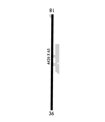
    Runway Identification: 18/36
    Length: 4426 ft
    Width: 75 ft
    Surface: ASPHALT-FAIR CONDITION
    Edge lights: Medium Intensity

    Treatment: NONE

     Runway: 18   Runway: 36
    Mag heading: 179°Mag heading: 359°
    Rwy Slope: .07% UpRwy Slope: -.07% Down
    Approach: Approach:
    Pattern: Left TrafficPattern: Left Traffic
    Markings: NONPRECISION INSTRUMENTMarkings: NONPRECISION INSTRUMENT
    Marking Condition: POOR; MKGS FADED.Marking Condition: POOR; MKGS FADED.
    Arresting Dev: Arresting Dev:
    Lat & Long: N3621.1  W09413.2Lat. & Long.: N3620.4  W09413.2
    Elev: 1289.3 ft. MSLElev: 1292.6 ft. MSL
    TCH: 45 ft. AGLTCH: 45 ft. AGL
    Visual Glide Path: 3.00 degreesVisual Glide Path: 3.00 degrees
    Displaced Threshold: 230 feetDisplaced Threshold: No
    Touchdown Zone: YESTouchdown Zone: YES
    Touchdown Elev.: 1298.1 feetTouchdown Elev.: 1298.1 feet
    Visual Glide Slope: 2-Light PAPI on LEFT side of RunwayVisual Glide Slope: 2-Light PAPI on RIGHT side of Runway
    RVR Equipment: RVR Equipment:
    RVV Equipment: NORVV Equipment: NO
    Approach Lights: Approach Lights:
    REIL: YESREIL: YES
    Centerline Lights: NOCenterline Lights: NO
    Touchdown lights: NOTouchdown lights: NO
    Runway Category: Runway with a Non-precision ApproachRunway Category: Runway with a Non-precision Approach
    Declared Distances: LDA:4196'Declared Distances: ASDA:4196' LDA:4196'
    Obstructions: BRUSHObstructions: POLE
    Marked: NOT Marked/LightedMarked: NOT Marked/Lighted
    Clearance slope: 16:1; APCH RATIO 38:1 TO DTHR.Clearance slope: 34:1
    Obstruction height: 19 feet AGLObstruction height: 12 feet AGL
    Dist. from runway: 510 feetDist. from runway: 615 feet
    Centerline offset: 285 right of centerlineCenterline offset: 170 feet left of centerline
    Comments: Comments:
    C:12/P: