Current Weather/Notams (Metars, TAFs, Notams, NWS Forecast, PIREPS, and nearby weather)
Customs Information Send updates to Support@FltPlan.com
Customs Not Available
Database effective 04/18/2024
Airport Diagram might not be current.
|
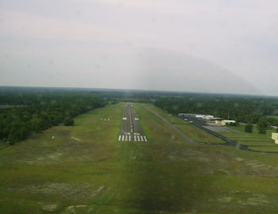
| Facility Name: | HUNTSVILLE MUNI |
| City Name: | HUNTSVILLE |
| County: | WALKER |
| State abbrev: | TX |
| State Name: | TEXAS |
| | |
| Ownership: | PUBLICLY OWNED |
| Use: | OPEN TO THE PUBLIC |
| Owner's Name: | CITY OF HUNTSVILLE |
| Address: | 1212 AVENUE M |
| | HUNTSVILLE, TX 77340 |
| Owner's Phone: | 936-291-5401 |
| | |
| Manager's Name: | KEVIN BYAL; DIR OF DVLPMT SVCS |
| Address: | 448 SH 75 NORTH |
| | HUNTSVILLE, TX 77340 |
| Phone: | 936-295-8136; ON SITE ATTENDANT. |
| | |
| FAA Region: | SOUTHWEST |
| FAA Field Office: | TEX |
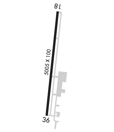
Runway Identifications
Runway Identification: 18/36Length: 5005 ft
Width: 100 ft
Surface: ASPHALT-POOR CONDITION
Edge lights: Medium IntensityTreatment: NONE
| | Runway: 18 | | Runway: 36 |
| Mag heading: | 180° | Mag heading: | 0° |
| Rwy Slope: | 1.26% Up | Rwy Slope: | -1.26% Down |
| Approach: | | Approach: | |
| Pattern: | Left Traffic | Pattern: | Left Traffic |
| Markings: | NONPRECISION INSTRUMENT | Markings: | NONPRECISION INSTRUMENT |
| Marking Condition: | GOOD | Marking Condition: | GOOD |
| Arresting Dev: | | Arresting Dev: | |
| Lat & Long: | N3045.2 W09535.2 | Lat. & Long.: | N3044.4 W09535.3 |
| Elev: | 299.4 ft. MSL | Elev: | 362.3 ft. MSL |
| TCH: | 26 ft. AGL | TCH: | 40 ft. AGL |
| Visual Glide Path: | 3.00 degrees | Visual Glide Path: | 3.00 degrees |
| Displaced Threshold: | No | Displaced Threshold: | No |
| Touchdown Zone: | YES | Touchdown Zone: | YES |
| Touchdown Elev.: | 338.0 feet | Touchdown Elev.: | 362.9 feet |
| Visual Glide Slope: | 4-Light PAPI on LEFT side of Runway | Visual Glide Slope: | 4-Light PAPI on LEFT side of Runway |
| RVR Equipment: | | RVR Equipment: | |
| RVV Equipment: | NO | RVV Equipment: | NO |
| Approach Lights: | | Approach Lights: | |
| REIL: | YES | REIL: | YES |
| Centerline Lights: | NO | Centerline Lights: | NO |
| Touchdown lights: | NO | Touchdown lights: | NO |
| Runway Category: | Runway with a Non-precision Approach having visibility minimums greater than 3/4 mile | Runway Category: | Runway with a Visual Approach |
| Declared Distances: | | Declared Distances: | |
| Obstructions: | TREES | Obstructions: | POLE |
| Marked: | NOT Marked/Lighted | Marked: | NOT Marked/Lighted |
| Clearance slope: | | Clearance slope: | 20:1 |
| Obstruction height: | 30 feet AGL | Obstruction height: | 45 feet AGL |
| Dist. from runway: | 201 feet | Dist. from runway: | 1135 feet |
| Centerline offset: | 175 right of centerline | Centerline offset: | 195 feet right of centerline |
| Comments: | 10-30 FT BRUSH & TREES 0-199 FT DSTC, 175 FT RIGHT. | Comments: | |