
| |||||||||||||||||||||||||||||||||||||||||||||||||||||||||||||||||||||
| |||||||||||||||||||||||||||||||||||||||||||||||||||||||||||||||||||||
| |||||||||||||||||||||||||||||||||||||||||||||||||||||||||||||||||||||
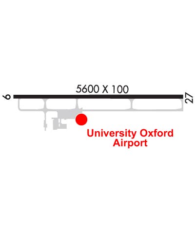
| Rwy | Rwy | |||||||
| 5600x100 | 5600' | 111.70 - 091° | 5600x100 | 5600' | ||||
| Runway ID | Single Wheel | Double Wheel | Double Tandem Wheel | Dual Double Wheel |
| 09/27 | 38,000 | 55,000 | 90,000 | N/A |
| These numbers are Advisory and are not limits. The Airport Manager should have more accurate Weight Limits | ||||
 Airport Diagram might not be current. | |
| Facility Name: | UNIVERSITY-OXFORD |
| City Name: | OXFORD |
| County: | LAFAYETTE |
| State abbrev: | MS |
| State Name: | MISSISSIPPI |
| Ownership: | PUBLICLY OWNED |
| Use: | OPEN TO THE PUBLIC |
| Owner's Name: | UNIVERSITY OF MISSISSIPPI |
| Address: | PO BOX 1848 |
| UNIVERSITY, MS 38677 | |
| Owner's Phone: | 662-915-7044 |
| Manager's Name: | JACOB PIND |
| Address: | UNIVERSITY-OXFORD AIRPORT |
| OXFORD, MS 38655 | |
| Phone: | 662-234-2036 |
| FAA Region: | SOUTHERN |
| FAA Field Office: | JAN |
| Date | Sunrise | Sunset |
|---|---|---|
| 04/15/24 Monday | 6:26 | 19:31 |
| 04/16/24 Tuesday | 6:25 | 19:31 |
| 04/17/24 Wednesday | 6:23 | 19:32 |
| 04/18/24 Thursday | 6:22 | 19:33 |
| 04/19/24 Friday | 6:21 | 19:34 |
| 04/20/24 Saturday | 6:20 | 19:35 |
| 04/21/24 Sunday | 6:19 | 19:35 |
| 04/22/24 Monday | 6:17 | 19:36 |
| 04/23/24 Tuesday | 6:16 | 19:37 |
| 04/24/24 Wednesday | 6:15 | 19:38 |
| 04/25/24 Thursday | 6:14 | 19:38 |
| 04/26/24 Friday | 6:13 | 19:39 |
| 04/27/24 Saturday | 6:12 | 19:40 |
| 04/28/24 Sunday | 6:11 | 19:41 |
| Airport Attendance Schedule | 7 Days A Week 0700-1800; FOR ARPT ATTENDANT NIGHTS CALL 662-234-2036. |
| Airport Status | OPERATIONAL (This Status can change at any time - please check NOTAMS) |
| Airport Lighting Schedule | MIRL RWY 09/27 OPRS DUSK-2200. AFT 2200, ACTVT REIL 09 & 27; PAPI RWY 09; MIRL RWY 09/27 - CTAF. PAPI RWY 27 OPR CONSLY. |
| Airport Storage Available | Tie Downs, Hanger |
| Extra Services Available | Flight Instruction, Aircraft Rental |
| Wind Indicator | YES - (lighted) |
| Control Tower | NO |
| CTAF Frequency | 123.000 |
| Unicom Frequency | 123.000 |
| Rotating Beacon Color | WG |
| Segmented Circle | YES |
| Landing Fee | NO |
| Airport Inspected | FEDERAL - performed by FAA AIRPORTS FIELD PERSONNEL |
| Inspection Date | 04/05/2022 |
| Type of Fuel Available | Grade 100LL, JET A (freeze point -40C), JET A |
| Airframe Repair Service | MINOR |
| Power Plant Repair Service | NONE |
| Latitude | N3423.1 |
| Longitude | W08932.2 (ESTIMATED) |
| Arpt Elevation | 452ft (SURVEYED) |
| Magnetic Variation | 01W |
| 2 miles NW | of OXFORD |
| Traffic Pattern Altitude | 800; TPA: 800 FT AGL LGT ACFT, 1200 FT AGL HI SPD ACFT. |
| Sectional Chart | MEMPHIS |
| Operations (Reported) | Yearly | Avg. Daily |
|---|---|---|
| General Aviation Transient | 16322 | 45 |
| General Aviation Local | 37241 | 102 |
| Air Taxi | 5146 | 14 |
| Commerical | 28 | 0 |
| Commuter | 0 | 0 |
| Military | 1516 | 4 |
| Aircraft based on Field | |
|---|---|
| General Aviation Singles | 12 |
| General Aviation Multi | 7 |
| Jet Aircraft | 3 |
| General Aviation Helicopters | 0 |
| Military Aircraft | 0 |
| Gliders | 0 |
| Ultralights | 0 |
| FSS on field | NO |
| FSS tie-in | GREENWOOD |
| FSS Phone | 1-800-WX-BRIEF |
| Who issues Notams | GWO |
| Notam D service at airport | YES |
| ARTCC Name | MEMPHIS |
| Airport Certification | CLSD TO ACR OPS WITH MORE THAN 30 PAX SEATS EXCP PPR CALL AMGR 662-234-2036. |
| Aircraft Rescue & Firefighting Index | AIRPORT HAS A CERTIFICATE UNDER CFR PART 139 |
| Airport of Entry | No |
| Custom Landing Rights | No |
| Joint Civil/Military | No |
| Military Landing rights | YES |
| NATIONAL PLAN OF INTEGRATED AIRPORT SYSTEMS (NPIAS) |
| GRANT AGREEMENTS UNDER FAAP/ADAP/AIP |
| ASSURANCES PURSUANT TO TITLE VI, CIVIL RIGHTS ACT OF 1964 |
| GCO AVBL ON FREQ 135.075 FOR MEMPHIS ARTCC (ZME). |
| FOR CD IF UNA VIA GCO CTC MEMPHIS ARTCC AT 901-368-8453/8449. |
Airport Communications & Frequencies:
| |||||||||
| Runway: 09 | Runway: 27 | ||
| Mag heading: | 92° | Mag heading: | 272° |
| Rwy Slope: | .70% Up | Rwy Slope: | -.70% Down |
| Approach: | LOCALIZER | Approach: | |
| Pattern: | Left Traffic | Pattern: | Left Traffic |
| Markings: | NONPRECISION INSTRUMENT | Markings: | NONPRECISION INSTRUMENT |
| Marking Condition: | FAIR | Marking Condition: | FAIR |
| Arresting Dev: | Arresting Dev: | ||
| Lat & Long: | N3423.1 W08932.8 | Lat. & Long.: | N3423.1 W08931.7 |
| Elev: | 412.7 ft. MSL | Elev: | 452.0 ft. MSL |
| TCH: | 40 ft. AGL | TCH: | 56 ft. AGL |
| Visual Glide Path: | 3.00 degrees | Visual Glide Path: | 3.60 degrees |
| Displaced Threshold: | No | Displaced Threshold: | No |
| Touchdown Zone: | YES | Touchdown Zone: | YES |
| Touchdown Elev.: | 417.7 feet | Touchdown Elev.: | 452.0 feet |
| Visual Glide Slope: | 4-Light PAPI on LEFT side of Runway | Visual Glide Slope: | 4-Light PAPI on LEFT side of Runway; PAPI UNUSBL BYD 6 DEG L OF CNTRLN. |
| RVR Equipment: | RVR Equipment: | ||
| RVV Equipment: | NO | RVV Equipment: | NO |
| Approach Lights: | Approach Lights: | ||
| REIL: | YES | REIL: | YES |
| Centerline Lights: | NO | Centerline Lights: | NO |
| Touchdown lights: | NO | Touchdown lights: | NO |
| Runway Category: | Runway with a Non-precision Approach having visibility minimums greater than 3/4 mile | Runway Category: | Runway with a Non-precision Approach having visibility minimums greater than 3/4 mile |
| Declared Distances: | Declared Distances: | ||
| Obstructions: | Obstructions: | TREE | |
| Marked: | Marked: | NOT Marked/Lighted | |
| Clearance slope: | 50:1 | Clearance slope: | 15:1 |
| Obstruction height: | Obstruction height: | 40 feet AGL | |
| Dist. from runway: | Dist. from runway: | 800 feet | |
| Centerline offset: | Centerline offset: | 75 feet right of centerline | |
| Comments: | Comments: |


