Click here for more info on on SMS!

KUGB

UGASHIK BAY AIRPORT
PILOT POINT
AK
Time Zone: Alaska
Lat: N 5725.5
Long: W 15744.4
Elev: 132
Var: -20
Longest Runway: 5280
CTAF: 122.9

FBO & Flight Services info for KUGB

FBOs: Update your Fuel Prices

AIRPORTPh: 907-267-1248
-
Freq: 122.9
RUNWAY - GRAVEL
-
-
 
If you are an FBO, call 1-203-262-1700 to update your info or email: FltPlan.Advertising@garmin.com
Advertise your FBO on FltPlan.com

Runway & Approach Info for KUGB
Rwy
Length
Land Dist**
Approach*
  Rwy
Length
Land Dist**
Approach*
12
5280x125  5280'          
 
  
30
  5280x125  5280'          
 
 * only ILS, LOC, LDA, and SDF approaches to a specific runway are shown
** For any Declared Landing Distance Available, please see A/FD or Approach plates
Runway Weight Capability (lbs.) Help
Runway IDSingle WheelDouble WheelDouble Tandem WheelDual Double Wheel
12/30N/AN/AN/AN/A
These numbers are Advisory and are not limits.   The Airport Manager should have more accurate Weight Limits
Approach Charts
FltPlan does not have IFR approach charts available for KUGB.
Current Weather/Notams
Customs Information Send updates to Support@FltPlan.com
Customs Not Available
Database effective 05/16/2024
Airport Diagram of KUGB
Airport Diagram might not be current.

Facility Name: UGASHIK BAY
City Name: PILOT POINT
County: BRISTOL BAY
State abbrev: AK
State Name: ALASKA
   
Ownership: PUBLICLY OWNED
Use: OPEN TO THE PUBLIC
Owner's Name: BLM--DIVISION OF LANDS
Address: 6881 ABBOTT LOOP ROAD
 ANCHORAGE, AK 99507
Owner's Phone: 907-267-1248
  
Manager's Name: DISTRICT MGR, BLM-ANC
Address: 6881 ABBOTT LOOP ROAD
 ANCHORAGE, AK 99507
Phone: 907-267-1248
   
FAA Region: ALASKA
FAA Field Office: NONE


Sunrise / Sunset times for UGASHIK BAY

DateSunriseSunset
05/06/24 Monday6:2722:29
05/07/24 Tuesday6:2522:31
05/08/24 Wednesday6:2222:33
05/09/24 Thursday6:2022:36
05/10/24 Friday6:1822:38
05/11/24 Saturday6:1622:40
05/12/24 Sunday6:1422:42
05/13/24 Monday6:1222:44
05/14/24 Tuesday6:1022:46
05/15/24 Wednesday6:0822:48
05/16/24 Thursday6:0622:50
05/17/24 Friday6:0422:52
05/18/24 Saturday6:0222:54
05/19/24 Sunday6:0022:56

Airport Facilities

Airport Attendance ScheduleUNATTENDED
Airport Status OPERATIONAL (This Status can change at any time - please check NOTAMS)
Airport Lighting Schedule
Airport Storage AvailableNONE
Extra Services AvailableNONE
Wind IndicatorNONE
Control TowerNO
CTAF Frequency122.900
Unicom Frequency
Rotating Beacon Color
Segmented CircleNO
Landing FeeNO

Airport Inspection Data

Airport InspectedSTATE - performed by PRIVATE CONTRACT PERSONNEL
Inspection Date05/23/2021

Airport Services

Type of Fuel AvailableNone
Airframe Repair ServiceNONE
Power Plant Repair ServiceNONE

Geographic Data

LatitudeN5725.5
LongitudeW15744.4 (ESTIMATED)
Arpt Elevation132ft (ESTIMATED)
Magnetic Variation20E
10 miles SSWof PILOT POINT
Traffic Pattern Altitude
Sectional ChartKODIAK

Aircraft Data

Operations (Reported)YearlyAvg. Daily
General Aviation Transient 00
General Aviation Local 00
Air Taxi 00
Commerical 00
Commuter 00
Military 00
Aircraft based on Field
General Aviation Singles 0
General Aviation Multi 0
Jet Aircraft 0
General Aviation Helicopters 0
Military Aircraft 0
Gliders 0
Ultralights 0

FAA Services

FSS on field NO
FSS tie-in KENAI
FSS Phone 1-800-866-864-1737
Who issues Notams ENA
Notam D service at airport YES
ARTCC Name ANCHORAGE

Federal Status

Airport Certification
Aircraft Rescue & Firefighting IndexNone
Airport of EntryNo
Custom Landing RightsNo
Joint Civil/MilitaryNo
Military Landing rightsNo

Remarks

RY NOT SUITABLE FOR TRICYCLE LNDG GEAR ACFT.
BRUSH GROWING ON RY.
EMERG USE ONLY.
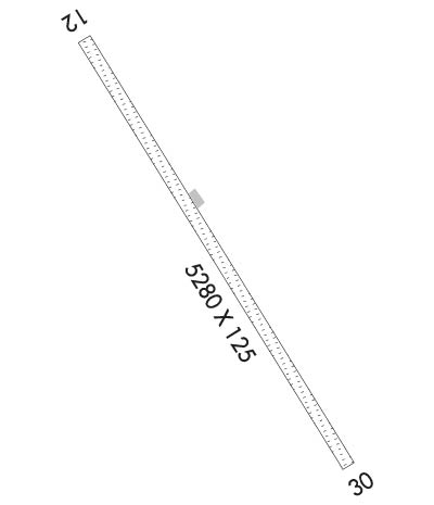
Runway Identifications
Runway Identification: 12/30
Length: 5280 ft
Width: 125 ft
Surface: NATURAL SOIL-POOR CONDITION
Edge lights:

Treatment: NONE

 Runway: 12   Runway: 30
Mag heading: N/AMag heading: N/A
Approach: Approach:
Pattern: Left TrafficPattern: Left Traffic
Markings: Markings:
Marking Condition: Marking Condition:
Arresting Dev: Arresting Dev:
Lat & Long:   Lat. & Long.:   
Elev: N/AElev: N/A
TCH: TCH:
Visual Glide Path: Visual Glide Path:
Displaced Threshold: NoDisplaced Threshold: No
Touchdown Zone: NOTouchdown Zone: NO
Touchdown Elev.: Touchdown Elev.:
Visual Glide Slope: Visual Glide Slope:
RVR Equipment: RVR Equipment:
RVV Equipment: NORVV Equipment: NO
Approach Lights: Approach Lights:
REIL: NOREIL: NO
Centerline Lights: NOCenterline Lights: NO
Touchdown lights: NOTouchdown lights: NO
Runway Category: Runway with a Visual ApproachRunway Category: Runway with a Visual Approach
Declared Distances: Declared Distances:
Obstructions: BRUSHObstructions: BRUSH
Marked: NOT Marked/LightedMarked: NOT Marked/Lighted
Clearance slope: Clearance slope:
Obstruction height: 3 feet AGLObstruction height: 15 feet AGL
Dist. from runway: 0 feetDist. from runway: 5 feet
Centerline offset: BCenterline offset: 5B
Comments: Comments:
C:/P: