Click here for more info on on SMS!

KUCY

EVERETT-STEWART RGNL
UNION CITY
TN
Time Zone: Central
Lat: N 3622.8
Long: W 08859.1
Elev: 346
Var: -00
Longest Runway: 6503
AWOS: 135.32
CTAF: 122.7

FBO & Flight Services info for KUCY

FBOs: Update your Fuel Prices

EVERETT-STWRT REGPh: 731-885-1221 Fax: 731-885-6746 Freq: 122.7
Service
Jet
100LL
SAF
MoGas
Fuel Avail: PRIST PREMIXED. Self-serv 24/7, - M-SAT 7:30A-5P, SUN 12:30P-5P.
Full5.605.22    Last Update: 04/19/2024 09:41

Self5.234.91    
 Address: 1489 AIRPORT CIRCLE   UNION CITY, TN 38261
AWOSPh: 731-885-9161
-
Freq: 135.32  
If you are an FBO, call 1-203-262-1700 to update your info or email: FltPlan.Advertising@garmin.com
Advertise your FBO on FltPlan.com

Runway & Approach Info for KUCY
Rwy
Length
Land Dist**
Approach*
  Rwy
Length
Land Dist**
Approach*
01
6503x100  6503'          
ILS
 109.70 - 006°  
  
19
  6503x100  6503'          
 
 * only ILS, LOC, LDA, and SDF approaches to a specific runway are shown
** For any Declared Landing Distance Available, please see A/FD or Approach plates
Runway Weight Capability (lbs.) Help
Runway IDSingle WheelDouble WheelDouble Tandem WheelDual Double Wheel
01/1945,00060,000N/AN/A
These numbers are Advisory and are not limits.   The Airport Manager should have more accurate Weight Limits
Approach Charts
Approaches    
Current Weather/Notams
Customs Information Send updates to Support@FltPlan.com
Customs Not Available
Database effective 05/16/2024
Airport Diagram of KUCY
Airport Diagram might not be current.

Facility Name: EVERETT-STEWART RGNL
City Name: UNION CITY
County: OBION
State abbrev: TN
State Name: TENNESSEE
   
Ownership: PUBLICLY OWNED
Use: OPEN TO THE PUBLIC
Owner's Name: OBION COUNTY
Address: COUNTY COURTHOUSE
 UNION CITY, TN 38261
Owner's Phone: 731-885-9611
  
Manager's Name: DON COADY
Address: 1489 AIRPORT CIRCLE
 UNION CITY, TN 38261
Phone: 731-885-1221
   
FAA Region: SOUTHERN
FAA Field Office: MEM


Sunrise / Sunset times for EVERETT-STEWART RGNL

DateSunriseSunset
04/25/24 Thursday6:0919:39
04/26/24 Friday6:0819:40
04/27/24 Saturday6:0619:41
04/28/24 Sunday6:0519:42
04/29/24 Monday6:0419:43
04/30/24 Tuesday6:0319:44
05/01/24 Wednesday6:0219:45
05/02/24 Thursday6:0119:45
05/03/24 Friday6:0019:46
05/04/24 Saturday5:5919:47
05/05/24 Sunday5:5819:48
05/06/24 Monday5:5719:49
05/07/24 Tuesday5:5619:50
05/08/24 Wednesday5:5519:51

Airport Facilities

Airport Attendance ScheduleSUN 1230-1700, MON-SAT 0730-1700
Airport Status OPERATIONAL (This Status can change at any time - please check NOTAMS)
Airport Lighting ScheduleACTVT ODALS RWY 01 - CTAF. PAPI RWY 01 & 19 ON CONSLY.
Airport Storage AvailableTie Downs, Hanger
Extra Services AvailableCrop Dusting, Charter, Flight Instruction, Aircraft Rental
Wind IndicatorYES - (lighted)
Control TowerNO
CTAF Frequency122.700
Unicom Frequency122.700
Rotating Beacon ColorWG
Segmented CircleYES
Landing FeeNO

Airport Inspection Data

Airport InspectedSTATE - performed by STATE AERONAUTICAL PERSONNEL
Inspection Date03/26/2021

Airport Services

Type of Fuel AvailableGrade 100LL, JET A
Airframe Repair ServiceMAJOR
Power Plant Repair ServiceMAJOR

Geographic Data

LatitudeN3622.8
LongitudeW08859.1 (ESTIMATED)
Arpt Elevation345ft (SURVEYED)
Magnetic Variation00E
4 miles SEof UNION CITY
Traffic Pattern Altitude
Sectional ChartST LOUIS

Aircraft Data

Operations (Reported)YearlyAvg. Daily
General Aviation Transient 1180032
General Aviation Local 1500041
Air Taxi 14004
Commerical 00
Commuter 00
Military 1500
Aircraft based on Field
General Aviation Singles 46
General Aviation Multi 6
Jet Aircraft 0
General Aviation Helicopters 0
Military Aircraft 0
Gliders 2
Ultralights 0

FAA Services

FSS on field NO
FSS tie-in JACKSON
FSS Phone 1-800-WX-BRIEF
Who issues Notams MKL
Notam D service at airport YES
ARTCC Name MEMPHIS

Federal Status

Airport Certification
Aircraft Rescue & Firefighting IndexNone
Airport of EntryNo
Custom Landing RightsNo
Joint Civil/MilitaryNo
Military Landing rightsYES

Federal Agreements

NATIONAL PLAN OF INTEGRATED AIRPORT SYSTEMS (NPIAS)
GRANT AGREEMENTS UNDER FAAP/ADAP/AIP
SURPLUS PROPERTY AGREEMENT UNDER REGULATION 16-WAA
ASSURANCES PURSUANT TO TITLE VI, CIVIL RIGHTS ACT OF 1964

Remarks

AEROBATIC ACT INVOF ARPT.
FOR CD CTC MEMPHIS ARTCC AT 901-368-8453/8449.
Airport Communications & Frequencies:
CTAF Frequency:
122.700
Unicom Frequency:
122.700
Remarks
  • APCH/DEP SVC PRVDD BY MEMPHIS ARTCC ON FREQS 133.65/292.15 (PADUCAH RCAG).
  • Runway Identifications
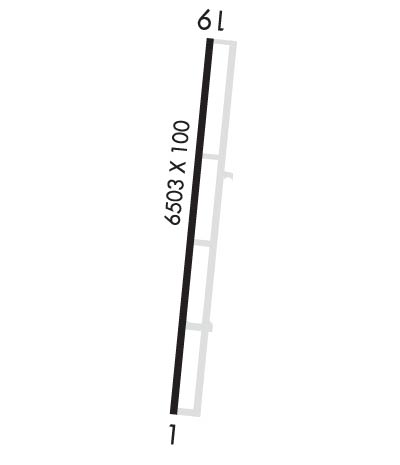
    Runway Identification: 01/19
    Length: 6503 ft
    Width: 100 ft
    Surface: ASPHALT-GOOD CONDITION
    Edge lights: Medium Intensity

    Treatment: NONE
    Weight: PCN 3 /F/D/X/T

     Runway: 01   Runway: 19
    Mag heading: Mag heading: 186°
    Rwy Slope: -.56% DownRwy Slope: .56% Up
    Approach: ILSApproach:
    Pattern: Left Traffic; RIGHT TFC WHEN AEROBATIC AREA ACTIVE.Pattern: Left Traffic
    Markings: PRECISION INSTRUMENTMarkings: PRECISION INSTRUMENT
    Marking Condition: GOODMarking Condition: GOOD
    Arresting Dev: Arresting Dev:
    Lat & Long: N3622.3  W08859.2Lat. & Long.: N3623.3  W08859.1
    Elev: 345.6 ft. MSLElev: 309.3 ft. MSL
    TCH: 42 ft. AGLTCH: 29 ft. AGL
    Visual Glide Path: 3.00 degreesVisual Glide Path: 3.00 degrees
    Displaced Threshold: NoDisplaced Threshold: No
    Touchdown Zone: YESTouchdown Zone: YES
    Touchdown Elev.: 345.6 feetTouchdown Elev.: 320.0 feet
    Visual Glide Slope: 4-Light PAPI on LEFT side of RunwayVisual Glide Slope: 4-Light PAPI on LEFT side of Runway
    RVR Equipment: RVR Equipment:
    RVV Equipment: NORVV Equipment: NO
    Approach Lights: ODALS - omnidirectional approach lighting systemApproach Lights:
    REIL: YESREIL: YES
    Centerline Lights: NOCenterline Lights: NO
    Touchdown lights: NOTouchdown lights: NO
    Runway Category: Precision Instrument RunwayRunway Category: Runway with a Non-precision Approach having visibility minimums greater than 3/4 mile
    Declared Distances: Declared Distances:
    Obstructions: ROAD 1040 FT S OF THR CROSSES L TO R.Obstructions: PLINE
    Marked: NOT Marked/LightedMarked: MARKED
    Clearance slope: 50:1Clearance slope: 43:1
    Obstruction height: Obstruction height: 75 feet AGL
    Dist. from runway: Dist. from runway: 3450 feet
    Centerline offset: Centerline offset:
    Comments: Comments:
    C:7/P: