Click here for more info on on SMS!

KU07

BULLFROG BASIN
GLEN CANYON NATL REC
UT
Time Zone: Mountain
Lat: N 3732.7
Long: W 11042.8
Elev: 4167
Var: -13
Longest Runway: 3500
CTAF: 122.8

FBO & Flight Services info for KU07

FBOs: Update your Fuel Prices

AIRPORTPh: 435-684-2233
-
Freq: 122.8
Service
Jet
100LL
SAF
MoGas
Fuel Avail: NO FUEL AVAILABLE
Full        Last Update: 04/18/2024 05:44:56

Self        
If you are an FBO, call 1-203-262-1700 to update your info or email: FltPlan.Advertising@garmin.com
Advertise your FBO on FltPlan.com

Runway & Approach Info for KU07
Rwy
Length
Land Dist**
Approach*
  Rwy
Length
Land Dist**
Approach*
01
3500x40  3500'          
 
  
19
  3500x40  3500'          
 
 * only ILS, LOC, LDA, and SDF approaches to a specific runway are shown
** For any Declared Landing Distance Available, please see A/FD or Approach plates
Runway Weight Capability (lbs.) Help
Runway IDSingle WheelDouble WheelDouble Tandem WheelDual Double Wheel
01/1912,500N/AN/AN/A
These numbers are Advisory and are not limits.   The Airport Manager should have more accurate Weight Limits
Approach Charts
FltPlan does not have IFR approach charts available for KU07.
Current Weather/Notams
Customs Information Send updates to Support@FltPlan.com
Customs Not Available
Database effective 04/18/2024
Airport Diagram of KU07
Airport Diagram might not be current.

Facility Name: BULLFROG BASIN
City Name: GLEN CANYON NATL REC AREA
County: KANE
State abbrev: UT
State Name: UTAH
   
Ownership: PUBLICLY OWNED
Use: OPEN TO THE PUBLIC
Owner's Name: US NATIONAL PARK SVC
Address: PO BOX 1507
 PAGE, AZ 86040
Owner's Phone: 928-608-6253
  
Manager's Name: GLEN CANYON DISPATCH
Address: P.O BOX 1507
 PAGE, AZ 86040
Phone: 928-608-6253
   
FAA Region: NORTHWEST MOUNTAIN
FAA Field Office: DEN


Sunrise / Sunset times for BULLFROG BASIN

DateSunriseSunset
04/17/24 Wednesday6:4420:01
04/18/24 Thursday6:4320:02
04/19/24 Friday6:4120:03
04/20/24 Saturday6:4020:04
04/21/24 Sunday6:3920:05
04/22/24 Monday6:3820:05
04/23/24 Tuesday6:3620:06
04/24/24 Wednesday6:3520:07
04/25/24 Thursday6:3420:08
04/26/24 Friday6:3220:09
04/27/24 Saturday6:3120:10
04/28/24 Sunday6:3020:11
04/29/24 Monday6:2920:12
04/30/24 Tuesday6:2820:13

Airport Facilities

Airport Attendance ScheduleUNATTENDED
Airport Status OPERATIONAL (This Status can change at any time - please check NOTAMS)
Airport Lighting ScheduleNATIONAL PARK SVC USE ONLY.
Airport Storage AvailableTie Downs
Extra Services AvailableNONE
Wind IndicatorYES - (unlit)
Control TowerNO
CTAF Frequency122.800
Unicom Frequency122.800; UNICOM MNT 0700-1900.
Rotating Beacon Color
Segmented CircleYES; MKD WITH WHITE TIRES.
Landing FeeNO

Airport Inspection Data

Airport InspectedSTATE - performed by PRIVATE CONTRACT PERSONNEL
Inspection Date09/30/2023

Airport Services

Type of Fuel AvailableNone
Airframe Repair ServiceNone
Power Plant Repair ServiceNone

Geographic Data

LatitudeN3732.7
LongitudeW11042.8 (ESTIMATED)
Arpt Elevation4167ft (ESTIMATED)
Magnetic Variation13E
5 miles N; 5 NM N OF MARINA.of GLEN CANYON NATL REC AREA
Traffic Pattern Altitude
Sectional ChartDENVER

Aircraft Data

Operations (Reported)YearlyAvg. Daily
General Aviation Transient 15964
General Aviation Local 8762
Air Taxi 300
Commerical 00
Commuter 00
Military 00
Aircraft based on Field
General Aviation Singles 0
General Aviation Multi 0
Jet Aircraft 0
General Aviation Helicopters 0
Military Aircraft 0
Gliders 0
Ultralights 0

FAA Services

FSS on field NO
FSS tie-in CEDAR CITY
FSS Phone 1-800-WX-BRIEF
Who issues Notams CDC
Notam D service at airport YES
ARTCC Name DENVER

Federal Status

Airport Certification
Aircraft Rescue & Firefighting IndexNone
Airport of EntryNo
Custom Landing RightsNo
Joint Civil/MilitaryNo
Military Landing rightsYES

Remarks

HILL 800 FT SW.
FOR CD IF UNA TO CTC ON FSS FREQ, CTC DENVER ARTCC AT 303-651-4257.
4 FT PERIMETER FENCE, 73 FT EACH SIDE OF RWY CNTRLN.
ARPT CLSD SS-SR.
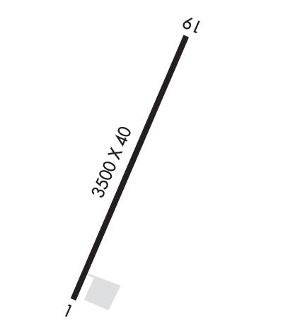
Runway Identifications
Runway Identification: 01/19
Length: 3500 ft
Width: 40 ft
Surface: ASPHALT-GOOD CONDITION
Edge lights: Low Intensity

Treatment: NONE

 Runway: 01   Runway: 19
Mag heading: N/AMag heading: N/A
Approach: Approach:
Pattern: Left TrafficPattern: Left Traffic
Markings: BASICMarkings: BASIC
Marking Condition: GOODMarking Condition: GOOD
Arresting Dev: Arresting Dev:
Lat & Long:   Lat. & Long.:   
Elev: N/AElev: N/A
TCH: TCH:
Visual Glide Path: Visual Glide Path:
Displaced Threshold: NoDisplaced Threshold: No
Touchdown Zone: NOTouchdown Zone: NO
Touchdown Elev.: Touchdown Elev.:
Visual Glide Slope: Visual Glide Slope:
RVR Equipment: RVR Equipment:
RVV Equipment: NORVV Equipment: NO
Approach Lights: Approach Lights:
REIL: NOREIL: NO
Centerline Lights: NOCenterline Lights: NO
Touchdown lights: NOTouchdown lights: NO
Runway Category: Runway with a Visual ApproachRunway Category: Runway with a Visual Approach
Declared Distances: Declared Distances:
Obstructions: HILLObstructions: HILL
Marked: NOT Marked/LightedMarked: NOT Marked/Lighted
Clearance slope: 11:1Clearance slope: 17:1
Obstruction height: 60 feet AGLObstruction height: 30 feet AGL
Dist. from runway: 870 feet; 60 FT HILL ON EXTDD CNTRLN.Dist. from runway: 720 feet; 30 FT HILL ON EXTDD CNTRLN.
Centerline offset: Centerline offset:
Comments: Comments:
C:1/P: