Click here for more info on on SMS!

KTVR

VICKSBURG TALLULAH RGNL
TALLULAH
LA
Time Zone: Central
Lat: N 3221.1
Long: W 09101.7
Elev: 86
Var: -02
Longest Runway: 5002
Clr Del: 135.07 GCO
AWOS: 118.52
CTAF: 123.0

FBO & Flight Services info for KTVR

FBOs: Update your Fuel Prices

VICKSBURG TALLULAPh: 318-574-5841 Fax: 318-574-5847 Freq: 123.0
Service
Jet
100LL
SAF
MoGas
Fuel Avail: 7A-7P CST 7 days a week 10A-4P holidays
Full5.655.49    Last Update: 03/30/2024 08:58

Self        
 Address: 175 AIRPORT RD   TALLULAH, LA 71282
ASOSPh: 318-574-4866
-
Freq: 118.52  
If you are an FBO, call 1-203-262-1700 to update your info or email: FltPlan.Advertising@garmin.com
Advertise your FBO on FltPlan.com

Runway & Approach Info for KTVR
Rwy
Length
Land Dist**
Approach*
  Rwy
Length
Land Dist**
Approach*
18
5002x100  5002'          
 
  
36
  5002x100  5002'          
LOC/GS
 109.70 - 357°  
 * only ILS, LOC, LDA, and SDF approaches to a specific runway are shown
** For any Declared Landing Distance Available, please see A/FD or Approach plates
Runway Weight Capability (lbs.) Help
Runway IDSingle WheelDouble WheelDouble Tandem WheelDual Double Wheel
18/3660,00075,000N/AN/A
These numbers are Advisory and are not limits.   The Airport Manager should have more accurate Weight Limits
Approach Charts
Approaches    
Current Weather/Notams
Customs Information Send updates to Support@FltPlan.com
Customs Not Available
Database effective 04/18/2024
Airport Diagram of KTVR
Airport Diagram might not be current.

Facility Name: VICKSBURG TALLULAH RGNL
City Name: TALLULAH
County: MADISON
State abbrev: LA
State Name: LOUISIANA
   
Ownership: PUBLICLY OWNED
Use: OPEN TO THE PUBLIC
Owner's Name: VICKSBURG-TALLULAH DISTRICT; AIRPORT BOARD.
Address: 175 VTR AIRPORT RD.
 TALLULAH, LA 71282
Owner's Phone: 318-574-5841
  
Manager's Name: RANDY WOODS
Address: 175 VTR AIRPORT RD.
 TALLULAH, LA 71282
Phone: 318-574-5841
   
FAA Region: SOUTHWEST
FAA Field Office: LNM


Sunrise / Sunset times for VICKSBURG TALLULAH RGNL

DateSunriseSunset
04/15/24 Monday6:3419:34
04/16/24 Tuesday6:3319:35
04/17/24 Wednesday6:3219:36
04/18/24 Thursday6:3119:36
04/19/24 Friday6:2919:37
04/20/24 Saturday6:2819:38
04/21/24 Sunday6:2719:39
04/22/24 Monday6:2619:39
04/23/24 Tuesday6:2519:40
04/24/24 Wednesday6:2419:41
04/25/24 Thursday6:2319:41
04/26/24 Friday6:2219:42
04/27/24 Saturday6:2119:43
04/28/24 Sunday6:2019:44

Airport Facilities

Airport Attendance Schedule7 Days A Week 0700-1900, HOLIDAYS 0900-1600; FOR ARPT MGR AFT HRS CALL 318-366-1615.
Airport Status OPERATIONAL (This Status can change at any time - please check NOTAMS)
Airport Lighting ScheduleMIRL RWY 18/36 ,REIL RWY 18, SSALR RWY 36 PRESET LOW INTST DUSK TO DAWN; TO INCR INTST ACTVT - CTAF.
Airport Storage AvailableTie Downs
Extra Services AvailableNONE
Wind IndicatorYES - (lighted)
Control TowerNO
CTAF Frequency123.000
Unicom Frequency123.000
Rotating Beacon ColorWG
Segmented CircleYES
Landing Fee

Airport Inspection Data

Airport InspectedFEDERAL - performed by STATE AERONAUTICAL PERSONNEL
Inspection Date12/12/2023

Airport Services

Type of Fuel AvailableGrade 100LL, JET A (freeze point -40C)
Airframe Repair ServiceMAJOR
Power Plant Repair ServiceMAJOR

Geographic Data

LatitudeN3221.1
LongitudeW09101.7 (ESTIMATED)
Arpt Elevation85ft (SURVEYED)
Magnetic Variation02E
9 miles E; DSTC & DRCTN TO ARPT FM VICKSBURG MS - 07 NM WEST.of TALLULAH
Traffic Pattern Altitude1000
Sectional ChartMEMPHIS

Aircraft Data

Operations (Reported)YearlyAvg. Daily
General Aviation Transient 25007
General Aviation Local 15004
Air Taxi 00
Commerical 00
Commuter 00
Military 2001
Aircraft based on Field
General Aviation Singles 16
General Aviation Multi 3
Jet Aircraft 2
General Aviation Helicopters 1
Military Aircraft 1
Gliders 0
Ultralights 0

FAA Services

FSS on field NO
FSS tie-in DE RIDDER
FSS Phone 1-800-WX-BRIEF
Who issues Notams TVR
Notam D service at airport YES
ARTCC Name MEMPHIS

Federal Status

Airport Certification
Aircraft Rescue & Firefighting IndexNone
Airport of EntryNo
Custom Landing RightsNo
Joint Civil/MilitaryNo
Military Landing rightsNo

Federal Agreements

NATIONAL PLAN OF INTEGRATED AIRPORT SYSTEMS (NPIAS)
GRANT AGREEMENTS UNDER FAAP/ADAP/AIP
ASSURANCES PURSUANT TO TITLE VI, CIVIL RIGHTS ACT OF 1964

Remarks

CROP DUSTING ACTIVITY 2 NM RADIUS OF ARPT.
PILOTS IN TFC PATTERN ARE REQUESTED TO AVOID OVER FLIGHT OF MOUND LA 1/2 MI SOUTH & EAST OF RY 36.
MIGRATORY BIRDS INVOF ARPT.
FOR CD CTC MEMPHIS ARTCC AT 901-368-8453/8449.
Airport Communications & Frequencies:
CTAF Frequency:
123.000
Unicom Frequency:
123.000
Remarks
  • APCH/DEP SVC PRVDD BY MEMPHIS ARTCC ON FREQS 132.5/259.1 (JACKSON RCAG).
  • Runway Identifications
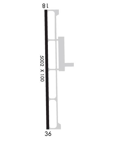
    Runway Identification: 18/36
    Length: 5002 ft
    Width: 100 ft
    Surface: ASPHALT-GOOD CONDITION
    Edge lights: Medium Intensity

    Treatment: NONE

     Runway: 18   Runway: 36
    Mag heading: 177°Mag heading: 357°
    Rwy Slope: .01% UpRwy Slope: -.01% Down
    Approach: Approach: LOC/GS
    Pattern: Left TrafficPattern: Left Traffic
    Markings: NONPRECISION INSTRUMENTMarkings: PRECISION INSTRUMENT
    Marking Condition: GOODMarking Condition: GOOD
    Arresting Dev: Arresting Dev:
    Lat & Long: N3221.5  W09101.7Lat. & Long.: N3220.7  W09101.7
    Elev: 85.3 ft. MSLElev: 85.7 ft. MSL
    TCH: 50 ft. AGLTCH: 50 ft. AGL
    Visual Glide Path: 3.00 degreesVisual Glide Path: 3.00 degrees
    Displaced Threshold: NoDisplaced Threshold: No
    Touchdown Zone: YESTouchdown Zone: YES
    Touchdown Elev.: 85.3 feetTouchdown Elev.: 85.7 feet
    Visual Glide Slope: 4-Light PAPI on LEFT side of RunwayVisual Glide Slope: 4-Light PAPI on LEFT side of Runway
    RVR Equipment: RVR Equipment:
    RVV Equipment: NORVV Equipment: NO
    Approach Lights: Approach Lights: SSALR - simplified short approach lighting system with runway alignment indicator lights
    REIL: YESREIL: NO
    Centerline Lights: NOCenterline Lights: NO
    Touchdown lights: NOTouchdown lights: NO
    Runway Category: Runway with a Non-precision Approach having visibility minimums greater than 3/4 mileRunway Category: Runway with a Non-precision Approach having visibility minimums greater than 3/4 mile
    Declared Distances: TORA:5002' TODA:5002' ASDA:5002' LDA:5002'Declared Distances: TORA:5002' TODA:5002' ASDA:5002' LDA:5002'
    Obstructions: TREESObstructions: TREES
    Marked: NOT Marked/LightedMarked: NOT Marked/Lighted
    Clearance slope: 24:1Clearance slope: 32:1
    Obstruction height: 91 feet AGLObstruction height: 64 feet AGL
    Dist. from runway: 2472 feetDist. from runway: 2285 feet
    Centerline offset: 134 right of centerlineCenterline offset: 375 feet right of centerline
    Comments: Comments:
    C:10/P: