
| ||||||||||||||||||||||||||||||||||||||||||||
| ||||||||||||||||||||||||||||||||||||||||||||
| ||||||||||||||||||||||||||||||||||||||||||||
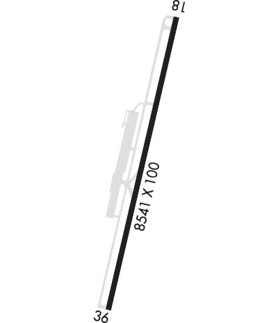
| Rwy | Rwy | |||||||
| 8541x100 | 7741' | 108.90 - 171° | 8541x100 | 6508' | ||||
| Runway ID | Single Wheel | Double Wheel | Double Tandem Wheel | Dual Double Wheel |
| 18/36 | 70,000 | 125,000 | 210,000 | N/A |
| These numbers are Advisory and are not limits. The Airport Manager should have more accurate Weight Limits | ||||
 Airport Diagram might not be current. | |
| Facility Name: | LAKE TAHOE |
| City Name: | SOUTH LAKE TAHOE |
| County: | EL DORADO |
| State abbrev: | CA |
| State Name: | CALIFORNIA |
| Ownership: | PUBLICLY OWNED |
| Use: | OPEN TO THE PUBLIC |
| Owner's Name: | SOUTH LAKE TAHOE |
| Address: | 1901 LISA MALOFF WAY, SUITE 100 |
| SOUTH LAKE TAHOE, CA 96150 | |
| Owner's Phone: | 530-542-6182 |
| Manager's Name: | JOHN DICKINSON |
| Address: | 1901 LISA MALOFF WAY, SUITE 100 |
| SOUTH LAKE TAHOE, CA 96150 | |
| Phone: | 530-542-6182 |
| FAA Region: | WESTERN-PACIFIC |
| FAA Field Office: | SFO |

| Date | Sunrise | Sunset |
|---|---|---|
| 04/23/24 Tuesday | 6:11 | 19:46 |
| 04/24/24 Wednesday | 6:10 | 19:47 |
| 04/25/24 Thursday | 6:09 | 19:48 |
| 04/26/24 Friday | 6:07 | 19:49 |
| 04/27/24 Saturday | 6:06 | 19:50 |
| 04/28/24 Sunday | 6:05 | 19:50 |
| 04/29/24 Monday | 6:04 | 19:51 |
| 04/30/24 Tuesday | 6:02 | 19:52 |
| 05/01/24 Wednesday | 6:01 | 19:53 |
| 05/02/24 Thursday | 6:00 | 19:54 |
| 05/03/24 Friday | 5:59 | 19:55 |
| 05/04/24 Saturday | 5:58 | 19:56 |
| 05/05/24 Sunday | 5:57 | 19:57 |
| 05/06/24 Monday | 5:55 | 19:58 |
| Airport Attendance Schedule | 0700-1600 |
| Airport Status | OPERATIONAL (This Status can change at any time - please check NOTAMS) |
| Airport Lighting Schedule | ACTVT MALSF RWY 18; PAPI RWY 18, MIRL RW 18/36 - CTAF. |
| Airport Storage Available | NONE |
| Extra Services Available | Charter, Flight Instruction, Aircraft Sales |
| Wind Indicator | YES - (lighted) |
| Control Tower | NO |
| CTAF Frequency | 122.850 |
| Unicom Frequency | MULTICOM 122.85 |
| Rotating Beacon Color | WG |
| Segmented Circle | YES |
| Landing Fee | NO |
| Airport Inspected | FEDERAL - performed by STATE AERONAUTICAL PERSONNEL |
| Inspection Date | 09/14/2023 |
| Type of Fuel Available | Grade 100LL, JET A (freeze point -40C) |
| Airframe Repair Service | MINOR |
| Power Plant Repair Service | MINOR |
| Latitude | N3853.6 |
| Longitude | W11959.7 (ESTIMATED) |
| Arpt Elevation | 6268ft (SURVEYED) |
| Magnetic Variation | 16E |
| 3 miles SW | of SOUTH LAKE TAHOE |
| Traffic Pattern Altitude | |
| Sectional Chart | SAN FRANCISCO |
| Operations (Reported) | Yearly | Avg. Daily |
|---|---|---|
| General Aviation Transient | 8099 | 22 |
| General Aviation Local | 646 | 2 |
| Air Taxi | 657 | 2 |
| Commerical | 207 | 1 |
| Commuter | 0 | 0 |
| Military | 236 | 1 |
| Aircraft based on Field | |
|---|---|
| General Aviation Singles | 18 |
| General Aviation Multi | 1 |
| Jet Aircraft | 0 |
| General Aviation Helicopters | 2 |
| Military Aircraft | 0 |
| Gliders | 0 |
| Ultralights | 0 |
| FSS on field | NO |
| FSS tie-in | RENO |
| FSS Phone | 1-800-WX-BRIEF |
| Who issues Notams | TVL |
| Notam D service at airport | YES |
| ARTCC Name | OAKLAND |
| Airport Certification | |
| Aircraft Rescue & Firefighting Index | None |
| Airport of Entry | No |
| Custom Landing Rights | No |
| Joint Civil/Military | No |
| Military Landing rights | YES |
| NATIONAL PLAN OF INTEGRATED AIRPORT SYSTEMS (NPIAS) |
| GRANT AGREEMENTS UNDER FAAP/ADAP/AIP |
| ASSURANCES PURSUANT TO TITLE VI, CIVIL RIGHTS ACT OF 1964 |
| AP SFC CONDS: TRML APRON EXCELLENT, TWY - RWY GOOD, NORTH GA APRON POOR. |
| AFTER WINTER STORMS RY 18/36 OPENS BEFORE ALL TWYS ARE CLEAR. |
| PREFERRED ARRIVAL RY 18; PREFERRED DEP RY 36. |
| RECREATIONAL AIRBORNE ACTIVITY ALONG SOUTHERN LAKE SHORE. |
| (E81) APRON ENTRANCE TWYS AND HIGH SPEED TWYS ONLY. |
| FOR LARGE AND HIGH PERFORMANCE ACFT DEP RY 18; RIGHT DOWNWIND DEP RECOMMENDED. |
| BIRDS AND WATERFOWL INVOF ARPT. |
| ADVERSE WEATHER EFFECTS MAGNIFIED BY MOUNTAINS. |
| TFC ADVISORIES & SEQUENCING IN THE TFC PAT ARE BASED ON POSITION REPORTS RECEIVED FROM PILOTS IN THESE AREAS. |
| ARPT SURROUNDED ON E; S & W BY RAPIDLY RISING TERRAIN. |
| ACCESS NOISE RESTRICTIONS: MAX 80 DBA DEP, 84 DBA ARR (TRANSPORT - 86 DBA), MAX 77.1 DBA NIGHT LIMIT. |
| NOISE ABATEMENT, DEP RWY 36 HDG 1 MILE, LEFT 320 DEG TO SHORELINE. |
| FOR NOISE ABATEMENT INFO CALL (530) 542-6182. |
| AVOID DESOLATION WILDERNESS WEST OF ARPT. |
| AP CONDS NOT MMT 1600-0700 DLY. |
| TWY H CLSD PERM. |
| TPA 7500' MSL FOR SMALL ACFT; 8000' MSL FOR TRANSPORT/HIGH PERFORMANCE ACFT. |
| PARAGLIDERS AND MOTORIZED PRCHTS OPR FROM RWY SFC. |
| AP CONDS NOT MNT SAT/SUN. |
| COLD TEMPERATURE AIRPORT. ALTITUDE CORRECTION REQUIRED AT OR BELOW -13C. |
Airport Communications & Frequencies:
| |||||||||
| Runway: 18 | Runway: 36 | ||
| Mag heading: | 177° | Mag heading: | 357° |
| Rwy Slope: | .16% Up | Rwy Slope: | -.16% Down |
| Approach: | LDA/DME | Approach: | |
| Pattern: | Left Traffic | Pattern: | Right Traffic |
| Markings: | NONPRECISION INSTRUMENT | Markings: | BASIC |
| Marking Condition: | GOOD | Marking Condition: | GOOD |
| Arresting Dev: | Arresting Dev: | ||
| Lat & Long: | N3854.3 W11959.5 | Lat. & Long.: | N3852.9 W11959.9 |
| Elev: | 6254.6 ft. MSL | Elev: | 6268.3 ft. MSL |
| TCH: | 48 ft. AGL | TCH: | |
| Visual Glide Path: | 3.00 degrees | Visual Glide Path: | |
| Displaced Threshold: | 800 feet | Displaced Threshold: | 2033 feet |
| Touchdown Zone: | YES | Touchdown Zone: | YES |
| Touchdown Elev.: | 6258.9 feet | Touchdown Elev.: | 6263.4 feet |
| Visual Glide Slope: | 4-Light PAPI on LEFT side of Runway; UNUSBL BYD 2 DEG LEFT OF RWY CNTRLN & BYD 3 NM. | Visual Glide Slope: | |
| RVR Equipment: | RVR Equipment: | ||
| RVV Equipment: | NO | RVV Equipment: | NO |
| Approach Lights: | MALSF - 1,400 foot medium intensity approach lighting system with sequenced flashers | Approach Lights: | |
| REIL: | NO | REIL: | YES |
| Centerline Lights: | NO | Centerline Lights: | NO |
| Touchdown lights: | NO | Touchdown lights: | NO |
| Runway Category: | Runway with a Non-precision Approach having visibility minimums greater than 3/4 mile | Runway Category: | Runway with a Visual Approach |
| Declared Distances: | TORA:8541' TODA:8541' ASDA:7817' LDA:7017' | Declared Distances: | TORA:8541' TODA:8541' ASDA:7741' LDA:5708' |
| Obstructions: | BRUSH | Obstructions: | TREES |
| Marked: | NOT Marked/Lighted | Marked: | NOT Marked/Lighted |
| Clearance slope: | 19:1 | Clearance slope: | 15:1; APCH RATIO 22:1 TO DSPLCD THLD. |
| Obstruction height: | 13 feet AGL | Obstruction height: | 345 feet AGL |
| Dist. from runway: | 450 feet | Dist. from runway: | 5700 feet |
| Centerline offset: | 125 left of centerline | Centerline offset: | 500 feet right of centerline |
| Comments: | Comments: |