
| ||||||||||||||||||||||||||||||||||||||||||||
| ||||||||||||||||||||||||||||||||||||||||||||
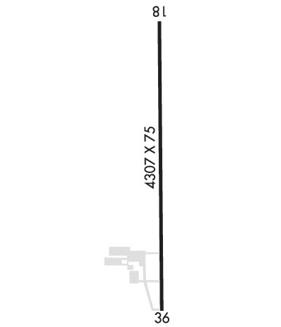
| Rwy | Rwy | |||||||
| 4307x75 | 3907' | 4307x75 | 4307' | |||||
| Runway ID | Single Wheel | Double Wheel | Double Tandem Wheel | Dual Double Wheel |
| 18/36 | N/A | N/A | N/A | N/A |
| These numbers are Advisory and are not limits. The Airport Manager should have more accurate Weight Limits | ||||
 Airport Diagram might not be current. | |
| Facility Name: | TRENTON MUNI |
| City Name: | TRENTON |
| County: | GRUNDY |
| State abbrev: | MO |
| State Name: | MISSOURI |
| Ownership: | PUBLICLY OWNED |
| Use: | OPEN TO THE PUBLIC |
| Owner's Name: | CITY OF TRENTON |
| Address: | 1100 MAIN ST., PO BOX 188 |
| TRENTON, MO 64683 | |
| Owner's Phone: | 660-359-2013 |
| Manager's Name: | WESLEY BARONE |
| Address: | 1100 MAIN ST., PO BOX 188 |
| TRENTON, MO 64683 | |
| Phone: | (660) 359-2013 |
| FAA Region: | CENTRAL |
| FAA Field Office: | NONE |
| Date | Sunrise | Sunset |
|---|---|---|
| 04/19/24 Friday | 6:29 | 19:58 |
| 04/20/24 Saturday | 6:28 | 19:59 |
| 04/21/24 Sunday | 6:27 | 20:00 |
| 04/22/24 Monday | 6:25 | 20:01 |
| 04/23/24 Tuesday | 6:24 | 20:02 |
| 04/24/24 Wednesday | 6:22 | 20:03 |
| 04/25/24 Thursday | 6:21 | 20:04 |
| 04/26/24 Friday | 6:20 | 20:05 |
| 04/27/24 Saturday | 6:18 | 20:06 |
| 04/28/24 Sunday | 6:17 | 20:07 |
| 04/29/24 Monday | 6:16 | 20:08 |
| 04/30/24 Tuesday | 6:14 | 20:09 |
| 05/01/24 Wednesday | 6:13 | 20:10 |
| 05/02/24 Thursday | 6:12 | 20:11 |
| Airport Attendance Schedule | MON-FRI 0730-1630 |
| Airport Status | OPERATIONAL (This Status can change at any time - please check NOTAMS) |
| Airport Lighting Schedule | MIRL RY 18/36 & PAPI RYS 18 & 36 OPER DUSK-2130; AFT 2130 TO DUSK ACTVT MIRL RY 18/36, PAPI RYS 18 & 36, REIL RYS 18 & 36 - CTAF. TO INCR INTST & ACTVT REIL RYS 18 & 36 - CTAF. |
| Airport Storage Available | Tie Downs |
| Extra Services Available | NONE |
| Wind Indicator | YES - (lighted) |
| Control Tower | NO |
| CTAF Frequency | 122.800 |
| Unicom Frequency | 122.800 |
| Rotating Beacon Color | WG |
| Segmented Circle | NO |
| Landing Fee | NO |
| Airport Inspected | STATE - performed by STATE AERONAUTICAL PERSONNEL |
| Inspection Date | 06/27/2022 |
| Type of Fuel Available | Grade 100LL, JET A (freeze point -40C); -1024 HR FUEL AVBL; CTC AMGR (660)359-2013; AFTER HRS CTC FIRE DEPT (660)359-5552. |
| Airframe Repair Service | None |
| Power Plant Repair Service | None |
| Latitude | N4005.0 |
| Longitude | W09335.4 (ESTIMATED) |
| Arpt Elevation | 757ft (SURVEYED) |
| Magnetic Variation | 03E |
| 1 miles E | of TRENTON |
| Traffic Pattern Altitude | |
| Sectional Chart | OMAHA |
| Operations (Reported) | Yearly | Avg. Daily |
|---|---|---|
| General Aviation Transient | 2000 | 5 |
| General Aviation Local | 450 | 1 |
| Air Taxi | 100 | 0 |
| Commerical | 0 | 0 |
| Commuter | 0 | 0 |
| Military | 10 | 0 |
| Aircraft based on Field | |
|---|---|
| General Aviation Singles | 13 |
| General Aviation Multi | 0 |
| Jet Aircraft | 0 |
| General Aviation Helicopters | 0 |
| Military Aircraft | 0 |
| Gliders | 0 |
| Ultralights | 0; ULTRALIGHT ACTIVITY ON & INVOF ARPT. |
| FSS on field | NO |
| FSS tie-in | COLUMBIA |
| FSS Phone | 1-800-WX-BRIEF |
| Who issues Notams | COU |
| Notam D service at airport | YES |
| ARTCC Name | KANSAS CITY |
| Airport Certification | |
| Aircraft Rescue & Firefighting Index | None |
| Airport of Entry | No |
| Custom Landing Rights | No |
| Joint Civil/Military | No |
| Military Landing rights | YES |
| NATIONAL PLAN OF INTEGRATED AIRPORT SYSTEMS (NPIAS) |
| ASSURANCES PURSUANT TO TITLE VI, CIVIL RIGHTS ACT OF 1964 |
| GRANT AGREEMENT HAS EXPIRED; HOWEVER, AGREEMENT REMAINS IN EFFECT FOR THIS FACILITY AS LONG AS IT IS PUBLIC USE. |
| BE ALERT FOR BIRDS & WILDLIFE ON AND INVOF ARPT. |
| FOR CD CTC KANSAS CITY ARTCC AT 913-254-8508. |
Airport Communications & Frequencies:
| |||||||||
| Runway: 18 | Runway: 36 | ||
| Mag heading: | 176° | Mag heading: | 356° |
| Rwy Slope: | -.06% Down | Rwy Slope: | .06% Up |
| Approach: | Approach: | ||
| Pattern: | Left Traffic | Pattern: | Left Traffic |
| Markings: | NONPRECISION INSTRUMENT | Markings: | NONPRECISION INSTRUMENT |
| Marking Condition: | GOOD | Marking Condition: | GOOD |
| Arresting Dev: | Arresting Dev: | ||
| Lat & Long: | N4005.4 W09335.4 | Lat. & Long.: | N4004.7 W09335.4 |
| Elev: | 757.3 ft. MSL | Elev: | 754.9 ft. MSL |
| TCH: | 40 ft. AGL | TCH: | 40 ft. AGL |
| Visual Glide Path: | 3.00 degrees | Visual Glide Path: | 3.00 degrees |
| Displaced Threshold: | 400 feet | Displaced Threshold: | No |
| Touchdown Zone: | YES | Touchdown Zone: | YES |
| Touchdown Elev.: | 757.3 feet | Touchdown Elev.: | 757.3 feet |
| Visual Glide Slope: | 4-Light PAPI on LEFT side of Runway | Visual Glide Slope: | 4-Light PAPI on LEFT side of Runway |
| RVR Equipment: | RVR Equipment: | ||
| RVV Equipment: | NO | RVV Equipment: | NO |
| Approach Lights: | Approach Lights: | ||
| REIL: | YES | REIL: | YES |
| Centerline Lights: | NO | Centerline Lights: | NO |
| Touchdown lights: | NO | Touchdown lights: | NO |
| Runway Category: | Runway with a Non-precision Approach | Runway Category: | Runway with a Non-precision Approach |
| Declared Distances: | Declared Distances: | ||
| Obstructions: | ROAD | Obstructions: | |
| Marked: | NOT Marked/Lighted | Marked: | |
| Clearance slope: | 2:1; 42:1 TO DTHR. | Clearance slope: | 20:1 |
| Obstruction height: | 15 feet AGL | Obstruction height: | |
| Dist. from runway: | 240 feet | Dist. from runway: | |
| Centerline offset: | 260 right of centerline | Centerline offset: | |
| Comments: | Comments: |
