Current Weather/Notams (Metars, TAFs, Notams, NWS Forecast, PIREPS, and nearby weather)
Customs Information Send updates to Support@FltPlan.com
Customs Not Available
Database effective 05/16/2024
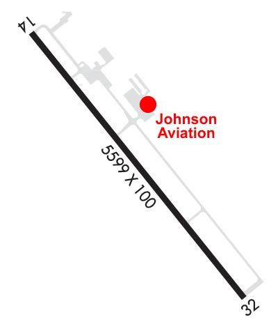
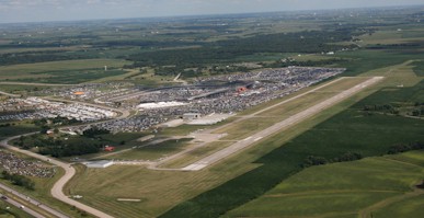
Airport Diagram might not be current. Facility Name: NEWTON MUNI-EARL JOHNSON FLD City Name: NEWTON County: JASPER State abbrev: IA State Name: IOWA Ownership: PUBLICLY OWNED Use: OPEN TO THE PUBLIC Owner's Name: CITY OF NEWTON Address: 115 N. 2ND AVE E. PO BOX 399 NEWTON, IA 50208 Owner's Phone: 641-792-2787 Manager's Name: ETHAN NASALROAD Address: BOX 986-2901 RUSTY WALLACE DRIVE NEWTON, IA 50208 Phone: 641-792-1292 FAA Region: CENTRAL FAA Field Office: NONE
Runway Identifications Help
Runway Identification: 14/32 Length: 5600 ftWidth: 100 ftSurface: ASPHALT-GOOD CONDITIONEdge lights: Medium Intensity Treatment: NONEWeight: PCN 32 /F/D/X/T Runway: 14 Runway: 32 Mag heading: 141° Mag heading: 321° Rwy Slope: -.12% Down Rwy Slope: .12% Up Approach: Approach: ILS Pattern: Left Traffic Pattern: Left Traffic Markings: NONPRECISION INSTRUMENT Markings: PRECISION INSTRUMENT Marking Condition: FAIR Marking Condition: FAIR Arresting Dev: Arresting Dev: Lat & Long: N4140.8 W09301.7 Lat. & Long.: N4140.1 W09300.9 Elev: 952.4 ft. MSL Elev: 945.5 ft. MSL TCH: 39 ft. AGL TCH: 49 ft. AGL Visual Glide Path: 3.00 degrees Visual Glide Path: 3.00 degrees Displaced Threshold: No Displaced Threshold: No Touchdown Zone: YES Touchdown Zone: YES Touchdown Elev.: 952.5 feet Touchdown Elev.: 950.2 feet Visual Glide Slope: 4-BOX VASI ON LEFT SIDE OF RUNWAY Visual Glide Slope: 4-BOX VASI ON LEFT SIDE OF RUNWAY RVR Equipment: RVR Equipment: RVV Equipment: NO RVV Equipment: NO Approach Lights: Approach Lights: MALSR - 1,400 foot medium intensity approach lighting system with runway alignment indicator lights REIL: YES REIL: NO Centerline Lights: NO Centerline Lights: NO Touchdown lights: NO Touchdown lights: NO Runway Category: Runway with a Non-precision Approach having visibility minimums greater than 3/4 mile Runway Category: Precision Instrument Runway Declared Distances: Declared Distances: Obstructions: ROAD Obstructions: Marked: NOT Marked/Lighted Marked: Clearance slope: 36:1 Clearance slope: 50:1 Obstruction height: 18 feet AGL Obstruction height: Dist. from runway: 860 feet Dist. from runway: Centerline offset: 350 left of centerline Centerline offset: Comments: Comments: