
| |||||||||||||||||||||||||||||||||||||||||||||||||||||||||||||||||||||
| |||||||||||||||||||||||||||||||||||||||||||||||||||||||||||||||||||||
| |||||||||||||||||||||||||||||||||||||||||||||||||||||||||||||||||||||
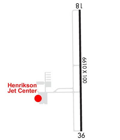
| Rwy | Rwy | |||||||
| 6610x100 | 6610' | 6610x100 | 6610' | |||||
| Runway ID | Single Wheel | Double Wheel | Double Tandem Wheel | Dual Double Wheel |
| 18/36 | N/A | 101,000 | N/A | N/A |
| These numbers are Advisory and are not limits. The Airport Manager should have more accurate Weight Limits | ||||
 Airport Diagram might not be current. | |
| Facility Name: | HOUSTON EXEC |
| City Name: | HOUSTON |
| County: | WALLER |
| State abbrev: | TX |
| State Name: | TEXAS |
| Ownership: | PRIVATELY OWNED |
| Use: | OPEN TO THE PUBLIC |
| Owner's Name: | WCF LLC |
| Address: | 1900 CARDIFF ROAD |
| BROOKSHIRE, TX 77423 | |
| Owner's Phone: | 281-945-5000 |
| Manager's Name: | ANDREW PERRY |
| Address: | 1900 CARDIFF ROAD |
| BROOKSHIRE, TX 77423 | |
| Phone: | 281-945-5000 |
| FAA Region: | SOUTHWEST |
| FAA Field Office: | TEX |

| Date | Sunrise | Sunset |
|---|---|---|
| 04/17/24 Wednesday | 6:54 | 19:52 |
| 04/18/24 Thursday | 6:53 | 19:53 |
| 04/19/24 Friday | 6:52 | 19:54 |
| 04/20/24 Saturday | 6:51 | 19:54 |
| 04/21/24 Sunday | 6:50 | 19:55 |
| 04/22/24 Monday | 6:49 | 19:56 |
| 04/23/24 Tuesday | 6:48 | 19:56 |
| 04/24/24 Wednesday | 6:47 | 19:57 |
| 04/25/24 Thursday | 6:46 | 19:57 |
| 04/26/24 Friday | 6:45 | 19:58 |
| 04/27/24 Saturday | 6:44 | 19:59 |
| 04/28/24 Sunday | 6:43 | 19:59 |
| 04/29/24 Monday | 6:42 | 20:00 |
| 04/30/24 Tuesday | 6:41 | 20:01 |
| Airport Attendance Schedule | CONTINUOUS |
| Airport Status | OPERATIONAL (This Status can change at any time - please check NOTAMS) |
| Airport Lighting Schedule | ACTVT MIRL RY 18/36, REIL RYS 18 & 36 - CTAF. |
| Airport Storage Available | Tie Downs, Hanger |
| Extra Services Available | Air Freight, Air Ambulance, Cargo Handling, Charter, Flight Instruction |
| Wind Indicator | YES - (lighted) |
| Control Tower | YES |
| CTAF Frequency | 126.975 |
| Unicom Frequency | 122.975 |
| Rotating Beacon Color | WG |
| Segmented Circle | YES |
| Landing Fee | NO |
| Airport Inspected | 5010-2 PRIVATE USE MAILOUT PROGRAM - performed by PRIVATE CONTRACT PERSONNEL |
| Inspection Date | 04/11/2023 |
| Type of Fuel Available | Grade 100LL, JET A (freeze point -40C) |
| Airframe Repair Service | MAJOR |
| Power Plant Repair Service | MAJOR |
| Latitude | N2948.3 |
| Longitude | W09553.9 (ESTIMATED) |
| Arpt Elevation | 165ft (SURVEYED) |
| Magnetic Variation | 04E |
| 28 miles W | of HOUSTON |
| Traffic Pattern Altitude | |
| Sectional Chart | HOUSTON |
| Operations (Reported) | Yearly | Avg. Daily |
|---|---|---|
| General Aviation Transient | 26645 | 73 |
| General Aviation Local | 19536 | 54 |
| Air Taxi | 0 | 0 |
| Commerical | 0 | 0 |
| Commuter | 0 | 0 |
| Military | 83 | 0 |
| Aircraft based on Field | |
|---|---|
| General Aviation Singles | 95 |
| General Aviation Multi | 17 |
| Jet Aircraft | 38 |
| General Aviation Helicopters | 0 |
| Military Aircraft | 0 |
| Gliders | 0 |
| Ultralights | 0 |
| FSS on field | NO |
| FSS tie-in | MONTGOMERY COUNTY |
| FSS Phone | 1-800-WX-BRIEF |
| Who issues Notams | CXO |
| Notam D service at airport | YES |
| ARTCC Name | HOUSTON |
| Airport Certification | |
| Aircraft Rescue & Firefighting Index | None |
| Airport of Entry | No |
| Custom Landing Rights | No |
| Joint Civil/Military | No |
| Military Landing rights | No |
| NOISE SENSITIVE AREA EAST OF ARPT IN EFFECT: AVOID HOUSING AREA. |
| BIRDS ON & INVOF ARPT. |
| FOR CD WHEN ATCT IS CLSD CTC HOUSTON APCH AT 281-443-5844 TO CNL IFR AT 281-443-5888. |
Airport Communications & Frequencies:
| ||||||||||||||||||||||
| Runway: 18 | Runway: 36 | ||
| Mag heading: | 175° | Mag heading: | 355° |
| Rwy Slope: | -.05% Down | Rwy Slope: | .05% Up |
| Approach: | Approach: | ||
| Pattern: | Left Traffic | Pattern: | Right Traffic |
| Markings: | NONPRECISION INSTRUMENT | Markings: | NONPRECISION INSTRUMENT |
| Marking Condition: | GOOD | Marking Condition: | GOOD |
| Arresting Dev: | Arresting Dev: | ||
| Lat & Long: | N2948.8 W09553.9 | Lat. & Long.: | N2947.8 W09553.9 |
| Elev: | 165.9 ft. MSL | Elev: | 162.6 ft. MSL |
| TCH: | 40 ft. AGL | TCH: | 40 ft. AGL |
| Visual Glide Path: | 3.00 degrees | Visual Glide Path: | 3.00 degrees |
| Displaced Threshold: | No | Displaced Threshold: | No |
| Touchdown Zone: | YES | Touchdown Zone: | YES |
| Touchdown Elev.: | 165.9 feet | Touchdown Elev.: | 164.1 feet |
| Visual Glide Slope: | 4-Light PAPI on LEFT side of Runway | Visual Glide Slope: | 4-Light PAPI on LEFT side of Runway |
| RVR Equipment: | RVR Equipment: | ||
| RVV Equipment: | NO | RVV Equipment: | NO |
| Approach Lights: | Approach Lights: | ||
| REIL: | YES | REIL: | YES |
| Centerline Lights: | NO | Centerline Lights: | NO |
| Touchdown lights: | NO | Touchdown lights: | NO |
| Runway Category: | D | Runway Category: | D |
| Declared Distances: | Declared Distances: | ||
| Obstructions: | PLINE | Obstructions: | |
| Marked: | MARKED | Marked: | |
| Clearance slope: | 33:1 | Clearance slope: | 50:1 |
| Obstruction height: | 17 feet AGL | Obstruction height: | |
| Dist. from runway: | 765 feet | Dist. from runway: | |
| Centerline offset: | Centerline offset: | ||
| Comments: | Comments: |