Click here for more info on on SMS!

KTDO

ED CARLSON MEMORIAL FIELD
TOLEDO
WA
Time Zone: Pacific
Lat: N 4628.6
Long: W 12248.4
Elev: 374
Var: -17
Longest Runway: 4479
CTAF: 122.9

FBO & Flight Services info for KTDO

FBOs: Update your Fuel Prices

ED CARLSONPh: 360-864-4966
-
Freq: 122.9
Service
Jet
100LL
SAF
MoGas
Fuel Avail: 24 HR SELF-SERV CARD LOCK SYSTEM. CREDIT CARD
Full        Last Update: 04/23/2024 13:24

Self  5.95    
 Address: 826 CINEBAR RD   CINEBAR, WA 98533
If you are an FBO, call 1-203-262-1700 to update your info or email: FltPlan.Advertising@garmin.com
Advertise your FBO on FltPlan.com

Runway & Approach Info for KTDO
Rwy
Length
Land Dist**
Approach*
  Rwy
Length
Land Dist**
Approach*
06
4479x150  4479'          
 
  
24
  4479x150  4479'          
 
 * only ILS, LOC, LDA, and SDF approaches to a specific runway are shown
** For any Declared Landing Distance Available, please see A/FD or Approach plates
Runway Weight Capability (lbs.) Help
Runway IDSingle WheelDouble WheelDouble Tandem WheelDual Double Wheel
06/2425,000N/AN/AN/A
These numbers are Advisory and are not limits.   The Airport Manager should have more accurate Weight Limits
Approach Charts
Approaches    
Current Weather/Notams
Customs Information Send updates to Support@FltPlan.com
Customs Not Available
Database effective 05/16/2024
Airport Diagram of KTDO
Airport Diagram might not be current.

Facility Name: ED CARLSON MEML FLD/SOUTH LEWIS COUNTY
City Name: TOLEDO
County: LEWIS
State abbrev: WA
State Name: WASHINGTON
   
Ownership: PUBLICLY OWNED
Use: OPEN TO THE PUBLIC
Owner's Name: LEWIS COUNTY
Address: 2025 NE KRESKY AVE
 CHEHALIS, WA 98532
Owner's Phone: 360-740-2606
  
Manager's Name: JOHN ROE
Address: 5239 JACKSON HWY
 TOLEDO, WA 98591-9732
Phone: 360-864 4966
   
FAA Region: NORTHWEST MOUNTAIN
FAA Field Office: SEA


Sunrise / Sunset times for ED CARLSON MEML FLD/SOUTH LEWIS COUNTY

DateSunriseSunset
04/23/24 Tuesday6:0920:11
04/24/24 Wednesday6:0720:12
04/25/24 Thursday6:0520:14
04/26/24 Friday6:0420:15
04/27/24 Saturday6:0220:16
04/28/24 Sunday6:0020:18
04/29/24 Monday5:5920:19
04/30/24 Tuesday5:5720:20
05/01/24 Wednesday5:5620:22
05/02/24 Thursday5:5420:23
05/03/24 Friday5:5320:24
05/04/24 Saturday5:5120:26
05/05/24 Sunday5:5020:27
05/06/24 Monday5:4820:28

Airport Facilities

Airport Attendance ScheduleMON-FRI 1000-1700
Airport Status OPERATIONAL (This Status can change at any time - please check NOTAMS)
Airport Lighting ScheduleACTVT REIL RWY 06 & 24; MIRL RWY 06/24 - CTAF. PAPI RWY 06 & 24 OPR CONSLY.
Airport Storage AvailableTie Downs
Extra Services AvailableGlider, Flight Instruction, Parachute Jumping
Wind IndicatorYES - (lighted)
Control TowerNO
CTAF Frequency122.900
Unicom Frequency
Rotating Beacon ColorWG
Segmented CircleNO
Landing FeeNO

Airport Inspection Data

Airport InspectedSTATE - performed by STATE AERONAUTICAL PERSONNEL
Inspection Date06/02/2021

Airport Services

Type of Fuel AvailableGrade 100LL; -1024 HR CREDIT CARD FUEL FAC.
Airframe Repair ServiceMINOR
Power Plant Repair ServiceMINOR

Geographic Data

LatitudeN4628.6
LongitudeW12248.4 (ESTIMATED)
Arpt Elevation373ft (SURVEYED)
Magnetic Variation17E
3 miles Nof TOLEDO
Traffic Pattern Altitude800
Sectional ChartSEATTLE

Aircraft Data

Operations (Reported)YearlyAvg. Daily
General Aviation Transient 500014
General Aviation Local 31008
Air Taxi 00
Commerical 00
Commuter 00
Military 2001
Aircraft based on Field
General Aviation Singles 38
General Aviation Multi 0
Jet Aircraft 0
General Aviation Helicopters 2
Military Aircraft 0
Gliders 0
Ultralights 0

FAA Services

FSS on field NO
FSS tie-in SEATTLE
FSS Phone 1-800-WX-BRIEF
Who issues Notams TDO
Notam D service at airport YES
ARTCC Name SEATTLE

Federal Status

Airport Certification
Aircraft Rescue & Firefighting IndexNone
Airport of EntryNo
Custom Landing RightsNo
Joint Civil/MilitaryNo
Military Landing rightsNo

Federal Agreements

NATIONAL PLAN OF INTEGRATED AIRPORT SYSTEMS (NPIAS)
AGREEMENT UNDER DLAND OR DCLA HAS EXPIRED.

Remarks

RDO CTL ACFT ADJ RWY 06/24 400 FT S & BLW.
DISTANCE TO GO MARKERS SOUTHSIDE OF RY.
GLDR ACT JUL-NOV.
LNAV GPS APPROACHES CURRENTLY PUBLISHED TO BOTH RUNWAY ENDS, MINIMA AS LOW AS 1 MILE.
FOR CD CTC SEATTLE ARTCC AT 253-351-3694.
Airport Communications & Frequencies:
CTAF Frequency:
122.900
Remarks
  • APCH/DEP CTL SVC PRVDD BY SEATTLE ARTCC (ZSE) ON FREQS 124.2/317.6 (NASSEL RCAG).
  • Runway Identifications
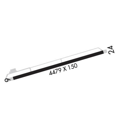
    Runway Identification: 06/24
    Length: 4479 ft
    Width: 150 ft
    Surface: ASPHALT-GOOD CONDITION
    Edge lights: Medium Intensity

    Treatment: NONE

     Runway: 06   Runway: 24
    Mag heading: 57°Mag heading: 237°
    Rwy Slope: .41% UpRwy Slope: -.41% Down
    Approach: Approach:
    Pattern: Left TrafficPattern: Left Traffic
    Markings: NONPRECISION INSTRUMENTMarkings: NONPRECISION INSTRUMENT
    Marking Condition: GOODMarking Condition: GOOD
    Arresting Dev: Arresting Dev:
    Lat & Long: N4628.5  W12248.9Lat. & Long.: N4628.7  W12247.9
    Elev: 355.5 ft. MSLElev: 373.9 ft. MSL
    TCH: 43 ft. AGLTCH: 44 ft. AGL
    Visual Glide Path: 3.00 degreesVisual Glide Path: 3.00 degrees
    Displaced Threshold: NoDisplaced Threshold: No
    Touchdown Zone: YESTouchdown Zone: YES
    Touchdown Elev.: 366.9 feetTouchdown Elev.: 373.9 feet
    Visual Glide Slope: 2-Light PAPI on LEFT side of RunwayVisual Glide Slope: 2-Light PAPI on LEFT side of Runway
    RVR Equipment: RVR Equipment:
    RVV Equipment: NORVV Equipment: NO
    Approach Lights: Approach Lights:
    REIL: YESREIL: YES
    Centerline Lights: NOCenterline Lights: NO
    Touchdown lights: NOTouchdown lights: NO
    Runway Category: Runway with a Non-precision Approach having visibility minimums greater than 3/4 mileRunway Category: Runway with a Non-precision Approach having visibility minimums greater than 3/4 mile
    Declared Distances: Declared Distances:
    Obstructions: TREESObstructions: 4 FT FENCE 300 FT FROM END BOTH SIDES OF CL.
    Marked: NOT Marked/LightedMarked: NOT Marked/Lighted
    Clearance slope: 25:1Clearance slope: 50:1
    Obstruction height: 100 feet AGLObstruction height:
    Dist. from runway: 2723 feetDist. from runway:
    Centerline offset: Centerline offset:
    Comments: Comments:
    C:/P: