
| ||||||||||||||||||||||||||||||||
| ||||||||||||||||||||||||||||||||
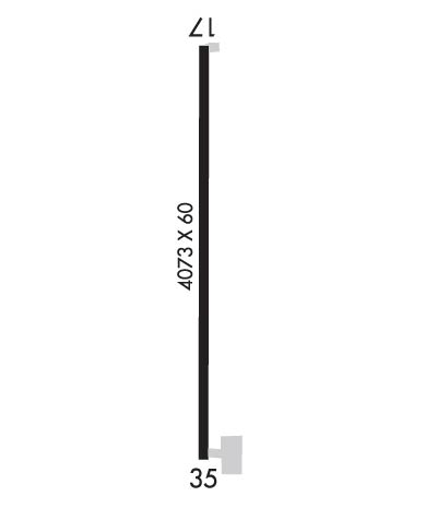
| Rwy | Rwy | |||||||
| 4073x60 | 4073' | 4073x60 | 4073' | |||||
| Runway ID | Single Wheel | Double Wheel | Double Tandem Wheel | Dual Double Wheel |
| 17/35 | 18,000 | N/A | N/A | N/A |
| These numbers are Advisory and are not limits. The Airport Manager should have more accurate Weight Limits | ||||
 Airport Diagram might not be current. | |
| Facility Name: | FOLLETT/LIPSCOMB COUNTY |
| City Name: | FOLLETT |
| County: | LIPSCOMB |
| State abbrev: | TX |
| State Name: | TEXAS |
| Ownership: | PUBLICLY OWNED |
| Use: | OPEN TO THE PUBLIC |
| Owner's Name: | CITY OF FOLLETT |
| Address: | BOX 216 |
| FOLLETT, TX 79034 | |
| Owner's Phone: | 806-653-2601 |
| Manager's Name: | ROBERT WILLIAMSON |
| Address: | BOX 216 |
| FOLLET, TX 79034 | |
| Phone: | 806-653-2601 |
| FAA Region: | SOUTHWEST |
| FAA Field Office: | TEX |
| Date | Sunrise | Sunset |
|---|---|---|
| 04/18/24 Thursday | 7:02 | 20:18 |
| 04/19/24 Friday | 7:01 | 20:19 |
| 04/20/24 Saturday | 6:59 | 20:20 |
| 04/21/24 Sunday | 6:58 | 20:21 |
| 04/22/24 Monday | 6:57 | 20:21 |
| 04/23/24 Tuesday | 6:56 | 20:22 |
| 04/24/24 Wednesday | 6:54 | 20:23 |
| 04/25/24 Thursday | 6:53 | 20:24 |
| 04/26/24 Friday | 6:52 | 20:25 |
| 04/27/24 Saturday | 6:51 | 20:26 |
| 04/28/24 Sunday | 6:50 | 20:27 |
| 04/29/24 Monday | 6:49 | 20:27 |
| 04/30/24 Tuesday | 6:47 | 20:28 |
| 05/01/24 Wednesday | 6:46 | 20:29 |
| Airport Attendance Schedule | UNATTENDED |
| Airport Status | OPERATIONAL (This Status can change at any time - please check NOTAMS) |
| Airport Lighting Schedule | |
| Airport Storage Available | Tie Downs |
| Extra Services Available | NONE |
| Wind Indicator | NONE |
| Control Tower | NO |
| CTAF Frequency | 122.900 |
| Unicom Frequency | |
| Rotating Beacon Color | |
| Segmented Circle | YES |
| Landing Fee | NO |
| Airport Inspected | STATE - performed by PRIVATE CONTRACT PERSONNEL |
| Inspection Date | 09/14/2021 |
| Type of Fuel Available | None |
| Airframe Repair Service | None |
| Power Plant Repair Service | None |
| Latitude | N3626.4 |
| Longitude | W10007.4 (ESTIMATED) |
| Arpt Elevation | 2600ft (SURVEYED) |
| Magnetic Variation | 06E |
| 1 miles E | of FOLLETT |
| Traffic Pattern Altitude | |
| Sectional Chart | WICHITA |
| Operations (Reported) | Yearly | Avg. Daily |
|---|---|---|
| General Aviation Transient | 50 | 0 |
| General Aviation Local | 50 | 0 |
| Air Taxi | 0 | 0 |
| Commerical | 0 | 0 |
| Commuter | 0 | 0 |
| Military | 0 | 0 |
| Aircraft based on Field | |
|---|---|
| General Aviation Singles | 3 |
| General Aviation Multi | 0 |
| Jet Aircraft | 0 |
| General Aviation Helicopters | 0 |
| Military Aircraft | 0 |
| Gliders | 0 |
| Ultralights | 0 |
| FSS on field | NO |
| FSS tie-in | FORT WORTH |
| FSS Phone | 1-800-WX-BRIEF |
| Who issues Notams | FTW |
| Notam D service at airport | YES |
| ARTCC Name | KANSAS CITY |
| Airport Certification | |
| Aircraft Rescue & Firefighting Index | None |
| Airport of Entry | No |
| Custom Landing Rights | No |
| Joint Civil/Military | No |
| Military Landing rights | No |
| THIS AIRPORT HAS BEEN SURVEYED BY THE NATIONAL GEODETIC SURVEY. |
| NO LINE OF SIGHT BTN RWY ENDS. |
| FOR CD CTC KANSAS CITY ARTCC AT 913-254-8508. |
| RWY 17/3 5 EXTENSIVE PAVEMENT CRACKING WITH VEGETATION GROWING THROUGH. LOOSE STONES ON RWY. |
| RWY 17/3 5 113 FT WIDE STRIP OF PAVEMENT ALNG WEST EDGE OF RWY IS SPONGY AND WILL NOT SUPPORT LISTED WHEEL WEIGHT. |
Airport Communications & Frequencies:
| |||||||
| Runway: 17 | Runway: 35 | ||
| Mag heading: | 174° | Mag heading: | 354° |
| Rwy Slope: | 1.70% Up | Rwy Slope: | -1.70% Down |
| Approach: | Approach: | ||
| Pattern: | Left Traffic | Pattern: | Left Traffic |
| Markings: | NONPRECISION INSTRUMENT | Markings: | NONPRECISION INSTRUMENT |
| Marking Condition: | NO PAVEMENT MARKINGS. | Marking Condition: | NO PAVEMENT MARKINGS. |
| Arresting Dev: | Arresting Dev: | ||
| Lat & Long: | N3626.8 W10007.4 | Lat. & Long.: | N3626.1 W10007.4 |
| Elev: | 2531.5 ft. MSL | Elev: | 2600.8 ft. MSL |
| TCH: | TCH: | ||
| Visual Glide Path: | Visual Glide Path: | ||
| Displaced Threshold: | No | Displaced Threshold: | No |
| Touchdown Zone: | YES | Touchdown Zone: | YES |
| Touchdown Elev.: | 2585.4 feet | Touchdown Elev.: | 2600.8 feet |
| Visual Glide Slope: | Visual Glide Slope: | ||
| RVR Equipment: | RVR Equipment: | ||
| RVV Equipment: | NO | RVV Equipment: | NO |
| Approach Lights: | Approach Lights: | ||
| REIL: | NO | REIL: | NO |
| Centerline Lights: | NO | Centerline Lights: | NO |
| Touchdown lights: | NO | Touchdown lights: | NO |
| Runway Category: | Runway with a Visual Approach | Runway Category: | Runway with a Non-precision Approach |
| Declared Distances: | Declared Distances: | ||
| Obstructions: | PLINE | Obstructions: | HILL |
| Marked: | NOT Marked/Lighted | Marked: | NOT Marked/Lighted |
| Clearance slope: | 38:1 | Clearance slope: | 24:1 |
| Obstruction height: | 12 feet AGL | Obstruction height: | 43 feet AGL |
| Dist. from runway: | 666 feet | Dist. from runway: | 1269 feet |
| Centerline offset: | 229 right of centerline | Centerline offset: | |
| Comments: | Comments: |
