
| ||||||||||||||||||||||||||||||||
| ||||||||||||||||||||||||||||||||
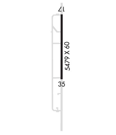
| Rwy | Rwy | |||||||
| 5479x60 | 5479' | 5479x60 | 5479' | |||||
| Runway ID | Single Wheel | Double Wheel | Double Tandem Wheel | Dual Double Wheel |
| 17/35 | 50,000 | N/A | N/A | N/A |
| These numbers are Advisory and are not limits. The Airport Manager should have more accurate Weight Limits | ||||
| FltPlan does not have IFR approach charts available for KT88. |
 Airport Diagram might not be current. | |
| Facility Name: | COLORADO CITY |
| City Name: | COLORADO CITY |
| County: | MITCHELL |
| State abbrev: | TX |
| State Name: | TEXAS |
| Ownership: | PUBLICLY OWNED |
| Use: | OPEN TO THE PUBLIC |
| Owner's Name: | CITY OF COLORADO CITY |
| Address: | PO BOX 912 |
| COLORADO CITY, TX 79512 | |
| Owner's Phone: | 325-728-3464 |
| Manager's Name: | DONNA MADRID; CITY MANAGER |
| Address: | PO BOX 912 |
| COLORADO CITY, TX 79512 | |
| Phone: | 325-728-3464 |
| FAA Region: | SOUTHWEST |
| FAA Field Office: | TEX |
| Date | Sunrise | Sunset |
|---|---|---|
| 04/24/24 Wednesday | 7:03 | 20:21 |
| 04/25/24 Thursday | 7:02 | 20:21 |
| 04/26/24 Friday | 7:01 | 20:22 |
| 04/27/24 Saturday | 7:00 | 20:23 |
| 04/28/24 Sunday | 6:59 | 20:23 |
| 04/29/24 Monday | 6:58 | 20:24 |
| 04/30/24 Tuesday | 6:57 | 20:25 |
| 05/01/24 Wednesday | 6:56 | 20:26 |
| 05/02/24 Thursday | 6:55 | 20:26 |
| 05/03/24 Friday | 6:54 | 20:27 |
| 05/04/24 Saturday | 6:53 | 20:28 |
| 05/05/24 Sunday | 6:53 | 20:28 |
| 05/06/24 Monday | 6:52 | 20:29 |
| 05/07/24 Tuesday | 6:51 | 20:30 |
| Airport Attendance Schedule | IRREGULAR |
| Airport Status | OPERATIONAL (This Status can change at any time - please check NOTAMS) |
| Airport Lighting Schedule | SS-SR |
| Airport Storage Available | Tie Downs |
| Extra Services Available | Crop Dusting |
| Wind Indicator | YES - (lighted) |
| Control Tower | NO |
| CTAF Frequency | 122.900 |
| Unicom Frequency | |
| Rotating Beacon Color | WG |
| Segmented Circle | YES |
| Landing Fee | NO |
| Airport Inspected | STATE - performed by STATE AERONAUTICAL PERSONNEL |
| Inspection Date | 05/31/2018 |
| Type of Fuel Available | None |
| Airframe Repair Service | NONE |
| Power Plant Repair Service | NONE |
| Latitude | N3228.1 |
| Longitude | W10055.3 (ESTIMATED) |
| Arpt Elevation | 2214ft (ESTIMATED) |
| Magnetic Variation | 08E |
| 6 miles NW | of COLORADO CITY |
| Traffic Pattern Altitude | |
| Sectional Chart | DALLAS-FT WORTH |
| Operations (Reported) | Yearly | Avg. Daily |
|---|---|---|
| General Aviation Transient | 300 | 1 |
| General Aviation Local | 1000 | 3 |
| Air Taxi | 0 | 0 |
| Commerical | 0 | 0 |
| Commuter | 0 | 0 |
| Military | 0 | 0 |
| Aircraft based on Field | |
|---|---|
| General Aviation Singles | 5 |
| General Aviation Multi | 0 |
| Jet Aircraft | 0 |
| General Aviation Helicopters | 0 |
| Military Aircraft | 0 |
| Gliders | 0 |
| Ultralights | 0 |
| FSS on field | NO |
| FSS tie-in | FORT WORTH |
| FSS Phone | 1-800-WX-BRIEF |
| Who issues Notams | FTW |
| Notam D service at airport | YES |
| ARTCC Name | FORT WORTH |
| Airport Certification | |
| Aircraft Rescue & Firefighting Index | None |
| Airport of Entry | No |
| Custom Landing Rights | No |
| Joint Civil/Military | No |
| Military Landing rights | YES |
| SURPLUS PROPERTY AGREEMENT UNDER PUBLIC LAW 289 |
| ASSURANCES PURSUANT TO TITLE VI, CIVIL RIGHTS ACT OF 1964 |
| FOR CD CTC FORT WORTH ARTCC AT 817-858-7584. |
| RWY 17/3 5 PAVEMENT FM RY 35 THLD LGTS SOUTHWARD USED AS A TWY AND NOT MAINTAINED. |
| Runway: 17 | Runway: 35 | ||
| Mag heading: | 173° | Mag heading: | 353° |
| Rwy Slope: | -.16% Down | Rwy Slope: | .16% Up |
| Approach: | Approach: | ||
| Pattern: | Left Traffic | Pattern: | Left Traffic |
| Markings: | BASIC | Markings: | BASIC |
| Marking Condition: | POOR; RWY MRKNGS FADED AND PEELING. NO CNTRLN. | Marking Condition: | POOR; RWY MRKNGS FADED AND PEELING. NO CNTRLN. |
| Arresting Dev: | Arresting Dev: | ||
| Lat & Long: | N3228.6 W10055.3 | Lat. & Long.: | N3227.7 W10055.3 |
| Elev: | 2214.1 ft. MSL | Elev: | 2205.4 ft. MSL |
| TCH: | TCH: | ||
| Visual Glide Path: | Visual Glide Path: | ||
| Displaced Threshold: | No | Displaced Threshold: | No |
| Touchdown Zone: | YES | Touchdown Zone: | YES |
| Touchdown Elev.: | 2214.0 feet | Touchdown Elev.: | 2213.0 feet |
| Visual Glide Slope: | Visual Glide Slope: | ||
| RVR Equipment: | RVR Equipment: | ||
| RVV Equipment: | NO | RVV Equipment: | NO |
| Approach Lights: | Approach Lights: | ||
| REIL: | NO | REIL: | NO |
| Centerline Lights: | NO | Centerline Lights: | NO |
| Touchdown lights: | NO | Touchdown lights: | NO |
| Runway Category: | Runway with a Visual Approach | Runway Category: | Runway with a Visual Approach |
| Declared Distances: | Declared Distances: |
