Current Weather/Notams (Metars, TAFs, Notams, NWS Forecast, PIREPS, and nearby weather)
Customs Information Send updates to Support@FltPlan.com
Customs Not Available
Database effective 05/16/2024
Airport Diagram might not be current.
|
| Facility Name: | WHEELER MUNI |
| City Name: | WHEELER |
| County: | WHEELER |
| State abbrev: | TX |
| State Name: | TEXAS |
| | |
| Ownership: | PUBLICLY OWNED |
| Use: | OPEN TO THE PUBLIC |
| Owner's Name: | CITY OF WHEELER TX |
| Address: | 501 ALAN BEAN BLVD, PO BOX 98 |
| | WHEELER, TX 79096 |
| Owner's Phone: | 806-826-3222 |
| | |
| Manager's Name: | PAUL ARGNBRIGHT; PUBLIC WORKS DIRECTOR |
| Address: | 505 ALAN BEAN BLVD, PO BOX 98 |
| | WHEELER, TX 79096 |
| Phone: | 806-669-4182 |
| | |
| FAA Region: | SOUTHWEST |
| FAA Field Office: | TEX |
Runway Identifications
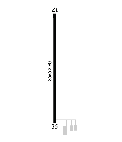
Runway Identification: 17/35Length: 3565 ft
Width: 60 ft
Surface: ASPHALT-FAIR CONDITION
Edge lights: Low IntensityTreatment: NONE
| | Runway: 17 | | Runway: 35 |
| Mag heading: | 175° | Mag heading: | 355° |
| Rwy Slope: | 1.10% Up | Rwy Slope: | -1.10% Down |
| Approach: | | Approach: | |
| Pattern: | Left Traffic | Pattern: | Left Traffic |
| Markings: | NONPRECISION INSTRUMENT | Markings: | NONPRECISION INSTRUMENT |
| Marking Condition: | FAIR | Marking Condition: | FAIR |
| Arresting Dev: | | Arresting Dev: | |
| Lat & Long: | N3527.4 W10012.0 | Lat. & Long.: | N3526.8 W10012.0 |
| Elev: | 2430.6 ft. MSL | Elev: | 2469.9 ft. MSL |
| TCH: | | TCH: | |
| Visual Glide Path: | | Visual Glide Path: | |
| Displaced Threshold: | No | Displaced Threshold: | 57 feet |
| Touchdown Zone: | YES | Touchdown Zone: | YES |
| Touchdown Elev.: | 2464.8 feet | Touchdown Elev.: | 2469.7 feet |
| Visual Glide Slope: | | Visual Glide Slope: | |
| RVR Equipment: | | RVR Equipment: | |
| RVV Equipment: | NO | RVV Equipment: | NO |
| Approach Lights: | | Approach Lights: | |
| REIL: | NO | REIL: | NO |
| Centerline Lights: | NO | Centerline Lights: | NO |
| Touchdown lights: | NO | Touchdown lights: | NO |
| Runway Category: | Runway with a Non-precision Approach | Runway Category: | Runway with a Non-precision Approach |
| Declared Distances: | | Declared Distances: | |
| Obstructions: | | Obstructions: | ROAD |
| Marked: | | Marked: | NOT Marked/Lighted |
| Clearance slope: | 50:1 | Clearance slope: | 18:1; APCH SLOPE 31:1 TO DSPLCD THLD. |
| Obstruction height: | | Obstruction height: | 20 feet AGL |
| Dist. from runway: | | Dist. from runway: | 564 feet |
| Centerline offset: | | Centerline offset: | |
| Comments: | | Comments: | |

