Click here for more info on on SMS!

KT23

ALBANY MUNI
ALBANY
TX
Time Zone: Central
Lat: N 3243.3
Long: W 09916.1
Elev: 1415
Var: -05
Longest Runway: 5000
CTAF: 122.9

FBO & Flight Services info for KT23

FBOs: Update your Fuel Prices

ALBANY MUNIPh: 325-762-3133
-
-
Service
Jet
100LL
SAF
MoGas
Fuel Avail: PRIST PREMIXED. 24/7 SS
Full        Last Update: 04/15/2024 15:06

price will vary depending on new purchase price
Self4.055.05    
 Address: 551 CR 119   ALBANY, TX 76430
If you are an FBO, call 1-203-262-1700 to update your info or email: FltPlan.Advertising@garmin.com
Advertise your FBO on FltPlan.com

Runway & Approach Info for KT23
Rwy
Length
Land Dist**
Approach*
  Rwy
Length
Land Dist**
Approach*
17
5000x75  5000'          
 
  
35
  5000x75  5000'          
 
 * only ILS, LOC, LDA, and SDF approaches to a specific runway are shown
** For any Declared Landing Distance Available, please see A/FD or Approach plates
Runway Weight Capability (lbs.) Help
Runway IDSingle WheelDouble WheelDouble Tandem WheelDual Double Wheel
17/3530,000N/AN/AN/A
These numbers are Advisory and are not limits.   The Airport Manager should have more accurate Weight Limits
Approach Charts
Approaches    
Current Weather/Notams
Customs Information Send updates to Support@FltPlan.com
Customs Not Available
Database effective 05/16/2024
Airport Diagram of KT23
Airport Diagram might not be current.

Facility Name: ALBANY MUNI
City Name: ALBANY
County: SHACKELFORD
State abbrev: TX
State Name: TEXAS
   
Ownership: PUBLICLY OWNED
Use: OPEN TO THE PUBLIC
Owner's Name: THE CITY OF ALBANY
Address: 425 S SECOND ST, P O BOX 3248
 ALBANY, TX 76430
Owner's Phone: 325-762-3133
  
Manager's Name: BILLY HOLSON; CITY/AIRPORT MGR.
Address: 425 S SECOND ST, P O BOX 3248
 ALBANY, TX 76430
Phone: 325-762-0383
   
FAA Region: SOUTHWEST
FAA Field Office: TEX


Sunrise / Sunset times for ALBANY MUNI

DateSunriseSunset
04/25/24 Thursday6:5520:15
04/26/24 Friday6:5420:16
04/27/24 Saturday6:5320:16
04/28/24 Sunday6:5220:17
04/29/24 Monday6:5120:18
04/30/24 Tuesday6:5020:19
05/01/24 Wednesday6:4920:19
05/02/24 Thursday6:4820:20
05/03/24 Friday6:4720:21
05/04/24 Saturday6:4620:22
05/05/24 Sunday6:4620:22
05/06/24 Monday6:4520:23
05/07/24 Tuesday6:4420:24
05/08/24 Wednesday6:4320:24

Airport Facilities

Airport Attendance ScheduleIRREGULAR
Airport Status OPERATIONAL (This Status can change at any time - please check NOTAMS)
Airport Lighting ScheduleMIRL RWY 17/35 PRESET LOW INTST; TO INCR INTST AND ACTVT PAPI RWY 17 & 35 - 123.5.
Airport Storage AvailableTie Downs
Extra Services AvailableNONE
Wind IndicatorYES - (lighted)
Control TowerNO
CTAF Frequency122.900
Unicom Frequency
Rotating Beacon ColorWG
Segmented CircleYES
Landing FeeNO

Airport Inspection Data

Airport InspectedSTATE - performed by PRIVATE CONTRACT PERSONNEL
Inspection Date11/13/2023

Airport Services

Type of Fuel AvailableGrade 100LL, JET A (freeze point -40C); -10100LL AND JET A 24 HRS SELF SERVE.
Airframe Repair ServiceNone
Power Plant Repair ServiceNone

Geographic Data

LatitudeN3243.3
LongitudeW09916.1 (ESTIMATED)
Arpt Elevation1414ft (SURVEYED)
Magnetic Variation05E
2 miles Eof ALBANY
Traffic Pattern Altitude
Sectional ChartDALLAS-FT WORTH

Aircraft Data

Operations (Reported)YearlyAvg. Daily
General Aviation Transient 7002
General Aviation Local 14004
Air Taxi 00
Commerical 00
Commuter 00
Military 00
Aircraft based on Field
General Aviation Singles 7
General Aviation Multi 0
Jet Aircraft 0
General Aviation Helicopters 1
Military Aircraft 0
Gliders 0
Ultralights 0

FAA Services

FSS on field NO
FSS tie-in FORT WORTH
FSS Phone 1-800-WX-BRIEF
Who issues Notams FTW
Notam D service at airport YES
ARTCC Name FORT WORTH

Federal Status

Airport Certification
Aircraft Rescue & Firefighting IndexNone
Airport of EntryNo
Custom Landing RightsNo
Joint Civil/MilitaryNo
Military Landing rightsNo

Remarks

FOR CD CTC FORT WORTH ARTCC AT 817-858-7584.
Airport Communications & Frequencies:
CTAF Frequency:
122.900
ABILENE Primary Approach Frequencies:  
125.0
338.3
ABILENE Primary Departure Frequencies:  
125.0
338.3
Runway Identifications
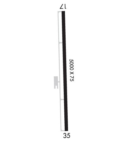
Runway Identification: 17/35
Length: 5000 ft
Width: 75 ft
Surface: ASPHALT
Edge lights: Medium Intensity

Treatment: NONE

 Runway: 17   Runway: 35
Mag heading: 173°Mag heading: 353°
Rwy Slope: .53% UpRwy Slope: -.53% Down
Approach: Approach:
Pattern: Left TrafficPattern: Right Traffic
Markings: NONPRECISION INSTRUMENTMarkings: NONPRECISION INSTRUMENT
Marking Condition: GOODMarking Condition: GOOD
Arresting Dev: Arresting Dev:
Lat & Long: N3243.7  W09916.1Lat. & Long.: N3242.9  W09916.0
Elev: 1386.0 ft. MSLElev: 1412.4 ft. MSL
TCH: 40 ft. AGLTCH: 40 ft. AGL
Visual Glide Path: 3.00 degreesVisual Glide Path: 3.00 degrees
Displaced Threshold: NoDisplaced Threshold: No
Touchdown Zone: YESTouchdown Zone: YES
Touchdown Elev.: 1414.4 feetTouchdown Elev.: 1414.8 feet
Visual Glide Slope: 2-Light PAPI on LEFT side of RunwayVisual Glide Slope: 2-Light PAPI on LEFT side of Runway
RVR Equipment: RVR Equipment:
RVV Equipment: NORVV Equipment: NO
Approach Lights: Approach Lights:
REIL: NOREIL: NO
Centerline Lights: NOCenterline Lights: NO
Touchdown lights: NOTouchdown lights: NO
Runway Category: Runway with a Non-precision Approach having visibility minimums greater than 3/4 mileRunway Category: Runway with a Non-precision Approach having visibility minimums greater than 3/4 mile
Declared Distances: Declared Distances:
Obstructions: ROADObstructions: TREES
Marked: NOT Marked/LightedMarked: MARKED
Clearance slope: 37:1; ALSO, 25 FT MKD PLINE, 990 FT DSTC, 0 FT B, APCH SLOPE 31:1.Clearance slope: 31:1
Obstruction height: 8 feet AGLObstruction height: 10 feet AGL
Dist. from runway: 500 feetDist. from runway: 512 feet
Centerline offset: Centerline offset: 160 feet left of centerline
Comments: Comments:
C:2/P: