Current Weather/Notams (Metars, TAFs, Notams, NWS Forecast, PIREPS, and nearby weather)
Customs Information Send updates to Support@FltPlan.com
Customs Not Available
Database effective 05/16/2024
Airport Diagram might not be current. Facility Name: STATESVILLE RGNL City Name: STATESVILLE County: IREDELL State abbrev: NC State Name: NORTH CAROLINA Ownership: PUBLICLY OWNED Use: OPEN TO THE PUBLIC Owner's Name: CITY OF STATESVILLE Address: PO BOX 1111 STATESVILLE, NC 28687 Owner's Phone: 704-873-1111 Manager's Name: JOHN M. FERGUSON Address: 238 AIRPORT ROAD STATESVILLE, NC 28677 Phone: 704-873-1111 FAA Region: SOUTHERN FAA Field Office: MEM
Runway Identifications Help
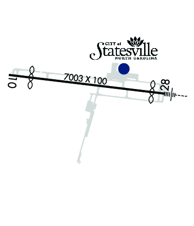
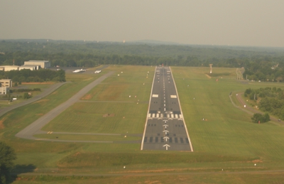
Runway Identification: 10/28 Length: 7003 ftWidth: 100 ftSurface: ASPHALTEdge lights: High Intensity Treatment: GROOVED Runway: 10 Runway: 28 Mag heading: 105° Mag heading: 285° Rwy Slope: -.02% Down Rwy Slope: .02% Up Approach: Approach: ILS/DME Pattern: Left Traffic Pattern: Left Traffic Markings: NONPRECISION INSTRUMENT Markings: PRECISION INSTRUMENT Marking Condition: GOOD Marking Condition: GOOD Arresting Dev: Arresting Dev: Lat & Long: N3546.0 W08057.9 Lat. & Long.: N3545.8 W08056.5 Elev: 958.6 ft. MSL Elev: 956.9 ft. MSL TCH: 50 ft. AGL TCH: 50 ft. AGL Visual Glide Path: 3.00 degrees Visual Glide Path: 3.00 degrees Displaced Threshold: No Displaced Threshold: 550 feet Touchdown Zone: YES Touchdown Zone: YES Touchdown Elev.: 967.8 feet Touchdown Elev.: 967.4 feet Visual Glide Slope: 4-Light PAPI on LEFT side of Runway Visual Glide Slope: 4-Light PAPI on LEFT side of Runway RVR Equipment: RVR Equipment: RVV Equipment: NO RVV Equipment: NO Approach Lights: Approach Lights: MALSR - 1,400 foot medium intensity approach lighting system with runway alignment indicator lights REIL: YES REIL: NO Centerline Lights: NO Centerline Lights: NO Touchdown lights: NO Touchdown lights: NO Runway Category: Runway with a Non-precision Approach having visibility minimums greater than 3/4 mile Runway Category: Precision Instrument Runway Declared Distances: TORA:7003' TODA:7003' ASDA:6453' LDA:6453' Declared Distances: TORA:7003' TODA:7003' ASDA:7003' LDA:6453' Obstructions: TREES Obstructions: TREES Marked: NOT Marked/Lighted Marked: NOT Marked/Lighted Clearance slope: 9:1 Clearance slope: 21:1; APCH SLP 34:1 AT DSPLCD THR DUE TO +43 FT TREES 1696 FT FM DSPLCD THR AND 617 FT LEFT OF CNTRLN. Obstruction height: 49 feet AGL Obstruction height: 46 feet AGL Dist. from runway: 671 feet Dist. from runway: 1170 feet Centerline offset: 468 left of centerline Centerline offset: 560 feet left of centerline Comments: Comments: