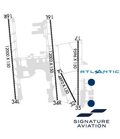
Click here for more info on on SMS!

KSLC

SALT LAKE CITY INTL
SALT LAKE CITY
UT
Time Zone: Mountain
Lat: N 4047.3
Long: W 11158.7
Elev: 4231
Var: -11
Longest Runway: 12002
Clr Del: 127.3
Dept. ATIS: 124.75
Arr. ATIS: 124.75/125.62
Ground: 121.9/133.65
Tower: 118.3E/119.05

FBO & Flight Services info for KSLC

FBOs: Update your Fuel Prices
Land at any FBO in our growing worldwide network and you'll receive a warm, friendly Signature greeting. Consistent, exceptional service. Line support that's expert, safe and ready on the ramp. Clean, comfortable, well-furnished facilities. Service professionals who go the extra mile for your passengers and crew. Competitive pricing in every market.
Ph: 801-359-2085 Fax: 801-933-7556 Freq: 130.87WebsiteE-Mail
                   
Service
Jet
100LL
SAF
MoGas
Fuel Avail: 24 hr 7 days weekly
Full8.068.90    Last Update: 04/18/2024 12:04

Self        
Misc. Info: JET-A + FSII ADDED FS $8.56Address: 303 NORTH 2370 WEST,   SALT LAKE CITY, UT 84116
Atlantic Aviation is your premier aviation service provider with more than 100 locations in North America, including Hawaii and the Caribbean. We provide standard ground services you'd expect, with a detailed focus on ensuring an unforgettable customer experience.
Ph: 385-715-7192 Fax: 385-715-9053 Freq: 130.62WebsiteE-Mail
                     
Service
Jet
100LL
SAF
MoGas
Full7.818.97    Last Update: 04/18/2024 13:28:40
PRICES GUARANTEED by FBO.
Self        
Misc. Info: Address: 369 NORTH 2370 WEST,   SALT LAKE CITY, UT 84116

ATISPh: 801-325-9749
-
-
 
ASOSPh: 801-328-3567
-
-
 
If you are an FBO, call 1-203-262-1700 to update your info or email: FltPlan.Advertising@garmin.com
Advertise your FBO on FltPlan.com
FBOs at nearby airports who want your business:
KHCR


  click here  
KHCR 800-388-4445 122.8

Gateway to Park City, Deer Valley, Heber City and all the Resorts
(15 -20 minute drive)

De-Icing, Large Lobby, Crew Lounge, WiFi, Conference Room, Rental Cars, Hangar Space, FAA Part 145 Maintenance, Pilatus Service Center
Ph: 800-388-4445 WebsiteE-MailFax: 800-388-4445 Freq: 122.8

Runway & Approach Info for KSLC
Rwy
Length
Land Dist**
Approach*
  Rwy
Length
Land Dist**
Approach*
14
4893x150  4893'          
 
  
32
  4893x150  4893'          
 
16L
12002x150  12002'          
ILS/DME
 109.50 - 163°  
  
34R
  12002x150  12002'          
ILS/DME
 109.50 - 343°  
16R
12000x150  12000'          
ILS/DME
 111.90 - 163°  
  
34L
  12000x150  12000'          
ILS/DME
 111.90 - 343°  
17
9596x150  9596'          
ILS/DME
 111.50 - 168°  
  
35
  9596x150  9272'          
LDA/DME
 111.50 - 343°  
 * only ILS, LOC, LDA, and SDF approaches to a specific runway are shown
** For any Declared Landing Distance Available, please see A/FD or Approach plates
Runway Weight Capability (lbs.) Help
Runway IDSingle WheelDouble WheelDouble Tandem WheelDual Double Wheel
14/3260,000200,000350,000850,000
16L/34R60,000200,000350,000850,000
16R/34L60,000200,000350,000850,000
17/3560,000200,000350,000850,000
HBN/AN/AN/AN/A
HFN/AN/AN/AN/A
These numbers are Advisory and are not limits.   The Airport Manager should have more accurate Weight Limits
Approach Charts
Approaches    
Current Weather/Notams
Customs Information Send updates to Support@FltPlan.com
Phone 801-524-3445
Fax 801-524-4433

Comments 2 hr advance notice required. Business hrs 0800-1630 Monday-Friday. Clearance hours are 1430 to 1530 and 1645 to 1815. Maximum passengers per flight: 40. Email service requests to: slcprivateair@cbp.dhs.gov. Request service outside of the clearance hours 72 hours in advance. Call by 1630 on preceding day for weekday arrivals and by 1630 Friday for weekend arrivals.
Database effective 04/18/2024
Airport Diagram of KSLC
Airport Diagram might not be current.

Facility Name: SALT LAKE CITY INTL
City Name: SALT LAKE CITY
County: SALT LAKE
State abbrev: UT
State Name: UTAH
   
Ownership: PUBLICLY OWNED
Use: OPEN TO THE PUBLIC
Owner's Name: SALT LAKE CITY
Address: CITY AND COUNTY BLDG
 SALT LAKE CITY, UT 84101
Owner's Phone: 801-575-2460
  
Manager's Name: MATTHEW BROWN
Address: P.O. BOX 145550
 SALT LAKE CITY, UT 84114-5550
Phone: 801-575-2244
   
FAA Region: NORTHWEST MOUNTAIN
FAA Field Office: DEN


Sunrise / Sunset times for SALT LAKE CITY INTL

DateSunriseSunset
04/17/24 Wednesday6:4520:10
04/18/24 Thursday6:4320:12
04/19/24 Friday6:4220:13
04/20/24 Saturday6:4020:14
04/21/24 Sunday6:3920:15
04/22/24 Monday6:3720:16
04/23/24 Tuesday6:3620:17
04/24/24 Wednesday6:3520:18
04/25/24 Thursday6:3320:19
04/26/24 Friday6:3220:20
04/27/24 Saturday6:3120:21
04/28/24 Sunday6:2920:22
04/29/24 Monday6:2820:23
04/30/24 Tuesday6:2720:24

Airport Facilities

Airport Attendance ScheduleCONTINUOUS
Airport Status OPERATIONAL (This Status can change at any time - please check NOTAMS)
Airport Lighting ScheduleSS-SR
Airport Storage AvailableTie Downs, Hanger
Extra Services AvailableAir Freight, Air Ambulance, Avionics, Cargo Handling, Charter, Flight Instruction, Aircraft Rental, Aircraft Sales
Wind IndicatorYES - (lighted)
Control TowerYES
CTAF Frequency
Unicom Frequency122.950
Rotating Beacon ColorWG
Segmented CircleNO
Landing FeeNO

Airport Inspection Data

Airport InspectedFEDERAL - performed by FAA AIRPORTS FIELD PERSONNEL
Inspection Date03/24/2023

Airport Services

Type of Fuel AvailableGrade 100LL, JET A-1 (icing inhibitor, freeze point -50C)
Airframe Repair ServiceMAJOR
Power Plant Repair ServiceMAJOR

Geographic Data

LatitudeN4047.3
LongitudeW11158.7 (ESTIMATED)
Arpt Elevation4230ft (SURVEYED)
Magnetic Variation11E
3 miles Wof SALT LAKE CITY
Traffic Pattern Altitude
Sectional ChartSALT LAKE CITY

Aircraft Data

Operations (Reported)YearlyAvg. Daily
General Aviation Transient 421812
General Aviation Local 46915129
Air Taxi 47817131
Commerical 174782479
Commuter 00
Military 28838
Aircraft based on Field
General Aviation Singles 192
General Aviation Multi 69
Jet Aircraft 51
General Aviation Helicopters 25
Military Aircraft 9
Gliders 0
Ultralights 0

FAA Services

FSS on field NO
FSS tie-in CEDAR CITY
FSS Phone 1-800-WX-BRIEF
Who issues Notams SLC
Notam D service at airport YES
ARTCC Name SALT LAKE CITY

Federal Status

Airport CertificationAIRPORT RECEIVING SCHEDULED AIR CARRIER SERVICE FROM CARRIERS CERTIFICATED BY THE CIVIL AERONAUTICS BOARD
Aircraft Rescue & Firefighting IndexAIRPORT HAS A CERTIFICATE UNDER CFR PART 139
Airport of EntryNo
Custom Landing RightsYES
Joint Civil/MilitaryNo
Military Landing rightsYES

Federal Agreements

NATIONAL PLAN OF INTEGRATED AIRPORT SYSTEMS (NPIAS)
GRANT AGREEMENTS UNDER FAAP/ADAP/AIP
SURPLUS PROPERTY AGREEMENT UNDER PUBLIC LAW 289
ASSURANCES PURSUANT TO TITLE VI, CIVIL RIGHTS ACT OF 1964

Remarks

SURFACE MOVEMENT GUIDANCE CONTROL SYSTEM & LOW VISIBILITY TAXI PROCEDURES.
DUE TO TFC VOL, LCL DEPARTURE AND ARR OPNS ARE DISCOURAGED AND DLAS CAN BE EXPCD BTN 1500-1730Z++ AND 0130-0300Z++.
SVFR IS NOT RCMD AT THE ARPT, IF REQD, EXPT DLAS.
MILITARY: ANG RAMP: OPR 1430-2230Z++ MON-THU. CLSD FRI-SUN AND HOL. OFFL BUS ONLY. PPR REQ 48 HR ALL ACFT, VALID 1 HR +/- ETA. TRAN PRK/SVC EXTREMELY LTD. BASE OPS DSN 245-2274, C801-245-2274. MIL ALT HILL AFB (KHIF) 25 NM N. ALL ACFT CTC UTAH CTL (COMD POST) 20 MIN OUT WITH ETA AND REQ.
MILITARY: ANG RAMP: ALL ACFT CTC UTAH CONTROL WITH LDG & DEP TIMES. COMD POST DSN: 245-2416/2417; C801-245-2416/2417. PHASE II WILDLIFE ACT DURING MIGRATION/MORNING/EVENING HRS FR OCT-APR. CTC UTAH CTL FOR CURRENT BIRD-WATCH COND.
SEE FLIP AP/1 SUPPLEMENTARY ARPT INFO.
MILITARY: COMMUNICATIONS: ANG COMD POST - CALL UTAH CONTROL.
USE CAUTION FOR EXTENSIVE PARAGLIDING OPS INVOF POINT OF THE MOUNTAIN.
SEE CURRENT NOTAMS FOR DATES AND ADDITIONAL INFO.
FLOCK OF BIRDS ON AND IN VICINITY OF ARPT.
MILITARY: SVC: FUEL A++.
TWY Y RSTD TO WINGSPANS LESS THAN 171 FT BTWN TWY H3 AND H4.
USE MINIMUM THRUST IN CONSTRUCTION AREAS.
CONTACT GROUND ON 123.775 BEFORE TAXIING OUT OF NORTH CARGO.
ASDE-X IN USE. OPERATE TRANSPONDERS WITH ALTITUDE REPORTING MODE AND ADS-B (IF EQUIPPED) ENABLED ON ALL AIRPORT SURFACES.
MILITARY: ANG RAMP: NSTD PAVEMENT MARK ON RAMP.
TWY K RSTRD TO ACFT WITH WINGSPAN LESS THAN 171 FT.
HELIPADS B AND F LOCATED ON GENERAL AVIATION APRONS.
RWY 14/3 2 RWY 14/32 CLSD BLW 1200 FT RVR.
RWY HB LIGHTED POLE 51 FT AGL 383 FT ESE OF HELIPAD B.
Airport Communications & Frequencies:
ATIS Frequencies:   Hours(local) of Operation: CONTINUOUS
124.75
125.625
SALT LAKE CITY Tower Frequencies:   Hours(local) of operation: CONTINUOUS   
118.3 ;RWY 14/32, 17/35
119.05 ;RWY 16L/34R
132.65 ;RWY 16R/34L
257.8 ;RWY 14/32, 16L/34R, 17/35
336.4 ;RWY 16R/34L
SALT LAKE CITY Ground Frequencies:
121.9 ;RWY 14/32, 17/35
123.775 ;RWY 16L/34R, 16R/34L
348.6
Clearance Delivery Frequencies:
127.3
127.3
379.975
Pre-Taxi Clearance Frequencies:
127.3
Emergency Frequencies:
121.5
243.0
Unicom Frequency:
122.950
Remarks
  • ANG
  • SALT LAKE CITY Primary Approach Frequencies:  
    120.9 SOUTH OF 41 DEG LAT BLW 8000 FT
    121.1 NORTH OF 41 DEG LAT BLW 8000 FT
    124.9 300-340 ABV 8000 FT
    125.7
    126.25
    128.1 160-250 ABV 8000 FT
    128.6 110-160 TCH ABV 8,000 FT
    135.5 340-110 ABV 8000 FT.
    233.7
    257.2
    269.625
    284.6
    290.3 300-340 TCH ABV 8000 FT
    307.05
    319.25
    322.3 110-160 TCH ABV 8000 FT
    353.6
    353.825 250-300 ABV 8000 FT
    SALT LAKE CITY Primary Departure Frequencies:  
    120.9 SOUTH OF 41 DEG LAT BLW 8000 FT
    121.1 NORTH OF 41 DEG LAT BLW 8000 FT
    125.7
    126.25
    126.25 250-300 ABV 8000 FT
    128.1 160-250 ABV 8000 FT
    128.6 110-160 TCH ABV 8,000 FT
    135.5 340-110 ABV 8000 FT.
    233.7
    284.6
    307.05
    316.15
    319.25
    322.3 110-160 TCH ABV 8000 FT
    353.6
    353.825 250-300 ABV 8000 FT
    Class B Frequencies:
    120.9 SOUTH OF 41 DEG LAT
    121.1 NORTH OF 41 DEG LAT
    257.2 SOUTH OF 41 DEG LAT
    319.25 NORTH OF 41 DEG LAT
    Runway Identifications
    Runway Identification: 14/32
    Length: 4893 ft
    Width: 150 ft
    Surface: ASPHALT-GOOD CONDITION
    Edge lights: High Intensity

    Treatment: GROOVED

     Runway: 14   Runway: 32
    Mag heading: 142°Mag heading: 322°
    Rwy Slope: .04% UpRwy Slope: -.04% Down
    Approach: Approach:
    Pattern: Left TrafficPattern: Left Traffic
    Markings: BASICMarkings: BASIC
    Marking Condition: GOODMarking Condition: GOOD
    Arresting Dev: Arresting Dev:
    Lat & Long: N4047.1  W11158.3Lat. & Long.: N4046.4  W11157.8
    Elev: 4224.7 ft. MSLElev: 4226.8 ft. MSL
    TCH: 40 ft. AGLTCH: 41 ft. AGL
    Visual Glide Path: 3.00 degreesVisual Glide Path: 3.00 degrees
    Displaced Threshold: NoDisplaced Threshold: No
    Touchdown Zone: YESTouchdown Zone: YES
    Touchdown Elev.: 4224.8 feetTouchdown Elev.: 4226.8 feet
    Visual Glide Slope: 4-Light PAPI on LEFT side of RunwayVisual Glide Slope: 4-Light PAPI on LEFT side of Runway
    RVR Equipment: RVR Equipment:
    RVV Equipment: NORVV Equipment: NO
    Approach Lights: Approach Lights:
    REIL: NOREIL: NO
    Centerline Lights: NOCenterline Lights: NO
    Touchdown lights: NOTouchdown lights: NO
    Runway Category: Runway with a Visual ApproachRunway Category: Runway with a Visual Approach
    Declared Distances: TORA:4892' TODA:4892' ASDA:4892' LDA:4892'Declared Distances: TORA:4892' TODA:4892' ASDA:4892' LDA:4892'
    Runway Identification: 16L/34R
    Length: 12002 ft
    Width: 150 ft
    Surface: ASPHALT-GOOD CONDITION
    Edge lights: High Intensity

    Treatment: GROOVED

     Runway: 16L   Runway: 34R
    Mag heading: 164°Mag heading: 344°
    Rwy Slope: -.04% DownRwy Slope: .04% Up
    Approach: ILS/DMEApproach: ILS/DME
    Pattern: Left TrafficPattern: Left Traffic
    Markings: PRECISION INSTRUMENTMarkings: PRECISION INSTRUMENT
    Marking Condition: GOODMarking Condition: GOOD
    Arresting Dev: Arresting Dev:
    Lat & Long: N4048.4  W11158.6Lat. & Long.: N4046.5  W11158.4
    Elev: 4229.1 ft. MSLElev: 4224.3 ft. MSL
    TCH: 70 ft. AGLTCH: 73 ft. AGL
    Visual Glide Path: 3.00 degreesVisual Glide Path: 3.00 degrees
    Displaced Threshold: NoDisplaced Threshold: No
    Touchdown Zone: YESTouchdown Zone: YES
    Touchdown Elev.: 4230.9 feetTouchdown Elev.: 4224.7 feet
    Visual Glide Slope: 4-Light PAPI on LEFT side of RunwayVisual Glide Slope: 4-Light PAPI on LEFT side of Runway
    RVR Equipment: TOUCHDOWN-MIDFIELD-ROLLOUTRVR Equipment: TOUCHDOWN-MIDFIELD-ROLLOUT
    RVV Equipment: NORVV Equipment: NO
    Approach Lights: ALSF2 - standard 2,400 foot high intensity approach lighting system with sequenced flashers, Category II or IIIApproach Lights: ALSF2 - standard 2,400 foot high intensity approach lighting system with sequenced flashers, Category II or III
    REIL: NOREIL: NO
    Centerline Lights: YESCenterline Lights: YES
    Touchdown lights: YESTouchdown lights: YES
    Runway Category: Precision Instrument RunwayRunway Category: Precision Instrument Runway
    Declared Distances: TORA:12002' TODA:12002' ASDA:12002' LDA:12002'Declared Distances: TORA:12002' TODA:12002' ASDA:12002' LDA:12002'
    Runway Identification: 16R/34L
    Length: 12000 ft
    Width: 150 ft
    Surface: CONCRETE-GOOD CONDITION
    Edge lights: High Intensity

    Treatment: GROOVED

     Runway: 16R   Runway: 34L
    Mag heading: 164°Mag heading: 344°
    Rwy Slope: .05% UpRwy Slope: -.05% Down
    Approach: ILS/DMEApproach: ILS/DME
    Pattern: Left TrafficPattern: Left Traffic
    Markings: PRECISION INSTRUMENTMarkings: PRECISION INSTRUMENT
    Marking Condition: GOODMarking Condition: GOOD
    Arresting Dev: Arresting Dev:
    Lat & Long: N4048.5  W11200.0Lat. & Long.: N4046.5  W11159.7
    Elev: 4223.4 ft. MSLElev: 4228.8 ft. MSL
    TCH: 73 ft. AGLTCH: 73 ft. AGL
    Visual Glide Path: 3.00 degreesVisual Glide Path: 3.00 degrees
    Displaced Threshold: NoDisplaced Threshold: No
    Touchdown Zone: YESTouchdown Zone: YES
    Touchdown Elev.: 4225.8 feetTouchdown Elev.: 4228.8 feet
    Visual Glide Slope: 4-Light PAPI on LEFT side of RunwayVisual Glide Slope: 4-Light PAPI on LEFT side of Runway
    RVR Equipment: TOUCHDOWN-MIDFIELD-ROLLOUTRVR Equipment: TOUCHDOWN-MIDFIELD-ROLLOUT
    RVV Equipment: NORVV Equipment: NO
    Approach Lights: ALSF2 - standard 2,400 foot high intensity approach lighting system with sequenced flashers, Category II or IIIApproach Lights: ALSF2 - standard 2,400 foot high intensity approach lighting system with sequenced flashers, Category II or III
    REIL: NOREIL: NO
    Centerline Lights: YESCenterline Lights: YES
    Touchdown lights: YESTouchdown lights: YES
    Runway Category: Precision Instrument RunwayRunway Category: Precision Instrument Runway
    Declared Distances: TORA:12000' TODA:12000' ASDA:12000' LDA:12000'Declared Distances: TORA:12000' TODA:12000' ASDA:12000' LDA:12000'
    Runway Identification: 17/35
    Length: 9596 ft
    Width: 150 ft
    Surface: ASPHALT-GOOD CONDITION
    Edge lights: High Intensity

    Treatment: GROOVED

     Runway: 17   Runway: 35
    Mag heading: 169°Mag heading: 349°
    Rwy Slope: .05% UpRwy Slope: -.05% Down
    Approach: ILS/DMEApproach: LDA/DME
    Pattern: Left TrafficPattern: Left Traffic
    Markings: PRECISION INSTRUMENTMarkings: PRECISION INSTRUMENT
    Marking Condition: GOODMarking Condition: GOOD
    Arresting Dev: Arresting Dev:
    Lat & Long: N4047.9  W11157.7Lat. & Long.: N4046.4  W11157.7
    Elev: 4221.7 ft. MSLElev: 4226.8 ft. MSL
    TCH: 73 ft. AGLTCH: 74 ft. AGL
    Visual Glide Path: 3.00 degreesVisual Glide Path: 3.00 degrees
    Displaced Threshold: NoDisplaced Threshold: 324 feet
    Touchdown Zone: YESTouchdown Zone: YES
    Touchdown Elev.: 4222.2 feetTouchdown Elev.: 4226.9 feet
    Visual Glide Slope: 4-Light PAPI on RIGHT side of RunwayVisual Glide Slope: 4-Light PAPI on LEFT side of Runway
    RVR Equipment: TOUCHDOWN-ROLLOUTRVR Equipment: TOUCHDOWN-ROLLOUT
    RVV Equipment: NORVV Equipment: NO
    Approach Lights: MALSR - 1,400 foot medium intensity approach lighting system with runway alignment indicator lightsApproach Lights: MALSR - 1,400 foot medium intensity approach lighting system with runway alignment indicator lights
    REIL: NOREIL: NO
    Centerline Lights: YESCenterline Lights: YES
    Touchdown lights: YESTouchdown lights: YES
    Runway Category: Precision Instrument RunwayRunway Category: Precision Instrument Runway
    Declared Distances: TORA:9596' TODA:9596' ASDA:9596' LDA:9596'Declared Distances: TORA:9596' TODA:9596' ASDA:9596' LDA:9272'
    Obstructions: Obstructions: ANT
    Marked: Marked: NOT Marked/Lighted
    Clearance slope: 50:1Clearance slope: 33:1; HAS 24 FT ANT 1005 FT, 250 FT, 50:1 SLOPE TO DTHR.
    Obstruction height: Obstruction height: 24 feet AGL
    Dist. from runway: Dist. from runway: 1005 feet
    Centerline offset: Centerline offset: 250 feet left of centerline
    Comments: Comments:
    Runway Identification: HB HELIPAD
    Length: 60 ft
    Width: 60 ft
    Surface: ASPHALT-GOOD CONDITION
    Edge lights:

    Treatment: NONE

    Runway Identification: HF HELIPAD
    Length: 60 ft
    Width: 60 ft
    Surface: ASPHALT-GOOD CONDITION
    Edge lights:

    Treatment: NONE

    C:374/P: