Click here for more info on on SMS!

KSHR

SHERIDAN COUNTY
SHERIDAN
WY
Time Zone: Mountain
Lat: N 4446.2
Long: W 10658.8
Elev: 4021
Var: -10
Longest Runway: 8301
AWOS: 135.17
CTAF: 123.0

FBO & Flight Services info for KSHR

FBOs: Update your Fuel Prices

  click here  
We're always here to meet the needs of every passenger & crewmember. Experience first class service and a full-range of amenities. Bighorn offers a spacious waiting room, pilot lounge, and kitchen, free hi-speed wifi, a spacious ramp area, hangar space available for transient aircraft as well as GPU, de-icing & pre-heat services, crew cars and on-site rental cars.
Ph: 307-672-3421 Fax: 307-672-8580 Freq: 123.0WebsiteE-Mail
                     
Service
Jet
100LL
SAF
MoGas
Fuel Avail: PRIST PREMIXED Discounts for quantity purchases
Full6.9046.554    Last Update: 04/07/2024 13:17

Self        
Misc. Info: Address: 912 W. BRUNDAGE LN.   SHERIDAN , WY 82801

ASOSPh: 307-672-5349
-
Freq: 135.17  
If you are an FBO, call 1-203-262-1700 to update your info or email: FltPlan.Advertising@garmin.com
Advertise your FBO on FltPlan.com

Runway & Approach Info for KSHR
Rwy
Length
Land Dist**
Approach*
  Rwy
Length
Land Dist**
Approach*
06
5039x75  5039'          
 
  
24
  5039x75  5039'          
 
15
8301x100  8301'          
 
  
33
  8301x100  8301'          
ILS/DME
 108.70 - 326°  
 * only ILS, LOC, LDA, and SDF approaches to a specific runway are shown
** For any Declared Landing Distance Available, please see A/FD or Approach plates
Runway Weight Capability (lbs.) Help
Runway IDSingle WheelDouble WheelDouble Tandem WheelDual Double Wheel
06/2436,00050,000N/AN/A
15/3360,00075,000N/AN/A
These numbers are Advisory and are not limits.   The Airport Manager should have more accurate Weight Limits
Approach Charts
Approaches    
Current Weather/Notams
Customs Information Send updates to Support@FltPlan.com
Customs Not Available
Database effective 05/16/2024
Airport Diagram of KSHR
Airport Diagram might not be current.

Facility Name: SHERIDAN COUNTY
City Name: SHERIDAN
County: SHERIDAN
State abbrev: WY
State Name: WYOMING
   
Ownership: PUBLICLY OWNED
Use: OPEN TO THE PUBLIC
Owner's Name: SHERIDAN COUNTY
Address: 908 W BRUNDAGE LANE
 SHERIDAN, WY 82801-5896
Owner's Phone: 307-674-4222
  
Manager's Name: E. ROBERT GILL
Address: 908 WEST BRUNDAGE LANE
 SHERIDAN, WY 82801-5827
Phone: 307-674-4222
   
FAA Region: NORTHWEST MOUNTAIN
FAA Field Office: DEN


Sunrise / Sunset times for SHERIDAN COUNTY

DateSunriseSunset
04/25/24 Thursday6:0620:07
04/26/24 Friday6:0420:08
04/27/24 Saturday6:0320:09
04/28/24 Sunday6:0120:10
04/29/24 Monday5:5920:12
04/30/24 Tuesday5:5820:13
05/01/24 Wednesday5:5720:14
05/02/24 Thursday5:5520:15
05/03/24 Friday5:5420:16
05/04/24 Saturday5:5220:18
05/05/24 Sunday5:5120:19
05/06/24 Monday5:5020:20
05/07/24 Tuesday5:4820:21
05/08/24 Wednesday5:4720:22

Airport Facilities

Airport Attendance Schedule7 Days A Week DALGT; CONDS NOT MONITORED AT NGT AFT THE LAST ACR ARR TIL 0500L. SEE NOTAMS FOR THE MOST UP-TO-DATE CONDS AND UPDTS.
Airport Status OPERATIONAL (This Status can change at any time - please check NOTAMS)
Airport Lighting ScheduleACTVT MALSR RWY 33; REIL RWY 06, 24, & 15; PAPI RWY 06, 24, 15 & 33; HIRL RWY 15/33; MIRL RWY 06/24 - CTAF.
Airport Storage AvailableTie Downs, Hanger
Extra Services AvailableAir Freight, Air Ambulance, Avionics, Cargo Handling, Charter, Glider, Flight Instruction, Aircraft Rental
Wind IndicatorYES - (lighted)
Control TowerNO
CTAF Frequency123.000
Unicom Frequency123.000
Rotating Beacon ColorWG
Segmented CircleYES
Landing FeeNO

Airport Inspection Data

Airport InspectedFEDERAL - performed by FAA AIRPORTS FIELD PERSONNEL
Inspection Date09/11/2023

Airport Services

Type of Fuel AvailableGrade 100, JET A (freeze point -40C), JET A-1 (icing inhibitor, freeze point -50C)
Airframe Repair ServiceMAJOR
Power Plant Repair ServiceMAJOR

Geographic Data

LatitudeN4446.2
LongitudeW10658.8 (ESTIMATED)
Arpt Elevation4021ft (SURVEYED)
Magnetic Variation10E
2 miles SWof SHERIDAN
Traffic Pattern Altitude800; TPA: 800 FT AGL SNGL ENG, 1500 FT AGL TURBOPROP/JET.
Sectional ChartBILLINGS

Aircraft Data

Operations (Reported)YearlyAvg. Daily
General Aviation Transient 1571743
General Aviation Local 1138131
Air Taxi 15084
Commerical 00
Commuter 00
Military 500
Aircraft based on Field
General Aviation Singles 54
General Aviation Multi 18
Jet Aircraft 2
General Aviation Helicopters 3
Military Aircraft 0
Gliders 0
Ultralights 0

FAA Services

FSS on field NO
FSS tie-in CASPER
FSS Phone 1-800-WX-BRIEF
Who issues Notams SHR
Notam D service at airport YES
ARTCC Name SALT LAKE CITY

Federal Status

Airport CertificationAIRPORT RECEIVING SCHEDULED AIR CARRIER SERVICE FROM CARRIERS CERTIFICATED BY THE CIVIL AERONAUTICS BOARD; PPR UNSKED ACFT OPS WITH MORE THAN 30 PAX SEATS CTC ARFF STN 307-673-1875.
Aircraft Rescue & Firefighting IndexAIRPORT HAS A CERTIFICATE UNDER CFR PART 139
Airport of EntryNo
Custom Landing RightsNo
Joint Civil/MilitaryNo
Military Landing rightsYES

Federal Agreements

NATIONAL PLAN OF INTEGRATED AIRPORT SYSTEMS (NPIAS)
GRANT AGREEMENTS UNDER FAAP/ADAP/AIP
ASSURANCES PURSUANT TO TITLE VI, CIVIL RIGHTS ACT OF 1964
AGREEMENT UNDER DLAND OR DCLA HAS EXPIRED.

Remarks

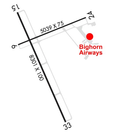
FW ACFT RSTRD TO RWYS & TWYS ONLY.
COLD TEMPERATURE AIRPORT. ALTITUDE CORRECTION REQUIRED AT OR BELOW -19C.
FOR CD IF UNA TO CTC ON FSS FREQ, CTC SALT LAKE ARTCC AT 801-320-2568.
Airport Communications & Frequencies:
CTAF Frequency:
123.000
Unicom Frequency:
123.000
Remarks
  • APCH/DEP CTL SVC PRVDD BY SALT LAKE ARTCC (ZLC) ON FREQS 127.75/351.9 (SHERIDAN RCAG).
  • Runway Identifications
    Runway Identification: 06/24
    Length: 5039 ft
    Width: 75 ft
    Surface: ASPHALT-GOOD CONDITION
    Edge lights: Medium Intensity

    Treatment: GROOVED
    Weight: PCN 11 /F/B/X/U

     Runway: 06   Runway: 24
    Mag heading: 58°Mag heading: 238°
    Rwy Slope: -1.63% DownRwy Slope: 1.63% Up
    Approach: Approach:
    Pattern: Left TrafficPattern: Left Traffic
    Markings: NONPRECISION INSTRUMENTMarkings: NONPRECISION INSTRUMENT
    Marking Condition: GOODMarking Condition: GOOD
    Arresting Dev: Arresting Dev:
    Lat & Long: N4446.3  W10659.3Lat. & Long.: N4446.6  W10658.2
    Elev: 4021.1 ft. MSLElev: 3939.1 ft. MSL
    TCH: 57 ft. AGLTCH: 39 ft. AGL
    Visual Glide Path: 4.00 degreesVisual Glide Path: 3.00 degrees
    Displaced Threshold: NoDisplaced Threshold: No
    Touchdown Zone: YESTouchdown Zone: YES
    Touchdown Elev.: 4021.1 feetTouchdown Elev.: 3981.3 feet
    Visual Glide Slope: 4-Light PAPI on LEFT side of RunwayVisual Glide Slope: 4-Light PAPI on LEFT side of Runway
    RVR Equipment: RVR Equipment:
    RVV Equipment: NORVV Equipment: NO
    Approach Lights: Approach Lights:
    REIL: YESREIL: YES
    Centerline Lights: NOCenterline Lights: NO
    Touchdown lights: NOTouchdown lights: NO
    Runway Category: Runway with a Visual ApproachRunway Category: Runway with a Visual Approach
    Declared Distances: TORA:5039' TODA:5039' ASDA:5039' LDA:5039'Declared Distances: TORA:5039' TODA:5039' ASDA:5039' LDA:5039'
    Obstructions: Obstructions: TREES
    Marked: Marked: NOT Marked/Lighted
    Clearance slope: 20:1Clearance slope: 20:1
    Obstruction height: Obstruction height: 40 feet AGL
    Dist. from runway: Dist. from runway: 750 feet
    Centerline offset: Centerline offset: 200 feet right of centerline
    Comments: Comments:
    Runway Identification: 15/33
    Length: 8301 ft
    Width: 100 ft
    Surface: ASPHALT
    Edge lights: High Intensity

    Treatment: POROUS FRICTION COURSE
    Weight: PCN 22 /F/B/X/U

     Runway: 15   Runway: 33
    Mag heading: 146°Mag heading: 326°
    Rwy Slope: -.47% DownRwy Slope: .47% Up
    Approach: Approach: ILS/DME
    Pattern: Left TrafficPattern: Left Traffic
    Markings: NONPRECISION INSTRUMENTMarkings: PRECISION INSTRUMENT
    Marking Condition: GOODMarking Condition: GOOD
    Arresting Dev: Arresting Dev:
    Lat & Long: N4446.6  W10659.3Lat. & Long.: N4445.4  W10658.5
    Elev: 4014.2 ft. MSLElev: 3975.4 ft. MSL
    TCH: 50 ft. AGLTCH: 54 ft. AGL
    Visual Glide Path: 3.00 degreesVisual Glide Path: 3.00 degrees
    Displaced Threshold: NoDisplaced Threshold: No
    Touchdown Zone: YESTouchdown Zone: YES
    Touchdown Elev.: 4014.2 feetTouchdown Elev.: 3984.9 feet
    Visual Glide Slope: 4-Light PAPI on LEFT side of RunwayVisual Glide Slope: 4-Light PAPI on LEFT side of Runway
    RVR Equipment: RVR Equipment:
    RVV Equipment: NORVV Equipment: NO
    Approach Lights: Approach Lights: MALSR - 1,400 foot medium intensity approach lighting system with runway alignment indicator lights
    REIL: YESREIL: NO
    Centerline Lights: NOCenterline Lights: NO
    Touchdown lights: NOTouchdown lights: NO
    Runway Category: Runway with a Non-precision Approach having visibility minimums greater than 3/4 mileRunway Category: Precision Instrument Runway
    Declared Distances: TORA:8301' TODA:8301' ASDA:8301' LDA:8301'Declared Distances: TORA:8301' TODA:8301' ASDA:8301' LDA:8301'
    C:25/P: