Current Weather/Notams (Metars, TAFs, Notams, NWS Forecast, PIREPS, and nearby weather)
Customs Information Send updates to Support@FltPlan.com
Customs Not Available
Database effective 04/18/2024
Airport Diagram might not be current.
|
| Facility Name: | MERKEL FLD SYLACAUGA MUNI |
| City Name: | SYLACAUGA |
| County: | TALLADEGA |
| State abbrev: | AL |
| State Name: | ALABAMA |
| | |
| Ownership: | PUBLICLY OWNED |
| Use: | OPEN TO THE PUBLIC |
| Owner's Name: | CITY OF SYLACAUGA |
| Address: | PO BOX 390 |
| | SYLACAUGA, AL 35150 |
| Owner's Phone: | 256-401-2400 |
| | |
| Manager's Name: | SYLACAUGA AIRPORT AUTHORITY |
| Address: | 195 AIRPORT RD. |
| | SYLACAUGA, AL 35151 |
| Phone: | 256-245-3246 |
| | |
| FAA Region: | SOUTHERN |
| FAA Field Office: | JAN |
Runway Identifications
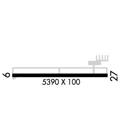
Runway Identification: 09/27Length: 5390 ft
Width: 100 ft
Surface: ASPHALT-GOOD CONDITION
Edge lights: Medium IntensityTreatment: GROOVED
Weight: PCN 24 /F/C/Y/T
| | Runway: 09 | | Runway: 27 |
| Mag heading: | 94° | Mag heading: | 274° |
| Rwy Slope: | -.39% Down | Rwy Slope: | .39% Up |
| Approach: | | Approach: | |
| Pattern: | Left Traffic | Pattern: | Left Traffic |
| Markings: | NONPRECISION INSTRUMENT | Markings: | NONPRECISION INSTRUMENT |
| Marking Condition: | GOOD | Marking Condition: | GOOD |
| Arresting Dev: | | Arresting Dev: | |
| Lat & Long: | N3310.3 W08618.9 | Lat. & Long.: | N3310.3 W08617.8 |
| Elev: | 568.8 ft. MSL | Elev: | 547.7 ft. MSL |
| TCH: | 49 ft. AGL | TCH: | 40 ft. AGL |
| Visual Glide Path: | 3.00 degrees | Visual Glide Path: | 3.00 degrees |
| Displaced Threshold: | No | Displaced Threshold: | No |
| Touchdown Zone: | YES | Touchdown Zone: | YES |
| Touchdown Elev.: | 568.9 feet | Touchdown Elev.: | 551.5 feet |
| Visual Glide Slope: | 2-Light PAPI on LEFT side of Runway | Visual Glide Slope: | 2-Light PAPI on LEFT side of Runway |
| RVR Equipment: | | RVR Equipment: | |
| RVV Equipment: | NO | RVV Equipment: | NO |
| Approach Lights: | | Approach Lights: | |
| REIL: | YES | REIL: | YES |
| Centerline Lights: | NO | Centerline Lights: | NO |
| Touchdown lights: | NO | Touchdown lights: | NO |
| Runway Category: | Runway with a Non-precision Approach having visibility minimums greater than 3/4 mile | Runway Category: | Runway with a Non-precision Approach having visibility minimums greater than 3/4 mile |
| Declared Distances: | | Declared Distances: | |
| Obstructions: | TREE | Obstructions: | |
| Marked: | NOT Marked/Lighted | Marked: | |
| Clearance slope: | 13:1 | Clearance slope: | 34:1 |
| Obstruction height: | 127 feet AGL | Obstruction height: | |
| Dist. from runway: | 1881 feet | Dist. from runway: | |
| Centerline offset: | 210 left of centerline | Centerline offset: | |
| Comments: | | Comments: | |

