Click here for more info on on SMS!

KS83

SHOSHONE COUNTY
KELLOGG
ID
Time Zone: Pacific
Lat: N 4732.8
Long: W 11611.3
Elev: 2227
Var: -19
Longest Runway: 5316
CTAF: 122.8

FBO & Flight Services info for KS83

FBOs: Update your Fuel Prices
Providing high quality fuel and services to you and your customers, from Phillips 66 Aviation.
Ph: 208-786-5381
-
Freq: 122.8WebsiteE-Mail
Service
Jet
100LL
SAF
MoGas
Full        Last Update: 03/26/2024 09:05

Self  6.12    
Misc. Info: Address: 926 AIRPORT RD   SMELTERVILLE, ID 83868

If you are an FBO, call 1-203-262-1700 to update your info or email: FltPlan.Advertising@garmin.com
Advertise your FBO on FltPlan.com

Runway & Approach Info for KS83
Rwy
Length
Land Dist**
Approach*
  Rwy
Length
Land Dist**
Approach*
07
5316x75  5316'          
 
  
25
  5316x75  4981'          
 
 * only ILS, LOC, LDA, and SDF approaches to a specific runway are shown
** For any Declared Landing Distance Available, please see A/FD or Approach plates
Runway Weight Capability (lbs.) Help
Runway IDSingle WheelDouble WheelDouble Tandem WheelDual Double Wheel
07/2514,000N/AN/AN/A
These numbers are Advisory and are not limits.   The Airport Manager should have more accurate Weight Limits
Approach Charts
FltPlan does not have IFR approach charts available for KS83.
Current Weather/Notams
Customs Information Send updates to Support@FltPlan.com
Customs Not Available
Database effective 05/16/2024
Airport Diagram of KS83
Airport Diagram might not be current.

Facility Name: SHOSHONE COUNTY
City Name: KELLOGG
County: SHOSHONE
State abbrev: ID
State Name: IDAHO
   
Ownership: PUBLICLY OWNED
Use: OPEN TO THE PUBLIC
Owner's Name: SHOSHONE COUNTY
Address: 700 BANK STREET
 WALLACE, ID 83873-2348
Owner's Phone: 208-752-3331
  
Manager's Name: JOHN HANSEN
Address: 700 BANK ST, SUITE 120
 WALLACE 83873
Phone: 208-512-0532
   
FAA Region: NORTHWEST MOUNTAIN
FAA Field Office: HLN


Sunrise / Sunset times for SHOSHONE COUNTY

DateSunriseSunset
04/22/24 Monday5:4219:45
04/23/24 Tuesday5:4019:47
04/24/24 Wednesday5:3819:48
04/25/24 Thursday5:3619:50
04/26/24 Friday5:3519:51
04/27/24 Saturday5:3319:52
04/28/24 Sunday5:3119:54
04/29/24 Monday5:3019:55
04/30/24 Tuesday5:2819:57
05/01/24 Wednesday5:2619:58
05/02/24 Thursday5:2519:59
05/03/24 Friday5:2320:01
05/04/24 Saturday5:2220:02
05/05/24 Sunday5:2020:03

Airport Facilities

Airport Attendance Schedule7 Days A Week DALGT
Airport Status OPERATIONAL (This Status can change at any time - please check NOTAMS)
Airport Lighting ScheduleACVT MIRL RY 07/25 - CTAF.
Airport Storage AvailableTie Downs
Extra Services AvailableNONE
Wind IndicatorYES - (lighted)
Control TowerNO
CTAF Frequency122.800
Unicom Frequency122.800
Rotating Beacon ColorWG
Segmented CircleYES
Landing FeeNO

Airport Inspection Data

Airport InspectedSTATE - performed by STATE AERONAUTICAL PERSONNEL
Inspection Date09/03/2021

Airport Services

Type of Fuel AvailableGrade 100LL
Airframe Repair ServiceNONE
Power Plant Repair ServiceNONE

Geographic Data

LatitudeN4732.8
LongitudeW11611.3 (ESTIMATED)
Arpt Elevation2227ft (ESTIMATED)
Magnetic Variation19E
3 miles Wof KELLOGG
Traffic Pattern Altitude
Sectional ChartGREAT FALLS

Aircraft Data

Operations (Reported)YearlyAvg. Daily
General Aviation Transient 550015
General Aviation Local 12003
Air Taxi 7502
Commerical 00
Commuter 00
Military 500
Aircraft based on Field
General Aviation Singles 12
General Aviation Multi 1
Jet Aircraft 0
General Aviation Helicopters 1
Military Aircraft 0
Gliders 0
Ultralights 1

FAA Services

FSS on field NO
FSS tie-in BOISE
FSS Phone 1-800-WX-BRIEF
Who issues Notams BOI
Notam D service at airport YES
ARTCC Name SEATTLE

Federal Status

Airport Certification
Aircraft Rescue & Firefighting IndexNone
Airport of EntryNo
Custom Landing RightsNo
Joint Civil/MilitaryNo
Military Landing rightsYES

Federal Agreements

NATIONAL PLAN OF INTEGRATED AIRPORT SYSTEMS (NPIAS)
GRANT AGREEMENTS UNDER FAAP/ADAP/AIP
CONVEYANCE UNDER SCETION 16, FEDERAL AIRPORT ACT OF 1946 OR SECTION 23, AIRPORT AND AIRWAY DEVELOPMENT ACT OF 1970
ASSURANCES PURSUANT TO TITLE VI, CIVIL RIGHTS ACT OF 1964

Remarks

FOR CD CTC SEATTLE ARTCC AT 253-351-3694.
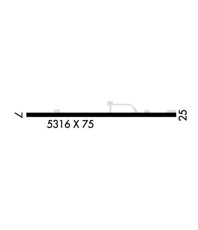
Runway Identifications
Runway Identification: 07/25
Length: 5316 ft
Width: 75 ft
Surface: ASPHALT
Edge lights: Medium Intensity

Treatment: NONE

 Runway: 07   Runway: 25
Mag heading: N/AMag heading: N/A
Rwy Slope: .36% UpRwy Slope: -.36% Down
Approach: Approach:
Pattern: Right TrafficPattern: Left Traffic
Markings: BASICMarkings: BASIC
Marking Condition: GOODMarking Condition: GOOD
Arresting Dev: Arresting Dev:
Lat & Long: N4732.8  W11612.0Lat. & Long.: N4732.8  W11610.7
Elev: 2208.0 ft. MSLElev: 2227.0 ft. MSL
TCH: TCH:
Visual Glide Path: Visual Glide Path:
Displaced Threshold: NoDisplaced Threshold: 335 feet
Touchdown Zone: NOTouchdown Zone: NO
Touchdown Elev.: Touchdown Elev.:
Visual Glide Slope: Visual Glide Slope:
RVR Equipment: RVR Equipment:
RVV Equipment: NORVV Equipment: NO
Approach Lights: Approach Lights:
REIL: NOREIL: NO
Centerline Lights: NOCenterline Lights: NO
Touchdown lights: NOTouchdown lights: NO
Runway Category: Runway with a Visual ApproachRunway Category: Runway with a Visual Approach
Declared Distances: Declared Distances:
Obstructions: TREEObstructions: TREE; RY 25 +80 FT TREES AT 1700 FT ON CNTRLN; +40 FT POLE & TRRN ON CNTRLN 700 FT FM RY END; +63 FT SIGN AT 1900 FT ON CNTRLN.
Marked: NOT Marked/LightedMarked: NOT Marked/Lighted
Clearance slope: 2:1Clearance slope: 5:1; RWY 25 APPROACH SLOPE 16:1 TO DISPLACED THRESHOLD.
Obstruction height: 50 feet AGLObstruction height: 55 feet AGL
Dist. from runway: 345 feetDist. from runway: 500 feet
Centerline offset: 125 right of centerlineCenterline offset: 100 feet left of centerline
Comments: Comments:
C:/P: