Current Weather/Notams (Metars, TAFs, Notams, NWS Forecast, PIREPS, and nearby weather)
Customs Information Send updates to Support@FltPlan.com
Customs Not Available
Database effective 05/16/2024
Airport Diagram might not be current.
|
| Facility Name: | SANDUSKY COUNTY RGNL |
| City Name: | FREMONT |
| County: | SANDUSKY |
| State abbrev: | OH |
| State Name: | OHIO |
| | |
| Ownership: | PUBLICLY OWNED |
| Use: | OPEN TO THE PUBLIC |
| Owner's Name: | SANDUSKY COUNTY |
| Address: | 1500 COUNTY ROAD 220 |
| | CLYDE, OH 43410-9562 |
| Owner's Phone: | 419-547-0131 |
| | |
| Manager's Name: | MICHAEL RUSSELL; MANAGER@SANDUSKYCOUNTYAIRPORT.COM. |
| Address: | 1500 COUNTY ROAD 220 |
| | CLYDE, OH 43410-9562 |
| Phone: | 419-547-0131 |
| | |
| FAA Region: | GREAT LAKES |
| FAA Field Office: | DET |
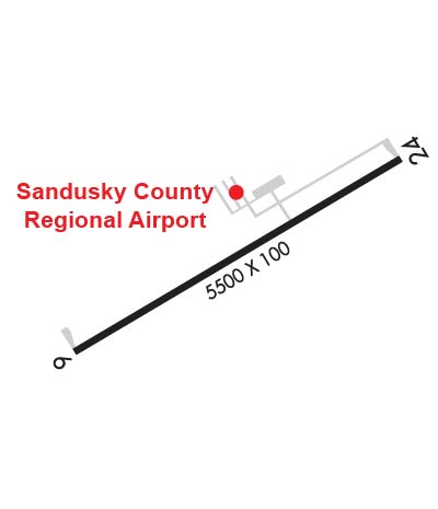
Runway Identifications
Runway Identification: 06/24Length: 5500 ft
Width: 100 ft
Surface: ASPHALT-GOOD CONDITION
Edge lights: Medium IntensityTreatment: GROOVED
| | Runway: 06 | | Runway: 24 |
| Mag heading: | 67° | Mag heading: | 247° |
| Rwy Slope: | -.15% Down | Rwy Slope: | .15% Up |
| Approach: | | Approach: | |
| Pattern: | Left Traffic | Pattern: | Left Traffic |
| Markings: | NONPRECISION INSTRUMENT | Markings: | NONPRECISION INSTRUMENT |
| Marking Condition: | GOOD | Marking Condition: | GOOD |
| Arresting Dev: | | Arresting Dev: | |
| Lat & Long: | N4117.5 W08302.8 | Lat. & Long.: | N4118.0 W08301.7 |
| Elev: | 664.2 ft. MSL | Elev: | 655.9 ft. MSL |
| TCH: | 44 ft. AGL | TCH: | 42 ft. AGL |
| Visual Glide Path: | 3.00 degrees | Visual Glide Path: | 3.00 degrees |
| Displaced Threshold: | No | Displaced Threshold: | No |
| Touchdown Zone: | YES | Touchdown Zone: | YES |
| Touchdown Elev.: | 664.5 feet | Touchdown Elev.: | 664.5 feet |
| Visual Glide Slope: | 4-Light PAPI on LEFT side of Runway | Visual Glide Slope: | 4-Light PAPI on LEFT side of Runway |
| RVR Equipment: | | RVR Equipment: | |
| RVV Equipment: | NO | RVV Equipment: | NO |
| Approach Lights: | | Approach Lights: | |
| REIL: | YES | REIL: | YES |
| Centerline Lights: | NO | Centerline Lights: | NO |
| Touchdown lights: | NO | Touchdown lights: | NO |
| Runway Category: | Runway with a Non-precision Approach having visibility minimums greater than 3/4 mile | Runway Category: | Runway with a Non-precision Approach having visibility minimums greater than 3/4 mile |
| Declared Distances: | | Declared Distances: | |
| Obstructions: | TREE | Obstructions: | |
| Marked: | NOT Marked/Lighted | Marked: | |
| Clearance slope: | 27:1 | Clearance slope: | 34:1 |
| Obstruction height: | 66 feet AGL | Obstruction height: | |
| Dist. from runway: | 2029 feet | Dist. from runway: | |
| Centerline offset: | 272 right of centerline | Centerline offset: | |
| Comments: | | Comments: | |