Current Weather/Notams (Metars, TAFs, Notams, NWS Forecast, PIREPS, and nearby weather)
Customs Information Send updates to Support@FltPlan.com
Customs Not Available
Database effective 04/18/2024
Airport Diagram might not be current.
|
| Facility Name: | ARENS FLD |
| City Name: | WINAMAC |
| County: | PULASKI |
| State abbrev: | IN |
| State Name: | INDIANA |
| | |
| Ownership: | PUBLICLY OWNED |
| Use: | OPEN TO THE PUBLIC |
| Owner's Name: | WINAMAC-PULASKI CO BOAC |
| Address: | 2595N. US 35 |
| | WINAMAC, IN 46996 |
| Owner's Phone: | 574-946-6785 |
| | |
| Manager's Name: | DARYN WILDER |
| Address: | 2595 N. US 35 |
| | WINAMAC, IN 46996 |
| Phone: | 574-946-6785 |
| | |
| FAA Region: | GREAT LAKES |
| FAA Field Office: | CHI |
Runway Identifications
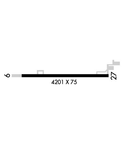
Runway Identification: 09/27Length: 4201 ft
Width: 75 ft
Surface: ASPHALT-GOOD CONDITION
Edge lights: Medium IntensityTreatment: GROOVED
| | Runway: 09 | | Runway: 27 |
| Mag heading: | 93° | Mag heading: | 273° |
| Rwy Slope: | .03% Up | Rwy Slope: | -.03% Down |
| Approach: | | Approach: | |
| Pattern: | Left Traffic | Pattern: | Left Traffic |
| Markings: | NONPRECISION INSTRUMENT | Markings: | NONPRECISION INSTRUMENT |
| Marking Condition: | GOOD | Marking Condition: | GOOD |
| Arresting Dev: | | Arresting Dev: | |
| Lat & Long: | N4105.5 W08637.2 | Lat. & Long.: | N4105.5 W08636.3 |
| Elev: | 705.6 ft. MSL | Elev: | 706.7 ft. MSL |
| TCH: | 25 ft. AGL | TCH: | 23 ft. AGL |
| Visual Glide Path: | 3.00 degrees | Visual Glide Path: | 3.50 degrees |
| Displaced Threshold: | No | Displaced Threshold: | 560 feet |
| Touchdown Zone: | YES | Touchdown Zone: | YES |
| Touchdown Elev.: | 708.3 feet | Touchdown Elev.: | 708.3 feet |
| Visual Glide Slope: | 2-Light PAPI on LEFT side of Runway | Visual Glide Slope: | 2-Light PAPI on LEFT side of Runway |
| RVR Equipment: | | RVR Equipment: | |
| RVV Equipment: | NO | RVV Equipment: | NO |
| Approach Lights: | | Approach Lights: | |
| REIL: | YES; REIL OTS INDEFLY. | REIL: | YES |
| Centerline Lights: | NO | Centerline Lights: | NO |
| Touchdown lights: | NO | Touchdown lights: | NO |
| Runway Category: | Runway with a Non-precision Approach | Runway Category: | Runway with a Non-precision Approach |
| Declared Distances: | | Declared Distances: | |
| Obstructions: | ROAD | Obstructions: | TREE |
| Marked: | NOT Marked/Lighted | Marked: | NOT Marked/Lighted |
| Clearance slope: | 23:1; 35:1 CLEARANCE SLOPE TO DISPLACED THRESHOLD | Clearance slope: | 5:1 |
| Obstruction height: | 10 feet AGL | Obstruction height: | 26 feet AGL |
| Dist. from runway: | 430 feet | Dist. from runway: | 350 feet |
| Centerline offset: | | Centerline offset: | 170 feet left of centerline |
| Comments: | 4 FT FENCE 200 FT N. | Comments: | |


