| |||||||||||||||||||||||||||||||||||||||||||||||||||||||||||||
| |||||||||||||||||||||||||||||||||||||||||||||||||||||||||||||
| |||||||||||||||||||||||||||||||||||||||||||||||||||||||||||||
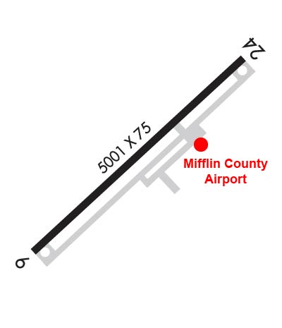
| Rwy | Rwy | |||||||
| 5001x75 | 5001' | 109.30 - 059° | 5001x75 | 5001' | ||||
| Runway ID | Single Wheel | Double Wheel | Double Tandem Wheel | Dual Double Wheel |
| 06/24 | 60,000 | N/A | N/A | N/A |
| These numbers are Advisory and are not limits. The Airport Manager should have more accurate Weight Limits | ||||
 Airport Diagram might not be current. | |
| Facility Name: | MIFFLIN COUNTY |
| City Name: | REEDSVILLE |
| County: | MIFFLIN |
| State abbrev: | PA |
| State Name: | PENNSYLVANIA |
| Ownership: | PUBLICLY OWNED |
| Use: | OPEN TO THE PUBLIC |
| Owner's Name: | MIFFLIN COUNTY ARPT AUTH. |
| Address: | PO BOX 461 |
| REEDSVILLE, PA 17084 | |
| Owner's Phone: | 717-667-6829 |
| Manager's Name: | LARRY MCCARL |
| Address: | 547 AIRPORT ROAD |
| REEDSVILLE, PA 17084 | |
| Phone: | 717-667-6829 |
| FAA Region: | EASTERN |
| FAA Field Office: | HAR |
| Date | Sunrise | Sunset |
|---|---|---|
| 04/25/24 Thursday | 6:16 | 20:01 |
| 04/26/24 Friday | 6:15 | 20:02 |
| 04/27/24 Saturday | 6:13 | 20:03 |
| 04/28/24 Sunday | 6:12 | 20:04 |
| 04/29/24 Monday | 6:11 | 20:05 |
| 04/30/24 Tuesday | 6:10 | 20:06 |
| 05/01/24 Wednesday | 6:08 | 20:07 |
| 05/02/24 Thursday | 6:07 | 20:08 |
| 05/03/24 Friday | 6:06 | 20:09 |
| 05/04/24 Saturday | 6:05 | 20:10 |
| 05/05/24 Sunday | 6:03 | 20:11 |
| 05/06/24 Monday | 6:02 | 20:13 |
| 05/07/24 Tuesday | 6:01 | 20:14 |
| 05/08/24 Wednesday | 6:00 | 20:15 |
| Airport Attendance Schedule | MAY 1 - OCT 31 MON-FRI 0800-1700, SAT 0800-1200, NOV 1 - APR 30 MON-FRI 0800-1600 |
| Airport Status | OPERATIONAL (This Status can change at any time - please check NOTAMS) |
| Airport Lighting Schedule | ACTVT REIL RWY 06 & 24; PAPI RWY 06 & 24; MIRL RWY 06/24 - CTAF. |
| Airport Storage Available | Tie Downs |
| Extra Services Available | Glider, Glider Towing |
| Wind Indicator | YES - (lighted) |
| Control Tower | NO |
| CTAF Frequency | 122.700 |
| Unicom Frequency | 122.700 |
| Rotating Beacon Color | WG |
| Segmented Circle | YES |
| Landing Fee | NO |
| Airport Inspected | STATE - performed by STATE AERONAUTICAL PERSONNEL |
| Inspection Date | 02/27/2024 |
| Type of Fuel Available | Grade 100LL, JET A (freeze point -40C); -A JET-A FUEL BY APNTMT ONLY AFT HRS. CALL 717-994-0323 DURG ATNDD HRS TO MAKE APNTMT.; -10100LL FUEL SS-24 HRS. |
| Airframe Repair Service | MAJOR |
| Power Plant Repair Service | MAJOR |
| Latitude | N4040.6 |
| Longitude | W07737.6 (ESTIMATED) |
| Arpt Elevation | 818ft (SURVEYED) |
| Magnetic Variation | 10W |
| 5 miles NW | of REEDSVILLE |
| Traffic Pattern Altitude | |
| Sectional Chart | DETROIT |
| Operations (Reported) | Yearly | Avg. Daily |
|---|---|---|
| General Aviation Transient | 1600 | 4 |
| General Aviation Local | 12600 | 35 |
| Air Taxi | 200 | 1 |
| Commerical | 0 | 0 |
| Commuter | 0 | 0 |
| Military | 0 | 0 |
| Aircraft based on Field | |
|---|---|
| General Aviation Singles | 37 |
| General Aviation Multi | 1 |
| Jet Aircraft | 0 |
| General Aviation Helicopters | 0 |
| Military Aircraft | 0 |
| Gliders | 3 |
| Ultralights | 0 |
| FSS on field | NO |
| FSS tie-in | WILLIAMSPORT |
| FSS Phone | 1-800-WX-BRIEF |
| Who issues Notams | IPT |
| Notam D service at airport | YES |
| ARTCC Name | NEW YORK |
| Airport Certification | |
| Aircraft Rescue & Firefighting Index | None |
| Airport of Entry | No |
| Custom Landing Rights | No |
| Joint Civil/Military | No |
| Military Landing rights | YES |
| NATIONAL PLAN OF INTEGRATED AIRPORT SYSTEMS (NPIAS) |
| GRANT AGREEMENTS UNDER FAAP/ADAP/AIP |
| ASSURANCES PURSUANT TO TITLE VI, CIVIL RIGHTS ACT OF 1964 |
| THIS AIRPORT HAS BEEN SURVEYED BY THE NATIONAL GEODETIC SURVEY. |
| HELICOPTERS LAND ON APRON. |
| GLIDER ACTIVITY DURING SUMMER MONTHS. |
| PHONE NUMBERS POSTED ON THE OFFICE DOOR FOR AFTER HOUR CALLS. |
| FOR CD CTC NEW YORK ARTCC AT 631-468-1425. |
Airport Communications & Frequencies:
| |||||||||
| Runway: 06 | Runway: 24 | ||
| Mag heading: | 59° | Mag heading: | 239° |
| Rwy Slope: | -.11% Down | Rwy Slope: | .11% Up |
| Approach: | LOCALIZER | Approach: | |
| Pattern: | Left Traffic | Pattern: | Left Traffic |
| Markings: | NONPRECISION INSTRUMENT | Markings: | NONPRECISION INSTRUMENT |
| Marking Condition: | GOOD | Marking Condition: | GOOD |
| Arresting Dev: | Arresting Dev: | ||
| Lat & Long: | N4040.4 W07738.0 | Lat. & Long.: | N4040.9 W07737.2 |
| Elev: | 815.5 ft. MSL | Elev: | 809.8 ft. MSL |
| TCH: | 48 ft. AGL | TCH: | 42 ft. AGL |
| Visual Glide Path: | 4.00 degrees | Visual Glide Path: | 3.00 degrees |
| Displaced Threshold: | No | Displaced Threshold: | No |
| Touchdown Zone: | YES | Touchdown Zone: | YES |
| Touchdown Elev.: | 818.8 feet | Touchdown Elev.: | 817.9 feet |
| Visual Glide Slope: | 2-Light PAPI on LEFT side of Runway | Visual Glide Slope: | 4-Light PAPI on LEFT side of Runway |
| RVR Equipment: | RVR Equipment: | ||
| RVV Equipment: | NO | RVV Equipment: | NO |
| Approach Lights: | Approach Lights: | ||
| REIL: | YES | REIL: | YES |
| Centerline Lights: | NO | Centerline Lights: | NO |
| Touchdown lights: | NO | Touchdown lights: | NO |
| Runway Category: | Runway with a Non-precision Approach having visibility minimums greater than 3/4 mile | Runway Category: | Runway with a Non-precision Approach having visibility minimums greater than 3/4 mile |
| Declared Distances: | Declared Distances: | ||
| Obstructions: | TREES | Obstructions: | |
| Marked: | NOT Marked/Lighted | Marked: | |
| Clearance slope: | 22:1 | Clearance slope: | 34:1 |
| Obstruction height: | 121 feet AGL | Obstruction height: | |
| Dist. from runway: | 2965 feet | Dist. from runway: | |
| Centerline offset: | 163 left of centerline | Centerline offset: | |
| Comments: | Comments: |