Click here for more info on on SMS!

KRST

ROCHESTER INTL
ROCHESTER
MN
Time Zone: Central
Lat: N 4354.5
Long: W 09230.0
Elev: 1317
Var: +01
Longest Runway: 9034
Dept. ATIS: 120.5
Arr. ATIS: 120.5
Ground: 121.9
Tower: 118.3

FBO & Flight Services info for KRST

FBOs: Update your Fuel Prices

SIGNATUREPh: 507-282-1717 Fax: 507-282-9939 Freq: 122.95
Service
Jet
100LL
SAF
MoGas
Fuel Avail: PRIST+$0.05/gal 24 hours, 7 days a week
Full7.777.04    Last Update: 04/19/2024 07:53

Self  6.04    
 Address: 7300 BRATAAS DRIVE SW,   ROCHESTER, MINNESOTA 55902
ASOSPh: 507-285-0298
-
-
 
If you are an FBO, call 1-203-262-1700 to update your info or email: FltPlan.Advertising@garmin.com
Advertise your FBO on FltPlan.com

Runway & Approach Info for KRST
Rwy
Length
Land Dist**
Approach*
  Rwy
Length
Land Dist**
Approach*
03
7301x150  7301'          
 
  
21
  7301x150  7301'          
 
13
9034x150  9034'          
ILS
 109.10 - 131°  
  
31
  9034x150  9034'          
ILS
 108.50 - 313°  
 * only ILS, LOC, LDA, and SDF approaches to a specific runway are shown
** For any Declared Landing Distance Available, please see A/FD or Approach plates
Runway Weight Capability (lbs.) Help
Runway IDSingle WheelDouble WheelDouble Tandem WheelDual Double Wheel
03/21100,000175,000300,000N/A
13/31100,000175,000300,000N/A
These numbers are Advisory and are not limits.   The Airport Manager should have more accurate Weight Limits
Approach Charts
Approaches    
Current Weather/Notams
Customs Information Send updates to Support@FltPlan.com
Phone 507-285-5278
Fax 507-282-9939

Comments 1 hr advance notice required. Business hrs 0800-1630 Monday-Friday.
Database effective 04/18/2024
Airport Diagram of KRST
Airport Diagram might not be current.

Facility Name: ROCHESTER INTL
City Name: ROCHESTER
County: OLMSTED
State abbrev: MN
State Name: MINNESOTA
   
Ownership: PUBLICLY OWNED
Use: OPEN TO THE PUBLIC
Owner's Name: CITY OF ROCHESTER
Address: CITY HALL, 201 4TH ST SE
 ROCHESTER, MN 55904-3708
Owner's Phone: 507-254-1161
  
Manager's Name: JOHN C REED
Address: 7600 HELGERSON DR SW
 ROCHESTER, MN 55902-1838
Phone: 507-254-1161
   
FAA Region: GREAT LAKES
FAA Field Office: DMA


Sunrise / Sunset times for ROCHESTER INTL

DateSunriseSunset
04/18/24 Thursday6:2119:58
04/19/24 Friday6:1920:00
04/20/24 Saturday6:1720:01
04/21/24 Sunday6:1620:02
04/22/24 Monday6:1420:03
04/23/24 Tuesday6:1320:04
04/24/24 Wednesday6:1120:06
04/25/24 Thursday6:1020:07
04/26/24 Friday6:0820:08
04/27/24 Saturday6:0620:09
04/28/24 Sunday6:0520:10
04/29/24 Monday6:0420:12
04/30/24 Tuesday6:0220:13
05/01/24 Wednesday6:0120:14

Airport Facilities

Airport Attendance ScheduleCONTINUOUS
Airport Status OPERATIONAL (This Status can change at any time - please check NOTAMS)
Airport Lighting ScheduleWHEN ATCT CLSD ACTVT OR INCR INTST MALSR RWY 13 & 31; HIRL RWY 13/31; MIRL RWY 03/21 - CTAF. HIRL RWY 13/31 PRESET LOW INTST. PAPI RWY 21, 13, & 31; VASI RWY 03 - OPR CONSLY.
Airport Storage AvailableHanger
Extra Services AvailableAir Ambulance, Avionics, Charter, Flight Instruction, Aircraft Rental
Wind IndicatorYES - (lighted)
Control TowerYES
CTAF Frequency118.300
Unicom Frequency122.950
Rotating Beacon ColorWG
Segmented CircleNO
Landing FeeNO

Airport Inspection Data

Airport InspectedFEDERAL - performed by FAA AIRPORTS FIELD PERSONNEL
Inspection Date08/15/2023

Airport Services

Type of Fuel AvailableGrade 100LL, JET A (freeze point -40C)
Airframe Repair ServiceMAJOR
Power Plant Repair ServiceMAJOR

Geographic Data

LatitudeN4354.5
LongitudeW09230.0 (ESTIMATED)
Arpt Elevation1317ft (SURVEYED)
Magnetic Variation01W
7 miles SWof ROCHESTER
Traffic Pattern Altitude
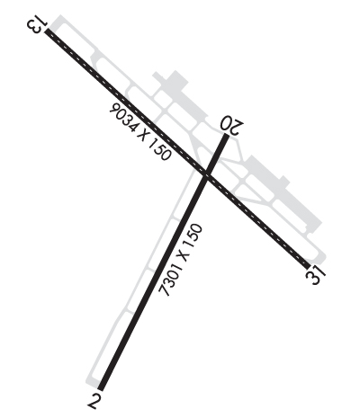
Sectional ChartCHICAGO

Aircraft Data

Operations (Reported)YearlyAvg. Daily
General Aviation Transient 1949953
General Aviation Local 1911952
Air Taxi 1018328
Commerical 23997
Commuter 00
Military 28578
Aircraft based on Field
General Aviation Singles 68
General Aviation Multi 2
Jet Aircraft 0
General Aviation Helicopters 0
Military Aircraft 0
Gliders 0
Ultralights 0

FAA Services

FSS on field NO
FSS tie-in PRINCETON
FSS Phone 1-800-WX-BRIEF
Who issues Notams RST
Notam D service at airport YES
ARTCC Name MINNEAPOLIS

Federal Status

Airport CertificationAIRPORT RECEIVING SCHEDULED AIR CARRIER SERVICE FROM CARRIERS CERTIFICATED BY THE CIVIL AERONAUTICS BOARD; 24 HR PPR FOR UNSKED ACR OPS GTR THAN 9 PAX SEATS BTN 2300-0500 CALL 507-254-1161.
Aircraft Rescue & Firefighting IndexAIRPORT HAS A CERTIFICATE UNDER CFR PART 139
Airport of EntryNo
Custom Landing RightsNo; US CUSTOMS USER FEE ARPT.
Joint Civil/MilitaryNo
Military Landing rightsYES

Federal Agreements

NATIONAL PLAN OF INTEGRATED AIRPORT SYSTEMS (NPIAS)
GRANT AGREEMENTS UNDER FAAP/ADAP/AIP
ASSURANCES PURSUANT TO TITLE VI, CIVIL RIGHTS ACT OF 1964

Remarks

WHEN ATCT CLSD SNOW REMOVAL EQPT PSNL MNT CTAF.
WATERFOWL ON & INVOF ARPT.
US CUST AVBL MON-FRI 0830-1700; PN AFT HRS & WKENDS CALL 507-285-5278.
FOR CD WHEN ATCT IS CLSD CTC FSS VIA RCO, IF UNA CTC MINNEAPOLIS ARTCC AT 651-463-5588.
RWY 03/2 1 RWY 03 END 2075 FT CONC, MID 3777 FT ASPHALT, RWY 21 END 1449 FT CONC.
Airport Communications & Frequencies:
ATIS Frequencies:   Hours(local) of Operation: CONTINUOUS
120.5
ROCHESTER Tower Frequencies:   Hours(local) of operation: 0500-2300   
118.3
257.8
ROCHESTER Ground Frequencies:
121.9
Emergency Frequencies:
121.5
243.0
CTAF Frequency:
118.300
Unicom Frequency:
122.950
Remarks
  • APCH/DEP SVC PRVDD BY MINNEAPOLIS ARTCC ON FREQS 132.35/307.3 (ROCHESTER RCAG) WHEN ROCHESTER APCH CTL CLSD.
  • ROCHESTER Primary Approach Frequencies:   Hours(local) of operation: 0500-2300   
    119.8
    251.125
    ROCHESTER Primary Departure Frequencies:   Hours(local) of operation: 0500-2300   
    119.8
    251.125
    Runway Identifications
    Runway Identification: 03/21
    Length: 7301 ft
    Width: 150 ft
    Surface: CONCRETE ASPHALT-GOOD CONDITION
    Edge lights: Medium Intensity

    Treatment: GROOVED
    Weight: PCN 70 /R/B/W/U

     Runway: 03   Runway: 21
    Mag heading: 27°Mag heading: 207°
    Rwy Slope: -.45% DownRwy Slope: .45% Up
    Approach: Approach:
    Pattern: Left TrafficPattern: Left Traffic
    Markings: NONPRECISION INSTRUMENTMarkings: NONPRECISION INSTRUMENT
    Marking Condition: GOODMarking Condition: GOOD
    Arresting Dev: Arresting Dev:
    Lat & Long: N4353.7  W09230.4Lat. & Long.: N4354.8  W09229.7
    Elev: 1314.6 ft. MSLElev: 1282.0 ft. MSL
    TCH: 48 ft. AGLTCH: 50 ft. AGL
    Visual Glide Path: 3.00 degreesVisual Glide Path: 3.05 degrees
    Displaced Threshold: NoDisplaced Threshold: No
    Touchdown Zone: YESTouchdown Zone: YES
    Touchdown Elev.: 1317.4 feetTouchdown Elev.: 1304.6 feet
    Visual Glide Slope: 4-BOX VASI ON LEFT SIDE OF RUNWAYVisual Glide Slope: 4-Light PAPI on LEFT side of Runway
    RVR Equipment: RVR Equipment:
    RVV Equipment: NORVV Equipment: NO
    Approach Lights: Approach Lights:
    REIL: YESREIL: YES
    Centerline Lights: NOCenterline Lights: NO
    Touchdown lights: NOTouchdown lights: NO
    Runway Category: Runway with a Non-precision Approach having visibility minimums greater than 3/4 mileRunway Category: Runway with a Non-precision Approach having visibility minimums greater than 3/4 mile
    Declared Distances: TORA:7300' TODA:7300' ASDA:7300' LDA:7300'Declared Distances: TORA:7300' TODA:7300' ASDA:7300' LDA:7300'
    Runway Identification: 13/31
    Length: 9034 ft
    Width: 150 ft
    Surface: CONCRETE-GOOD CONDITION
    Edge lights: High Intensity

    Treatment: GROOVED
    Weight: PCN 70 /R/B/W/U

     Runway: 13   Runway: 31
    Mag heading: 133°Mag heading: 313°
    Rwy Slope: .40% UpRwy Slope: -.40% Down
    Approach: ILSApproach: ILS
    Pattern: Left TrafficPattern: Left Traffic
    Markings: PRECISION INSTRUMENTMarkings: PRECISION INSTRUMENT
    Marking Condition: GOODMarking Condition: GOOD
    Arresting Dev: Arresting Dev:
    Lat & Long: N4355.2  W09230.7Lat. & Long.: N4354.2  W09229.2
    Elev: 1268.3 ft. MSLElev: 1304.1 ft. MSL
    TCH: 53 ft. AGLTCH: 55 ft. AGL
    Visual Glide Path: 3.00 degreesVisual Glide Path: 3.00 degrees
    Displaced Threshold: NoDisplaced Threshold: No
    Touchdown Zone: YESTouchdown Zone: YES
    Touchdown Elev.: 1280.3 feetTouchdown Elev.: 1304.1 feet
    Visual Glide Slope: 4-Light PAPI on LEFT side of RunwayVisual Glide Slope: 4-Light PAPI on LEFT side of Runway
    RVR Equipment: TOUCHDOWN; RVR UNAVBL WHEN ATCT CLSD.RVR Equipment: TOUCHDOWN; RVR UNAVBL WHEN ATCT CLSD.
    RVV Equipment: YESRVV Equipment: YES
    Approach Lights: MALSR - 1,400 foot medium intensity approach lighting system with runway alignment indicator lightsApproach Lights: MALSR - 1,400 foot medium intensity approach lighting system with runway alignment indicator lights
    REIL: NOREIL: NO
    Centerline Lights: YESCenterline Lights: YES
    Touchdown lights: YESTouchdown lights: YES
    Runway Category: Precision Instrument RunwayRunway Category: Precision Instrument Runway
    Declared Distances: TORA:9033' TODA:9033' ASDA:9033' LDA:9033'Declared Distances: TORA:9033' TODA:9033' ASDA:9033' LDA:9033'
    C:122/P: