Click here for more info on on SMS!

KRKR

ROBERT S KERR
POTEAU
OK
Time Zone: Central
Lat: N 3501.3
Long: W 09437.3
Elev: 451
Var: -03
Longest Runway: 4007
AWOS: 120.62
CTAF: 122.8

FBO & Flight Services info for KRKR

FBOs: Update your Fuel Prices

POTEAU AVIATIONPh: 918-647-7576 Fax: 918-647-4226 Freq: 122.8
Service
Jet
100LL
SAF
MoGas
Fuel Avail: 24/7 self serv w/credit card
Full        Caution: Fuel prices have not been updated in 39 days.
Last Update: 03/11/2024 10:13

Self5.495.99    
 Address: 1900 AIRPORT RD,   POTEAU, OK 74953
AWOSPh: 918-647-4063
-
Freq: 120.62  
If you are an FBO, call 1-203-262-1700 to update your info or email: FltPlan.Advertising@garmin.com
Advertise your FBO on FltPlan.com

Runway & Approach Info for KRKR
Rwy
Length
Land Dist**
Approach*
  Rwy
Length
Land Dist**
Approach*
18
4007x75  4007'          
 
  
36
  4007x75  4007'          
 
 * only ILS, LOC, LDA, and SDF approaches to a specific runway are shown
** For any Declared Landing Distance Available, please see A/FD or Approach plates
Runway Weight Capability (lbs.) Help
Runway IDSingle WheelDouble WheelDouble Tandem WheelDual Double Wheel
18/3627,000N/AN/AN/A
These numbers are Advisory and are not limits.   The Airport Manager should have more accurate Weight Limits
Approach Charts
Approaches    
Current Weather/Notams
Customs Information Send updates to Support@FltPlan.com
Customs Not Available
Database effective 04/18/2024
Airport Diagram of KRKR
Airport Diagram might not be current.

Facility Name: ROBERT S KERR
City Name: POTEAU
County: LE FLORE
State abbrev: OK
State Name: OKLAHOMA
   
Ownership: PUBLICLY OWNED
Use: OPEN TO THE PUBLIC
Owner's Name: CITY OF POTEAU
Address: CITY HALL, 111 PETERS ST.
 POTEAU, OK 74953
Owner's Phone: 918-647-4191
  
Manager's Name: ROSSI CHRISTENBERRY
Address: 1900 AIRPORT ROAD
 POTEAU, OK 74953
Phone: 918-647-4226; 918-647-7576.
   
FAA Region: SOUTHWEST
FAA Field Office: AOK


Sunrise / Sunset times for ROBERT S KERR

DateSunriseSunset
04/18/24 Thursday6:4219:54
04/19/24 Friday6:4019:55
04/20/24 Saturday6:3919:56
04/21/24 Sunday6:3819:57
04/22/24 Monday6:3719:57
04/23/24 Tuesday6:3619:58
04/24/24 Wednesday6:3519:59
04/25/24 Thursday6:3320:00
04/26/24 Friday6:3220:01
04/27/24 Saturday6:3120:01
04/28/24 Sunday6:3020:02
04/29/24 Monday6:2920:03
04/30/24 Tuesday6:2820:04
05/01/24 Wednesday6:2720:05

Airport Facilities

Airport Attendance Schedule7 Days A Week 0800-1700
Airport Status OPERATIONAL (This Status can change at any time - please check NOTAMS)
Airport Lighting ScheduleACTVT ODALS RWY 18; REIL RWY 36 - CTAF. MIRL RWY 18/36 - SS-SR; INCR INTST - CTAF.
Airport Storage AvailableTie Downs, Hanger
Extra Services AvailableFlight Instruction, Aircraft Sales
Wind IndicatorYES - (lighted)
Control TowerNO
CTAF Frequency122.800
Unicom Frequency122.800
Rotating Beacon ColorWG
Segmented CircleYES
Landing FeeNO

Airport Inspection Data

Airport InspectedSTATE - performed by STATE AERONAUTICAL PERSONNEL
Inspection Date05/25/2023

Airport Services

Type of Fuel AvailableGrade 100LL, JET A; -10AVBL H24 WITH CREDIT CARD.
Airframe Repair ServiceMAJOR
Power Plant Repair ServiceMAJOR

Geographic Data

LatitudeN3501.3
LongitudeW09437.3 (ESTIMATED)
Arpt Elevation450ft (SURVEYED)
Magnetic Variation03E
2 miles Sof POTEAU
Traffic Pattern Altitude
Sectional ChartMEMPHIS

Aircraft Data

Operations (Reported)YearlyAvg. Daily
General Aviation Transient 27007
General Aviation Local 500014
Air Taxi 240
Commerical 00
Commuter 00
Military 3001
Aircraft based on Field
General Aviation Singles 15
General Aviation Multi 1
Jet Aircraft 1
General Aviation Helicopters 1
Military Aircraft 0
Gliders 0
Ultralights 0

FAA Services

FSS on field NO
FSS tie-in MC ALESTER
FSS Phone 1-800-WX-BRIEF
Who issues Notams RKR
Notam D service at airport YES
ARTCC Name MEMPHIS

Federal Status

Airport Certification
Aircraft Rescue & Firefighting IndexNone
Airport of EntryNo
Custom Landing RightsNo
Joint Civil/MilitaryNo
Military Landing rightsYES

Federal Agreements

NATIONAL PLAN OF INTEGRATED AIRPORT SYSTEMS (NPIAS)
GRANT AGREEMENTS UNDER FAAP/ADAP/AIP
ASSURANCES PURSUANT TO TITLE VI, CIVIL RIGHTS ACT OF 1964

Remarks

FOR CD CTC RAZORBACK APCH 479-649-2416, WHEN APCH CLSD CTC MEMPHIS ARTCC AT 901-368-8453/8449.
ULTRALIGHT ACT ON & INVOF ARPT.
Airport Communications & Frequencies:
CTAF Frequency:
122.800
Unicom Frequency:
122.800
Remarks
  • APCH/DEP SVC PRVDD BY MEMPHIS ARTCC ON FREQS 126.1/269.0 (FAYETTEVILLE RCAG) WHEN RAZORBACK APCH CTL CLSD.
  • RAZORBACK Primary Approach Frequencies:  
    120.9
    343.75
    RAZORBACK Primary Departure Frequencies:  
    120.9
    343.75
    Runway Identifications
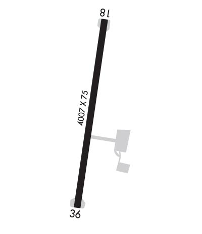
    Runway Identification: 18/36
    Length: 4007 ft
    Width: 75 ft
    Surface: ASPHALT-FAIR CONDITION
    Edge lights: Medium Intensity

    Treatment: NONE

     Runway: 18   Runway: 36
    Mag heading: 187°Mag heading:
    Rwy Slope: .06% UpRwy Slope: -.06% Down
    Approach: Approach:
    Pattern: Left TrafficPattern: Left Traffic
    Markings: NONPRECISION INSTRUMENTMarkings: NONPRECISION INSTRUMENT
    Marking Condition: POOR; FADED.Marking Condition: POOR; FADED.
    Arresting Dev: Arresting Dev:
    Lat & Long: N3501.6  W09437.2Lat. & Long.: N3501.0  W09437.3
    Elev: 447.9 ft. MSLElev: 450.4 ft. MSL
    TCH: 42 ft. AGLTCH: 42 ft. AGL
    Visual Glide Path: 3.00 degreesVisual Glide Path: 3.00 degrees
    Displaced Threshold: NoDisplaced Threshold: No
    Touchdown Zone: YESTouchdown Zone: YES
    Touchdown Elev.: 450.2 feetTouchdown Elev.: 450.9 feet
    Visual Glide Slope: 4-Light PAPI on LEFT side of RunwayVisual Glide Slope: 4-Light PAPI on LEFT side of Runway
    RVR Equipment: RVR Equipment:
    RVV Equipment: NORVV Equipment: NO
    Approach Lights: ODALS - omnidirectional approach lighting systemApproach Lights:
    REIL: NOREIL: YES
    Centerline Lights: NOCenterline Lights: NO
    Touchdown lights: NOTouchdown lights: NO
    Runway Category: Runway with a Non-precision Approach having visibility minimums greater than 3/4 mileRunway Category: Runway with a Non-precision Approach having visibility minimums greater than 3/4 mile
    Declared Distances: Declared Distances:
    Obstructions: TREESObstructions:
    Marked: NOT Marked/LightedMarked:
    Clearance slope: 30:1Clearance slope: 34:1
    Obstruction height: 54 feet AGLObstruction height:
    Dist. from runway: 1831 feetDist. from runway:
    Centerline offset: 99 left of centerlineCenterline offset:
    Comments: Comments:
    C:2/P: