
| ||||||||||||||||||||||||||||||||||||||||||||
| ||||||||||||||||||||||||||||||||||||||||||||
| Rwy | Rwy | |||||||
| 3214x50 | 3214' | 3214x50 | 3214' | |||||
| Runway ID | Single Wheel | Double Wheel | Double Tandem Wheel | Dual Double Wheel |
| 12/30 | 28,000 | 39,000 | N/A | N/A |
| These numbers are Advisory and are not limits. The Airport Manager should have more accurate Weight Limits | ||||
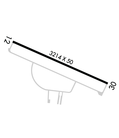 Airport Diagram might not be current. | |
| Facility Name: | GOODEN AIRPARK |
| City Name: | RIDGELY |
| County: | CAROLINE |
| State abbrev: | MD |
| State Name: | MARYLAND |
| Ownership: | PRIVATELY OWNED |
| Use: | OPEN TO THE PUBLIC |
| Owner's Name: | AIR-LAND LLC |
| Address: | 3532 TURKEY POINT ROAD |
| VIOLA, DE 19979 | |
| Owner's Phone: | 302-270-2227 |
| Manager's Name: | JOHN GOODEN |
| Address: | 3532 TURKEY POINT ROAD |
| VIOLA, DE 19979 | |
| Phone: | 302-270-2227 |
| FAA Region: | EASTERN |
| FAA Field Office: | DCA |
| Date | Sunrise | Sunset |
|---|---|---|
| 04/22/24 Monday | 6:16 | 19:48 |
| 04/23/24 Tuesday | 6:15 | 19:49 |
| 04/24/24 Wednesday | 6:13 | 19:50 |
| 04/25/24 Thursday | 6:12 | 19:51 |
| 04/26/24 Friday | 6:11 | 19:52 |
| 04/27/24 Saturday | 6:10 | 19:53 |
| 04/28/24 Sunday | 6:08 | 19:54 |
| 04/29/24 Monday | 6:07 | 19:55 |
| 04/30/24 Tuesday | 6:06 | 19:56 |
| 05/01/24 Wednesday | 6:05 | 19:57 |
| 05/02/24 Thursday | 6:03 | 19:58 |
| 05/03/24 Friday | 6:02 | 19:59 |
| 05/04/24 Saturday | 6:01 | 20:00 |
| 05/05/24 Sunday | 6:00 | 20:01 |
| Airport Attendance Schedule | UNATTENDED |
| Airport Status | OPERATIONAL (This Status can change at any time - please check NOTAMS) |
| Airport Lighting Schedule | ACTIVATE REIL RWY 12 & 30; LIRL RWY 12/30 - CTAF.; ACTVT ARPT BEACON - CTAF. |
| Airport Storage Available | Tie Downs |
| Extra Services Available | Crop Dusting, Parachute Jumping |
| Wind Indicator | YES - (lighted) |
| Control Tower | NO |
| CTAF Frequency | 122.800 |
| Unicom Frequency | 122.800; UNICOM UNMON. |
| Rotating Beacon Color | WG |
| Segmented Circle | YES |
| Landing Fee | NO |
| Airport Inspected | STATE - performed by STATE AERONAUTICAL PERSONNEL |
| Inspection Date | 03/07/2024 |
| Type of Fuel Available | None |
| Airframe Repair Service | MAJOR |
| Power Plant Repair Service | MAJOR |
| Latitude | N3858.2 |
| Longitude | W07552.0 (ESTIMATED) |
| Arpt Elevation | 64ft (SURVEYED) |
| Magnetic Variation | 12W |
| 2 miles NE | of RIDGELY |
| Traffic Pattern Altitude | |
| Sectional Chart | WASHINGTON |
| Operations (Reported) | Yearly | Avg. Daily |
|---|---|---|
| General Aviation Transient | 1900 | 5 |
| General Aviation Local | 10000 | 27 |
| Air Taxi | 0 | 0 |
| Commerical | 0 | 0 |
| Commuter | 0 | 0 |
| Military | 0 | 0 |
| Aircraft based on Field | |
|---|---|
| General Aviation Singles | 6 |
| General Aviation Multi | 0 |
| Jet Aircraft | 0 |
| General Aviation Helicopters | 0 |
| Military Aircraft | 0 |
| Gliders | 0 |
| Ultralights | 0 |
| FSS on field | NO |
| FSS tie-in | LEESBURG |
| FSS Phone | 1-800-WX-BRIEF |
| Who issues Notams | DCA |
| Notam D service at airport | YES |
| ARTCC Name | WASHINGTON |
| Airport Certification | |
| Aircraft Rescue & Firefighting Index | None |
| Airport of Entry | No |
| Custom Landing Rights | No |
| Joint Civil/Military | No |
| Military Landing rights | No |
| FOR CD CTC DOVER APCH AT 302-677-3940. |
| TURF AREAS ADJACENT TO ACFT MOVEMENT AREAS SOFT WHEN WET. |
| UNLIMITED VEHICLE ACCESS TO ACFT MOVEMENT AREAS. |
| BIRDS, DEER & WILDLIFE ON & INVOF ARPT. |
| TWY/APN PAVEMENTS ARE FAILING WITH LOOSE AGGREGATE AND ALLIGATOR CRACKING. |
| RWY 12 1 THR BARS AND RWY NRS ARE HALF SIZE. |
| RWY 30 1 THR BARS AND RWY NRS ARE HALF SIZE. |
Airport Communications & Frequencies:
| ||||||||||||||||||||||||||
| Runway: 12 | Runway: 30 | ||
| Mag heading: | 121° | Mag heading: | 301° |
| Rwy Slope: | .00% Up | Rwy Slope: | .00% Down |
| Approach: | Approach: | ||
| Pattern: | Left Traffic | Pattern: | Right Traffic |
| Markings: | NONSTANDARD | Markings: | NONSTANDARD |
| Marking Condition: | FAIR; FADED, CRACK SEAL THRU MRKGS. | Marking Condition: | FAIR; FADED, CRACK SEAL THRU MRKGS. |
| Arresting Dev: | Arresting Dev: | ||
| Lat & Long: | N3858.3 W07552.4 | Lat. & Long.: | N3858.2 W07551.8 |
| Elev: | 63.5 ft. MSL | Elev: | 63.6 ft. MSL |
| TCH: | TCH: | ||
| Visual Glide Path: | Visual Glide Path: | ||
| Displaced Threshold: | No | Displaced Threshold: | No |
| Touchdown Zone: | YES | Touchdown Zone: | YES |
| Touchdown Elev.: | 63.6 feet | Touchdown Elev.: | 63.6 feet |
| Visual Glide Slope: | Visual Glide Slope: | ||
| RVR Equipment: | RVR Equipment: | ||
| RVV Equipment: | NO | RVV Equipment: | NO |
| Approach Lights: | Approach Lights: | ||
| REIL: | YES | REIL: | YES |
| Centerline Lights: | NO | Centerline Lights: | NO |
| Touchdown lights: | NO | Touchdown lights: | NO |
| Runway Category: | Runway with a Non-precision Approach having visibility minimums greater than 3/4 mile | Runway Category: | Runway with a Non-precision Approach having visibility minimums greater than 3/4 mile |
| Declared Distances: | Declared Distances: | ||
| Obstructions: | PLINE | Obstructions: | TREES |
| Marked: | MARKED and LIGHTED | Marked: | NOT Marked/Lighted |
| Clearance slope: | 35:1 | Clearance slope: | 4:1 |
| Obstruction height: | 27 feet AGL | Obstruction height: | 68 feet AGL |
| Dist. from runway: | 1170 feet | Dist. from runway: | 527 feet |
| Centerline offset: | Centerline offset: | 257 feet right of centerline | |
| Comments: | Comments: |
