
| ||||||||||||||||||||||||||||||||
| ||||||||||||||||||||||||||||||||
| ||||||||||||||||||||||||||||||||
| Rwy | Rwy | |||||||
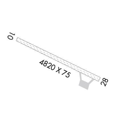
| 4820x75 | 4820' | 4820x75 | 4820' | |||||
| Runway ID | Single Wheel | Double Wheel | Double Tandem Wheel | Dual Double Wheel |
| 10/28 | N/A | N/A | N/A | N/A |
| These numbers are Advisory and are not limits. The Airport Manager should have more accurate Weight Limits | ||||
| FltPlan does not have IFR approach charts available for KRDV. |
 Airport Diagram might not be current. | |
| Facility Name: | RED DEVIL |
| City Name: | RED DEVIL |
| County: | BETHEL |
| State abbrev: | AK |
| State Name: | ALASKA |
| Ownership: | PUBLICLY OWNED |
| Use: | OPEN TO THE PUBLIC |
| Owner's Name: | ALASKA DOT&PF CENTRAL REGION |
| Address: | PO BOX 196900 |
| ANCHORAGE, AK 99519-6900 | |
| Owner's Phone: | 907-269-0749 |
| Manager's Name: | RICHARD CILETTI |
| Address: | PO BOX 584 |
| ANIAK, AK 99557 | |
| Phone: | 907-675-4345 |
| FAA Region: | ALASKA |
| FAA Field Office: | NONE |
| Date | Sunrise | Sunset |
|---|---|---|
| 04/19/24 Friday | 6:51 | 22:07 |
| 04/20/24 Saturday | 6:48 | 22:10 |
| 04/21/24 Sunday | 6:45 | 22:13 |
| 04/22/24 Monday | 6:41 | 22:15 |
| 04/23/24 Tuesday | 6:38 | 22:18 |
| 04/24/24 Wednesday | 6:35 | 22:21 |
| 04/25/24 Thursday | 6:32 | 22:24 |
| 04/26/24 Friday | 6:29 | 22:26 |
| 04/27/24 Saturday | 6:26 | 22:29 |
| 04/28/24 Sunday | 6:23 | 22:32 |
| 04/29/24 Monday | 6:20 | 22:35 |
| 04/30/24 Tuesday | 6:17 | 22:37 |
| 05/01/24 Wednesday | 6:14 | 22:40 |
| 05/02/24 Thursday | 6:11 | 22:43 |
| Airport Attendance Schedule | UNATTENDED |
| Airport Status | OPERATIONAL (This Status can change at any time - please check NOTAMS) |
| Airport Lighting Schedule | |
| Airport Storage Available | NONE |
| Extra Services Available | Cargo Handling |
| Wind Indicator | YES - (unlit) |
| Control Tower | NO |
| CTAF Frequency | 122.800 |
| Unicom Frequency | |
| Rotating Beacon Color | |
| Segmented Circle | NO |
| Landing Fee | NO |
| Airport Inspected | STATE - performed by PRIVATE CONTRACT PERSONNEL |
| Inspection Date | 06/19/2017 |
| Type of Fuel Available | None |
| Airframe Repair Service | NONE |
| Power Plant Repair Service | NONE |
| Latitude | N6147.3 |
| Longitude | W15721.0 (ESTIMATED) |
| Arpt Elevation | 180ft (SURVEYED) |
| Magnetic Variation | 21E |
| 1 miles NW | of RED DEVIL |
| Traffic Pattern Altitude | |
| Sectional Chart | MC GRATH |
| Operations (Reported) | Yearly | Avg. Daily |
|---|---|---|
| General Aviation Transient | 0 | 0 |
| General Aviation Local | 0 | 0 |
| Air Taxi | 500 | 1 |
| Commerical | 0 | 0 |
| Commuter | 0 | 0 |
| Military | 0 | 0 |
| Aircraft based on Field | |
|---|---|
| General Aviation Singles | 0 |
| General Aviation Multi | 0 |
| Jet Aircraft | 0 |
| General Aviation Helicopters | 0 |
| Military Aircraft | 0 |
| Gliders | 0 |
| Ultralights | 0 |
| FSS on field | NO |
| FSS tie-in | KENAI |
| FSS Phone | 1-800-866-864-1737 |
| Who issues Notams | ENA |
| Notam D service at airport | YES |
| ARTCC Name | ANCHORAGE |
| Airport Certification | |
| Aircraft Rescue & Firefighting Index | None |
| Airport of Entry | No |
| Custom Landing Rights | No |
| Joint Civil/Military | No |
| Military Landing rights | YES |
| NATIONAL PLAN OF INTEGRATED AIRPORT SYSTEMS (NPIAS) |
| CONVEYANCE UNDER SCETION 16, FEDERAL AIRPORT ACT OF 1946 OR SECTION 23, AIRPORT AND AIRWAY DEVELOPMENT ACT OF 1970 |
| GRANT AGREEMENT HAS EXPIRED; HOWEVER, AGREEMENT REMAINS IN EFFECT FOR THIS FACILITY AS LONG AS IT IS PUBLIC USE. |
| RY CONDITION NOT MONITORED; RECOMMEND VISUAL INSPECTION PRIOR TO USING. |
| NIGHT OPERATIONS PROHIBITED, EXCEPT ROTARY WING. |
| SLEETMUTE AIRSTRIP EIGHT MILES SE. |
| LARGE WILDLIFE AND BIRDS ON RY OR INVOF ARPT. |
| RWY 10/2 8 PART OF THE RY IS WASHBOARDED AND ROUGH WITH 3 INCH RIDGES AND 2 INCH DEPRESSIONS. |
| Runway: 10 | Runway: 28 | ||
| Mag heading: | 100° | Mag heading: | 280° |
| Rwy Slope: | .02% Up | Rwy Slope: | -.02% Down |
| Approach: | Approach: | ||
| Pattern: | Left Traffic | Pattern: | Left Traffic |
| Markings: | Markings: | ||
| Marking Condition: | RY 10/28 THLD MARKED BY 30 INCH TALL ORANGE CONES WITH REFLECTIVE COLLARS. | Marking Condition: | |
| Arresting Dev: | Arresting Dev: | ||
| Lat & Long: | N6147.5 W15721.7 | Lat. & Long.: | N6147.1 W15720.3 |
| Elev: | 179.5 ft. MSL | Elev: | 180.5 ft. MSL |
| TCH: | TCH: | ||
| Visual Glide Path: | Visual Glide Path: | ||
| Displaced Threshold: | No | Displaced Threshold: | No |
| Touchdown Zone: | YES | Touchdown Zone: | YES |
| Touchdown Elev.: | 179.8 feet | Touchdown Elev.: | 180.6 feet |
| Visual Glide Slope: | Visual Glide Slope: | ||
| RVR Equipment: | RVR Equipment: | ||
| RVV Equipment: | NO | RVV Equipment: | NO |
| Approach Lights: | Approach Lights: | ||
| REIL: | NO | REIL: | NO |
| Centerline Lights: | NO | Centerline Lights: | NO |
| Touchdown lights: | NO | Touchdown lights: | NO |
| Runway Category: | Runway with a Visual Approach | Runway Category: | Runway with a Visual Approach |
| Declared Distances: | Declared Distances: | ||
| Obstructions: | TREES | Obstructions: | TREES |
| Marked: | NOT Marked/Lighted | Marked: | NOT Marked/Lighted |
| Clearance slope: | Clearance slope: | ||
| Obstruction height: | 25 feet AGL | Obstruction height: | 25 feet AGL |
| Dist. from runway: | 0 feet | Dist. from runway: | 0 feet |
| Centerline offset: | 120 right of centerline | Centerline offset: | 120 feet left of centerline |
| Comments: | Comments: |
