
| ||||||||||||||||||||||||||||||||||||||||||||||||||||||||||||||||||||
| ||||||||||||||||||||||||||||||||||||||||||||||||||||||||||||||||||||
| ||||||||||||||||||||||||||||||||||||||||||||||||||||||||||||||||||||
| Rwy | Rwy | |||||||
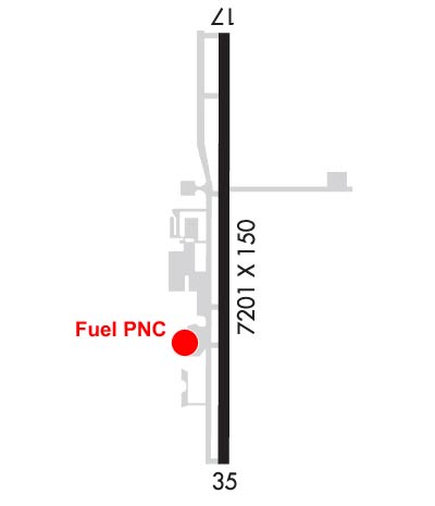
| 7201x100 | 7201' | 111.90 - 175° | 7201x100 | 7201' | ||||
| Runway ID | Single Wheel | Double Wheel | Double Tandem Wheel | Dual Double Wheel |
| 17/35 | 51,000 | 65,000 | 122,000 | N/A |
| These numbers are Advisory and are not limits. The Airport Manager should have more accurate Weight Limits | ||||
 Airport Diagram might not be current. | |
| Facility Name: | PONCA CITY RGNL |
| City Name: | PONCA CITY |
| County: | KAY |
| State abbrev: | OK |
| State Name: | OKLAHOMA |
| Ownership: | PUBLICLY OWNED |
| Use: | OPEN TO THE PUBLIC |
| Owner's Name: | CITY OF PONCA CITY |
| Address: | BOX 1450 |
| PONCA CITY, OK 74602 | |
| Owner's Phone: | 580-767-0300 |
| Manager's Name: | DON NUZUM |
| Address: | BOX 1450 |
| PONCA CITY, OK 74602 | |
| Phone: | 580-767-0470 |
| FAA Region: | SOUTHWEST |
| FAA Field Office: | AOK |

| Date | Sunrise | Sunset |
|---|---|---|
| 04/24/24 Wednesday | 6:42 | 20:12 |
| 04/25/24 Thursday | 6:41 | 20:12 |
| 04/26/24 Friday | 6:39 | 20:13 |
| 04/27/24 Saturday | 6:38 | 20:14 |
| 04/28/24 Sunday | 6:37 | 20:15 |
| 04/29/24 Monday | 6:36 | 20:16 |
| 04/30/24 Tuesday | 6:35 | 20:17 |
| 05/01/24 Wednesday | 6:34 | 20:18 |
| 05/02/24 Thursday | 6:33 | 20:19 |
| 05/03/24 Friday | 6:32 | 20:19 |
| 05/04/24 Saturday | 6:30 | 20:20 |
| 05/05/24 Sunday | 6:29 | 20:21 |
| 05/06/24 Monday | 6:28 | 20:22 |
| 05/07/24 Tuesday | 6:27 | 20:23 |
| Airport Attendance Schedule | 7 Days A Week 0700-1900 |
| Airport Status | OPERATIONAL (This Status can change at any time - please check NOTAMS) |
| Airport Lighting Schedule | ACTVT MALSR RWY 17; ODALS RWY 35; HIRL RWY 17/35 - CTAF. PAPI RWY 17 & 35 ON CONSLY. |
| Airport Storage Available | Tie Downs, Hanger |
| Extra Services Available | Air Ambulance, Charter, Flight Instruction, Aircraft Rental, Aircraft Sales |
| Wind Indicator | YES - (lighted) |
| Control Tower | NO |
| CTAF Frequency | 123.000 |
| Unicom Frequency | 123.000 |
| Rotating Beacon Color | WG |
| Segmented Circle | YES |
| Landing Fee | NO |
| Airport Inspected | STATE - performed by STATE AERONAUTICAL PERSONNEL |
| Inspection Date | 12/13/2022 |
| Type of Fuel Available | Grade 100LL, JET A (freeze point -40C); -10100LL AVBL 24 HR.; JET A & SVC AVBL 0700-DUSK; OTR TIMES - 580-767-0429. |
| Airframe Repair Service | MAJOR |
| Power Plant Repair Service | MAJOR |
| Latitude | N3643.9 |
| Longitude | W09706.0 (ESTIMATED) |
| Arpt Elevation | 1008ft (SURVEYED) |
| Magnetic Variation | 05E |
| 2 miles NW | of PONCA CITY |
| Traffic Pattern Altitude | |
| Sectional Chart | WICHITA |
| Operations (Reported) | Yearly | Avg. Daily |
|---|---|---|
| General Aviation Transient | 37000 | 101 |
| General Aviation Local | 10000 | 27 |
| Air Taxi | 0 | 0 |
| Commerical | 0 | 0 |
| Commuter | 0 | 0 |
| Military | 5000 | 14 |
| Aircraft based on Field | |
|---|---|
| General Aviation Singles | 30 |
| General Aviation Multi | 4 |
| Jet Aircraft | 5 |
| General Aviation Helicopters | 1 |
| Military Aircraft | 0 |
| Gliders | 0 |
| Ultralights | 0 |
| FSS on field | NO |
| FSS tie-in | MC ALESTER |
| FSS Phone | 1-800-WX-BRIEF |
| Who issues Notams | PNC |
| Notam D service at airport | YES |
| ARTCC Name | KANSAS CITY |
| Airport Certification | |
| Aircraft Rescue & Firefighting Index | None |
| Airport of Entry | No |
| Custom Landing Rights | No |
| Joint Civil/Military | No |
| Military Landing rights | YES |
| NATIONAL PLAN OF INTEGRATED AIRPORT SYSTEMS (NPIAS) |
| GRANT AGREEMENTS UNDER FAAP/ADAP/AIP |
| SURPLUS PROPERTY AGREEMENT UNDER PUBLIC LAW 289 |
| ASSURANCES PURSUANT TO TITLE VI, CIVIL RIGHTS ACT OF 1964 |
| ULTRALIGHTS ON & INVOF ARPT. |
| FOR CD IF UNA TO CTC ON FSS FREQ, CTC KANSAS CITY ARTCC AT 913-254-8508. |
| RWY 17/3 5 NORTH 2400 FT NSTD PLASTIC GROOVING ENTIRE WIDTH; 25 FT EACH EDGE REMAINING 4801 FT. |
Airport Communications & Frequencies:
| |||||||||
| Runway: 17 | Runway: 35 | ||
| Mag heading: | 175° | Mag heading: | 355° |
| Rwy Slope: | .21% Up | Rwy Slope: | -.21% Down |
| Approach: | ILS/DME | Approach: | |
| Pattern: | Right Traffic | Pattern: | Left Traffic |
| Markings: | PRECISION INSTRUMENT | Markings: | PRECISION INSTRUMENT |
| Marking Condition: | GOOD | Marking Condition: | FAIR |
| Arresting Dev: | Arresting Dev: | ||
| Lat & Long: | N3644.5 W09706.0 | Lat. & Long.: | N3643.3 W09706.0 |
| Elev: | 993.7 ft. MSL | Elev: | 1008.6 ft. MSL |
| TCH: | 52 ft. AGL | TCH: | 46 ft. AGL |
| Visual Glide Path: | 3.00 degrees | Visual Glide Path: | 3.00 degrees |
| Displaced Threshold: | No | Displaced Threshold: | No |
| Touchdown Zone: | YES | Touchdown Zone: | YES |
| Touchdown Elev.: | 1004.2 feet | Touchdown Elev.: | 1008.0 feet |
| Visual Glide Slope: | 4-Light PAPI on LEFT side of Runway | Visual Glide Slope: | 4-Light PAPI on LEFT side of Runway; PAPI UNUSBL BYD 8 DEGS RIGHT OF CNTRLN. |
| RVR Equipment: | RVR Equipment: | ||
| RVV Equipment: | NO | RVV Equipment: | NO |
| Approach Lights: | MALSR - 1,400 foot medium intensity approach lighting system with runway alignment indicator lights | Approach Lights: | ODALS - omnidirectional approach lighting system |
| REIL: | NO | REIL: | NO |
| Centerline Lights: | NO | Centerline Lights: | NO |
| Touchdown lights: | NO | Touchdown lights: | NO |
| Runway Category: | Precision Instrument Runway | Runway Category: | Runway with a Non-precision Approach having visibility minimums greater than 3/4 mile |
| Declared Distances: | Declared Distances: | ||
| Obstructions: | Obstructions: | BLDG | |
| Marked: | Marked: | LIGHTED | |
| Clearance slope: | 50:1 | Clearance slope: | 18:1 |
| Obstruction height: | Obstruction height: | 28 feet AGL | |
| Dist. from runway: | Dist. from runway: | 710 feet | |
| Centerline offset: | Centerline offset: | 555 feet left of centerline | |
| Comments: | Comments: |