
| ||||||||||||||||||||||||||||||||||||||||||||
| ||||||||||||||||||||||||||||||||||||||||||||
| ||||||||||||||||||||||||||||||||||||||||||||
| Rwy | Rwy | |||||||
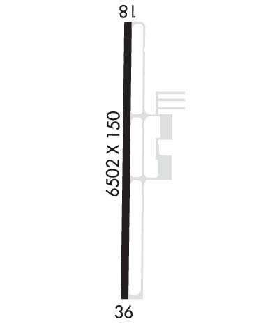
| 6502x150 | 6502' | 109.50 - 180° | 6502x150 | 6502' | ||||
| Runway ID | Single Wheel | Double Wheel | Double Tandem Wheel | Dual Double Wheel |
| 18/36 | 125,000 | 225,000 | 275,000 | N/A |
| These numbers are Advisory and are not limits. The Airport Manager should have more accurate Weight Limits | ||||
 Airport Diagram might not be current. | |
| Facility Name: | HATTIESBURG/LAUREL RGNL |
| City Name: | HATTIESBURG-LAUREL |
| County: | JONES |
| State abbrev: | MS |
| State Name: | MISSISSIPPI |
| Ownership: | PUBLICLY OWNED |
| Use: | OPEN TO THE PUBLIC |
| Owner's Name: | REGIONAL AIRPORT AUTH; HATTIESBURG-LAUREL REGIONAL AIRPORT AUTHORITY. |
| Address: | 1002 TERMINAL DR |
| MOSELLE, MS 39459 | |
| Owner's Phone: | 601-545-3111 |
| Manager's Name: | THOMAS HEANUE |
| Address: | 1002 TERMINAL DR |
| MOSELLE, MS 39459 | |
| Phone: | 601-545-3111 |
| FAA Region: | SOUTHERN |
| FAA Field Office: | JAN |
| Date | Sunrise | Sunset |
|---|---|---|
| 04/23/24 Tuesday | 6:19 | 19:32 |
| 04/24/24 Wednesday | 6:18 | 19:33 |
| 04/25/24 Thursday | 6:17 | 19:33 |
| 04/26/24 Friday | 6:16 | 19:34 |
| 04/27/24 Saturday | 6:15 | 19:35 |
| 04/28/24 Sunday | 6:14 | 19:36 |
| 04/29/24 Monday | 6:13 | 19:36 |
| 04/30/24 Tuesday | 6:12 | 19:37 |
| 05/01/24 Wednesday | 6:12 | 19:38 |
| 05/02/24 Thursday | 6:11 | 19:38 |
| 05/03/24 Friday | 6:10 | 19:39 |
| 05/04/24 Saturday | 6:09 | 19:40 |
| 05/05/24 Sunday | 6:08 | 19:40 |
| 05/06/24 Monday | 6:07 | 19:41 |
| Airport Attendance Schedule | 7 Days A Week 0500-2300 |
| Airport Status | OPERATIONAL (This Status can change at any time - please check NOTAMS) |
| Airport Lighting Schedule | ACTVT MALSR RWY 18; REILS RWY 18 & 36; HIRL RWY 18/36 - CTAF. HIRL RWY 18/36 PRESET TO MED INTST, TO INCRS INTST - CTAF. PAPIS RWY 18 & 36 OPR CONSLY. |
| Airport Storage Available | Tie Downs, Hanger |
| Extra Services Available | Flight Instruction, Aircraft Rental |
| Wind Indicator | YES - (lighted) |
| Control Tower | NO |
| CTAF Frequency | 123.000 |
| Unicom Frequency | 123.000 |
| Rotating Beacon Color | WG |
| Segmented Circle | YES |
| Landing Fee | NO |
| Airport Inspected | FEDERAL - performed by FAA AIRPORTS FIELD PERSONNEL |
| Inspection Date | 02/03/2023 |
| Type of Fuel Available | Grade 100, JET A (freeze point -40C) |
| Airframe Repair Service | MINOR |
| Power Plant Repair Service | MINOR |
| Latitude | N3128.0 |
| Longitude | W08920.2 (ESTIMATED) |
| Arpt Elevation | 297ft (SURVEYED) |
| Magnetic Variation | 01W |
| 9 miles N | of HATTIESBURG-LAUREL |
| Traffic Pattern Altitude | |
| Sectional Chart | NEW ORLEANS |
| Operations (Reported) | Yearly | Avg. Daily |
|---|---|---|
| General Aviation Transient | 18432 | 50 |
| General Aviation Local | 21360 | 59 |
| Air Taxi | 0 | 0 |
| Commerical | 1252 | 3 |
| Commuter | 0 | 0 |
| Military | 327 | 1 |
| Aircraft based on Field | |
|---|---|
| General Aviation Singles | 50 |
| General Aviation Multi | 8 |
| Jet Aircraft | 6 |
| General Aviation Helicopters | 0 |
| Military Aircraft | 0 |
| Gliders | 0 |
| Ultralights | 0 |
| FSS on field | NO |
| FSS tie-in | GREENWOOD |
| FSS Phone | 1-800-WX-BRIEF |
| Who issues Notams | PIB |
| Notam D service at airport | YES |
| ARTCC Name | HOUSTON |
| Airport Certification | AIRPORT RECEIVING SCHEDULED AIR CARRIER SERVICE FROM CARRIERS CERTIFICATED BY THE CIVIL AERONAUTICS BOARD; CLSD TO ACR OPS WITH MORE THAN 30 PAX SEATS EXCP 24 HR PPR, CALL ARPT MGR 601-545-3111. |
| Aircraft Rescue & Firefighting Index | AIRPORT HAS A CERTIFICATE UNDER CFR PART 139 |
| Airport of Entry | No |
| Custom Landing Rights | No |
| Joint Civil/Military | No |
| Military Landing rights | YES |
| NATIONAL PLAN OF INTEGRATED AIRPORT SYSTEMS (NPIAS) |
| GRANT AGREEMENTS UNDER FAAP/ADAP/AIP |
| ASSURANCES PURSUANT TO TITLE VI, CIVIL RIGHTS ACT OF 1964 |
| THIS AIRPORT HAS BEEN SURVEYED BY THE NATIONAL GEODETIC SURVEY. |
| FOR CD CTC HOUSTON ARTCC AT 281-230-5622. |
Airport Communications & Frequencies:
| |||||||||
| Runway: 18 | Runway: 36 | ||
| Mag heading: | 181° | Mag heading: | 1° |
| Rwy Slope: | -.06% Down | Rwy Slope: | .06% Up |
| Approach: | ILS | Approach: | |
| Pattern: | Left Traffic | Pattern: | Left Traffic |
| Markings: | PRECISION INSTRUMENT | Markings: | PRECISION INSTRUMENT |
| Marking Condition: | GOOD | Marking Condition: | GOOD |
| Arresting Dev: | Arresting Dev: | ||
| Lat & Long: | N3128.6 W08920.2 | Lat. & Long.: | N3127.5 W08920.2 |
| Elev: | 297.6 ft. MSL | Elev: | 293.9 ft. MSL |
| TCH: | 58 ft. AGL | TCH: | 44 ft. AGL |
| Visual Glide Path: | 3.00 degrees | Visual Glide Path: | 3.00 degrees |
| Displaced Threshold: | No | Displaced Threshold: | No |
| Touchdown Zone: | YES | Touchdown Zone: | YES |
| Touchdown Elev.: | 297.6 feet | Touchdown Elev.: | 295.6 feet |
| Visual Glide Slope: | 4-Light PAPI on LEFT side of Runway | Visual Glide Slope: | 4-Light PAPI on LEFT side of Runway |
| RVR Equipment: | RVR Equipment: | ||
| RVV Equipment: | NO | RVV Equipment: | NO |
| Approach Lights: | MALSR - 1,400 foot medium intensity approach lighting system with runway alignment indicator lights | Approach Lights: | |
| REIL: | YES | REIL: | YES |
| Centerline Lights: | NO | Centerline Lights: | NO |
| Touchdown lights: | NO | Touchdown lights: | NO |
| Runway Category: | Precision Instrument Runway | Runway Category: | Runway with a Non-precision Approach having visibility minimums greater than 3/4 mile |
| Declared Distances: | TORA:6502' TODA:6502' ASDA:6502' LDA:6502' | Declared Distances: | TORA:6502' TODA:6502' ASDA:6502' LDA:6502' |
