Current Weather/Notams (Metars, TAFs, Notams, NWS Forecast, PIREPS, and nearby weather)
Customs Information Send updates to Support@FltPlan.com
Customs Not Available
Database effective 05/16/2024
Airport Diagram might not be current.
|
| Facility Name: | PUTNAM COUNTY |
| City Name: | OTTAWA |
| County: | PUTNAM |
| State abbrev: | OH |
| State Name: | OHIO |
| | |
| Ownership: | PUBLICLY OWNED |
| Use: | OPEN TO THE PUBLIC |
| Owner's Name: | PUTNAM CO ARPT AUTHORITY |
| Address: | 10218 ROAD 5H |
| | OTTAWA, OH 45875-9715 |
| Owner's Phone: | 419-523-3910 |
| | |
| Manager's Name: | CHAD & LINDA NIESE |
| Address: | 10218 ROAD 5H |
| | OTTAWA, OH 45875-9715 |
| Phone: | 419-523-3910 |
| | |
| FAA Region: | GREAT LAKES |
| FAA Field Office: | DET |
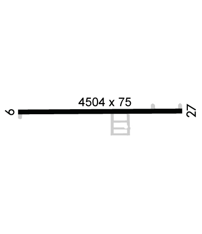
Runway Identifications
Runway Identification: 09/27Length: 4502 ft
Width: 75 ft
Surface: ASPHALT-GOOD CONDITION
Edge lights: Medium IntensityTreatment: NONE
| | Runway: 09 | | Runway: 27 |
| Mag heading: | 95° | Mag heading: | 275° |
| Rwy Slope: | .21% Up | Rwy Slope: | -.21% Down |
| Approach: | | Approach: | |
| Pattern: | Left Traffic | Pattern: | Left Traffic |
| Markings: | NONPRECISION INSTRUMENT | Markings: | NONPRECISION INSTRUMENT |
| Marking Condition: | GOOD | Marking Condition: | GOOD |
| Arresting Dev: | | Arresting Dev: | |
| Lat & Long: | N4102.1 W08359.4 | Lat. & Long.: | N4102.1 W08358.4 |
| Elev: | 754.1 ft. MSL | Elev: | 763.5 ft. MSL |
| TCH: | 41 ft. AGL | TCH: | 44 ft. AGL |
| Visual Glide Path: | 3.00 degrees | Visual Glide Path: | 3.00 degrees |
| Displaced Threshold: | No | Displaced Threshold: | No |
| Touchdown Zone: | YES | Touchdown Zone: | YES |
| Touchdown Elev.: | 759.8 feet | Touchdown Elev.: | 763.5 feet |
| Visual Glide Slope: | 2-Light PAPI on LEFT side of Runway | Visual Glide Slope: | 2-Light PAPI on LEFT side of Runway |
| RVR Equipment: | | RVR Equipment: | |
| RVV Equipment: | NO | RVV Equipment: | NO |
| Approach Lights: | | Approach Lights: | |
| REIL: | YES | REIL: | YES |
| Centerline Lights: | NO | Centerline Lights: | NO |
| Touchdown lights: | NO | Touchdown lights: | NO |
| Runway Category: | Runway with a Non-precision Approach | Runway Category: | Runway with a Non-precision Approach |
| Declared Distances: | | Declared Distances: | |
| Obstructions: | ROAD | Obstructions: | ROAD |
| Marked: | NOT Marked/Lighted | Marked: | NOT Marked/Lighted |
| Clearance slope: | | Clearance slope: | |
| Obstruction height: | 16 feet AGL | Obstruction height: | 11 feet AGL |
| Dist. from runway: | 201 feet | Dist. from runway: | 201 feet |
| Centerline offset: | 217 left of centerline | Centerline offset: | 208 feet right of centerline |
| Comments: | +9 FT ROAD, 0-200 FT DIST, 217 FT L. | Comments: | +11 FT ROAD, 0-200 FT DIST, 208 FT R. |

