
| ||||||||||||||||||||||||||||||||||||||||||||
| ||||||||||||||||||||||||||||||||||||||||||||
| ||||||||||||||||||||||||||||||||||||||||||||
| Rwy | Rwy | |||||||
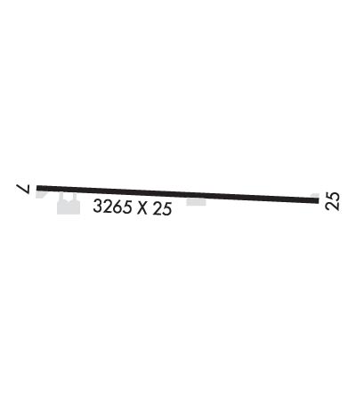
| 3265x25 | 2758' | 3265x25 | 3265' | |||||
| Runway ID | Single Wheel | Double Wheel | Double Tandem Wheel | Dual Double Wheel |
| 07/25 | 5,000 | N/A | N/A | N/A |
| These numbers are Advisory and are not limits. The Airport Manager should have more accurate Weight Limits | ||||
 Airport Diagram might not be current. | |
| Facility Name: | DELAURENTIS |
| City Name: | OAK HARBOR |
| County: | ISLAND |
| State abbrev: | WA |
| State Name: | WASHINGTON |
| Ownership: | PRIVATELY OWNED |
| Use: | OPEN TO THE PUBLIC |
| Owner's Name: | DFF LLC |
| Address: | PO BOX 3351 |
| SAN DIEGO, CA 92163 | |
| Owner's Phone: | 619-368-9410 |
| Manager's Name: | ROBERT DELAURENTIS |
| Address: | 1140 MONROE LANDING ROAD |
| OAK HARBOR, WA 98277 | |
| Phone: | 619-368-9410 |
| FAA Region: | NORTHWEST MOUNTAIN |
| FAA Field Office: | SEA |
| Date | Sunrise | Sunset |
|---|---|---|
| 04/23/24 Tuesday | 6:04 | 20:14 |
| 04/24/24 Wednesday | 6:02 | 20:16 |
| 04/25/24 Thursday | 6:01 | 20:17 |
| 04/26/24 Friday | 5:59 | 20:19 |
| 04/27/24 Saturday | 5:57 | 20:20 |
| 04/28/24 Sunday | 5:55 | 20:22 |
| 04/29/24 Monday | 5:54 | 20:23 |
| 04/30/24 Tuesday | 5:52 | 20:24 |
| 05/01/24 Wednesday | 5:50 | 20:26 |
| 05/02/24 Thursday | 5:49 | 20:27 |
| 05/03/24 Friday | 5:47 | 20:29 |
| 05/04/24 Saturday | 5:46 | 20:30 |
| 05/05/24 Sunday | 5:44 | 20:31 |
| 05/06/24 Monday | 5:42 | 20:33 |
| Airport Attendance Schedule | UNATTENDED |
| Airport Status | OPERATIONAL (This Status can change at any time - please check NOTAMS) |
| Airport Lighting Schedule | ACTVT NSTD LIRL RWY 07 & 25 - CTAF. |
| Airport Storage Available | Tie Downs |
| Extra Services Available | Flight Instruction |
| Wind Indicator | YES - (unlit) |
| Control Tower | NO |
| CTAF Frequency | 122.800 |
| Unicom Frequency | 122.800 |
| Rotating Beacon Color | WG |
| Segmented Circle | YES |
| Landing Fee | YES |
| Airport Inspected | STATE - performed by STATE AERONAUTICAL PERSONNEL |
| Inspection Date | 07/23/2020 |
| Type of Fuel Available | Grade 100LL |
| Airframe Repair Service | NONE |
| Power Plant Repair Service | NONE |
| Latitude | N4815.1 |
| Longitude | W12240.4 (ESTIMATED) |
| Arpt Elevation | 193ft (SURVEYED) |
| Magnetic Variation | 19E |
| 3 miles SW | of OAK HARBOR |
| Traffic Pattern Altitude | |
| Sectional Chart | SEATTLE |
| Operations (Reported) | Yearly | Avg. Daily |
|---|---|---|
| General Aviation Transient | 6500 | 18 |
| General Aviation Local | 10924 | 30 |
| Air Taxi | 728 | 2 |
| Commerical | 0 | 0 |
| Commuter | 0 | 0 |
| Military | 0 | 0 |
| Aircraft based on Field | |
|---|---|
| General Aviation Singles | 21 |
| General Aviation Multi | 3 |
| Jet Aircraft | 0 |
| General Aviation Helicopters | 0 |
| Military Aircraft | 0 |
| Gliders | 0 |
| Ultralights | 0 |
| FSS on field | NO |
| FSS tie-in | SEATTLE |
| FSS Phone | 1-800-WX-BRIEF |
| Who issues Notams | OKH |
| Notam D service at airport | YES |
| ARTCC Name | SEATTLE |
| Airport Certification | |
| Aircraft Rescue & Firefighting Index | None |
| Airport of Entry | No |
| Custom Landing Rights | No |
| Joint Civil/Military | No |
| Military Landing rights | No |
| TREES, BRUSH, SIGN & PARKED ACFT IN PRIM SFC. |
| PPR FOR ULTRALIGHTS AND GLIDERS CTC AMGR PHONE 360-672-5695. |
| DEER NEAR ALL MOVEMENT AREAS. |
| WHIDBEY ISLAND NAS (AULT FLD) ATIS AVBL ON FREQ 134.15/281.5. |
| AWOS-3 FREQ 132.775 OR CALL 360-675-8431. |
| FOR CD CTC WHIDBEY APCH AT 360-257-3310. |
| RWY 07/2 5 RWY 07/25 HAS SVR WEATHERING, RUTTING, AND RAVELING OVER 20% OF THE SFC. |
| RWY 07/2 5 NSTD LIRL ONLY W 2604 FT FM RY LIGHTS. |
Airport Communications & Frequencies:
| ||||||||||||||
| Runway: 07 | Runway: 25 | ||
| Mag heading: | 71° | Mag heading: | 251° |
| Rwy Slope: | 1.60% Up | Rwy Slope: | -1.60% Down |
| Approach: | Approach: | ||
| Pattern: | Right Traffic | Pattern: | Left Traffic |
| Markings: | BASIC | Markings: | BASIC |
| Marking Condition: | POOR; MARKINGS ARE FADED. | Marking Condition: | FAIR |
| Arresting Dev: | Arresting Dev: | ||
| Lat & Long: | N4815.1 W12240.8 | Lat. & Long.: | N4815.1 W12240.0 |
| Elev: | 141.0 ft. MSL | Elev: | 193.3 ft. MSL |
| TCH: | TCH: | ||
| Visual Glide Path: | Visual Glide Path: | ||
| Displaced Threshold: | 507 feet | Displaced Threshold: | No |
| Touchdown Zone: | YES | Touchdown Zone: | YES |
| Touchdown Elev.: | 193.3 feet | Touchdown Elev.: | 193.3 feet |
| Visual Glide Slope: | 2-Light PAPI on LEFT side of Runway | Visual Glide Slope: | |
| RVR Equipment: | RVR Equipment: | ||
| RVV Equipment: | NO | RVV Equipment: | NO |
| Approach Lights: | Approach Lights: | ||
| REIL: | NO | REIL: | NO |
| Centerline Lights: | NO | Centerline Lights: | NO |
| Touchdown lights: | NO | Touchdown lights: | NO |
| Runway Category: | Runway with a Visual Approach | Runway Category: | Runway with a Visual Approach |
| Declared Distances: | Declared Distances: | ||
| Obstructions: | FENCE | Obstructions: | TREE |
| Marked: | NOT Marked/Lighted | Marked: | NOT Marked/Lighted |
| Clearance slope: | 15:1; APCH RATIO 50:1 FM DSPLCD THR. | Clearance slope: | 12:1 |
| Obstruction height: | 22 feet AGL | Obstruction height: | 90 feet AGL |
| Dist. from runway: | 530 feet | Dist. from runway: | 1287 feet |
| Centerline offset: | Centerline offset: | 105 feet left of centerline | |
| Comments: | ROAD AT 32 FT; 8 FT BRUSH & FENCE AT 85 FT. | Comments: | 5' FENCE 29' FM THR 125 L & R. |
