Approach Charts
| FltPlan does not have IFR approach charts available for KO45. |
Current Weather/Notams (Metars, TAFs, Notams, NWS Forecast, PIREPS, and nearby weather)
Customs Information Send updates to Support@FltPlan.com
Customs Not Available
Database effective 05/16/2024
Airport Diagram might not be current.
|
| Facility Name: | HOOKER MUNI |
| City Name: | HOOKER |
| County: | TEXAS |
| State abbrev: | OK |
| State Name: | OKLAHOMA |
| | |
| Ownership: | PUBLICLY OWNED |
| Use: | OPEN TO THE PUBLIC |
| Owner's Name: | CITY OF HOOKER |
| Address: | 111 S. BROADWAY, BOX 67 |
| | HOOKER, OK 73945 |
| Owner's Phone: | 580-652-2885 |
| | |
| Manager's Name: | SARA ODGEN |
| Address: | 111 S. BROADWAY |
| | HOOKER, OK 73945 |
| Phone: | 580-652-2885 |
| | |
| FAA Region: | SOUTHWEST |
| FAA Field Office: | AOK |
Runway Identifications
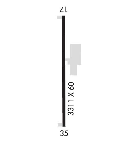
Runway Identification: 17/35Length: 3312 ft
Width: 60 ft
Surface: ASPHALT-GOOD CONDITION
Edge lights: Medium IntensityTreatment: NONE
| | Runway: 17 | | Runway: 35 |
| Mag heading: | 171° | Mag heading: | 351° |
| Rwy Slope: | -.21% Down | Rwy Slope: | .21% Up |
| Approach: | | Approach: | |
| Pattern: | Right Traffic | Pattern: | Left Traffic |
| Markings: | BASIC | Markings: | BASIC |
| Marking Condition: | GOOD | Marking Condition: | GOOD |
| Arresting Dev: | | Arresting Dev: | |
| Lat & Long: | N3651.7 W10113.6 | Lat. & Long.: | N3651.2 W10113.6 |
| Elev: | 3000.2 ft. MSL | Elev: | 2993.4 ft. MSL |
| TCH: | 40 ft. AGL | TCH: | 51 ft. AGL |
| Visual Glide Path: | 3.00 degrees | Visual Glide Path: | 3.50 degrees |
| Displaced Threshold: | No | Displaced Threshold: | No |
| Touchdown Zone: | YES | Touchdown Zone: | YES |
| Touchdown Elev.: | 3000.2 feet | Touchdown Elev.: | 2999.6 feet |
| Visual Glide Slope: | 2-Light PAPI on LEFT side of Runway | Visual Glide Slope: | 2-Light PAPI on LEFT side of Runway |
| RVR Equipment: | | RVR Equipment: | |
| RVV Equipment: | NO | RVV Equipment: | NO |
| Approach Lights: | | Approach Lights: | |
| REIL: | NO | REIL: | NO |
| Centerline Lights: | NO | Centerline Lights: | NO |
| Touchdown lights: | NO | Touchdown lights: | NO |
| Runway Category: | Runway with a Visual Approach | Runway Category: | Runway with a Visual Approach |
| Declared Distances: | | Declared Distances: | |
| Obstructions: | | Obstructions: | PLINE |
| Marked: | | Marked: | MARKED |
| Clearance slope: | 20:1 | Clearance slope: | 19:1 |
| Obstruction height: | | Obstruction height: | 57 feet AGL |
| Dist. from runway: | | Dist. from runway: | 1338 feet |
| Centerline offset: | | Centerline offset: | |
| Comments: | | Comments: | |

