Approach Charts
| FltPlan does not have IFR approach charts available for KO43. |
Current Weather/Notams (Metars, TAFs, Notams, NWS Forecast, PIREPS, and nearby weather)
Customs Information Send updates to Support@FltPlan.com
Customs Not Available
Database effective 05/16/2024
Airport Diagram might not be current.
|
| Facility Name: | YERINGTON MUNI |
| City Name: | YERINGTON |
| County: | LYON |
| State abbrev: | NV |
| State Name: | NEVADA |
| | |
| Ownership: | PUBLICLY OWNED |
| Use: | OPEN TO THE PUBLIC |
| Owner's Name: | CITY OF YERINGTON |
| Address: | 14 EAST GOLDFIELD AVENUE |
| | YERINGTON, NV 89447 |
| Owner's Phone: | 775-463-3511 |
| | |
| Manager's Name: | ROBERT SWITZER |
| Address: | 14 EAST GOLDFIELD AVENUE |
| | YERINGTON, NV 89447 |
| Phone: | 775-431-4534; 775-302-1155 |
| | |
| FAA Region: | WESTERN-PACIFIC |
| FAA Field Office: | PHX |
Runway Identifications
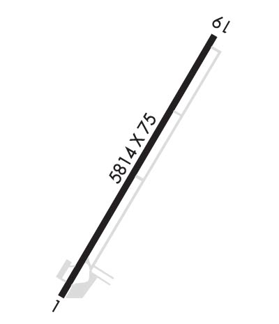
Runway Identification: 02/20Length: 5822 ft
Width: 75 ft
Surface: ASPHALT
Edge lights: Medium IntensityTreatment: NONE
| | Runway: 02 | | Runway: 20 |
| Mag heading: | N/A | Mag heading: | N/A |
| Rwy Slope: | -.10% Down | Rwy Slope: | .10% Up |
| Approach: | | Approach: | |
| Pattern: | Left Traffic | Pattern: | Left Traffic |
| Markings: | NONPRECISION INSTRUMENT | Markings: | NONPRECISION INSTRUMENT |
| Marking Condition: | GOOD | Marking Condition: | GOOD |
| Arresting Dev: | | Arresting Dev: | |
| Lat & Long: | N3859.9 W11909.7 | Lat. & Long.: | N3900.7 W11909.1 |
| Elev: | 4380.3 ft. MSL | Elev: | 4374.5 ft. MSL |
| TCH: | 40 ft. AGL | TCH: | 40 ft. AGL |
| Visual Glide Path: | 3.00 degrees | Visual Glide Path: | 3.00 degrees |
| Displaced Threshold: | No | Displaced Threshold: | No |
| Touchdown Zone: | YES | Touchdown Zone: | YES |
| Touchdown Elev.: | 4381.5 feet | Touchdown Elev.: | 4377.8 feet |
| Visual Glide Slope: | 2-Light PAPI on LEFT side of Runway; PAPI UNUSBL BYD 3.0 NM FM RWY THR DUE TO TRRN. | Visual Glide Slope: | 2-Light PAPI on LEFT side of Runway |
| RVR Equipment: | | RVR Equipment: | |
| RVV Equipment: | NO | RVV Equipment: | NO |
| Approach Lights: | | Approach Lights: | |
| REIL: | YES | REIL: | YES |
| Centerline Lights: | NO | Centerline Lights: | NO |
| Touchdown lights: | NO | Touchdown lights: | NO |
| Runway Category: | Runway with a Visual Approach | Runway Category: | Runway with a Visual Approach |
| Declared Distances: | | Declared Distances: | |
| Obstructions: | ANT | Obstructions: | TREES |
| Marked: | NOT Marked/Lighted | Marked: | NOT Marked/Lighted |
| Clearance slope: | 20:1 | Clearance slope: | 20:1 |
| Obstruction height: | 35 feet AGL | Obstruction height: | 78 feet AGL |
| Dist. from runway: | 902 feet | Dist. from runway: | 1785 feet |
| Centerline offset: | 215 right of centerline | Centerline offset: | 52 feet left of centerline |
| Comments: | | Comments: | |

