Click here for more info on on SMS!

KNY0

FULTON COUNTY
JOHNSTOWN
NY
Time Zone: Eastern
Lat: N 4259.9
Long: W 07419.8
Elev: 881
Var: +14
Longest Runway: 4000
AWOS: 119.22
CTAF: 122.7

FBO & Flight Services info for KNY0

FBOs: Update your Fuel Prices
Providing high quality fuel and services to you and your customers, from Phillips 66 Aviation.
Ph: 518-882-6392 Fax: 518-762-0220 Freq: 122.7Website-
Service
Jet
100LL
SAF
MoGas
Full        Caution: Fuel prices have not been updated in 59 days.
Last Update: 02/19/2024 13:30

Self6.996.19    
Misc. Info: Address: 160 COUNTY HIGHWAY 153   JOHNSTOWN, NY 12095

AWOSPh: 518.762.0322
-
Freq: 119.22  
If you are an FBO, call 1-203-262-1700 to update your info or email: FltPlan.Advertising@garmin.com
Advertise your FBO on FltPlan.com

Runway & Approach Info for KNY0
Rwy
Length
Land Dist**
Approach*
  Rwy
Length
Land Dist**
Approach*
10
4000x75  4000'          
 
  
28
  4000x75  4000'          
 
 * only ILS, LOC, LDA, and SDF approaches to a specific runway are shown
** For any Declared Landing Distance Available, please see A/FD or Approach plates
Runway Weight Capability (lbs.) Help
Runway IDSingle WheelDouble WheelDouble Tandem WheelDual Double Wheel
10/28N/AN/AN/AN/A
These numbers are Advisory and are not limits.   The Airport Manager should have more accurate Weight Limits
Approach Charts
Approaches    
Current Weather/Notams
Customs Information Send updates to Support@FltPlan.com
Customs Not Available
Database effective 04/18/2024
Airport Diagram of KNY0
Airport Diagram might not be current.

Facility Name: FULTON COUNTY
City Name: JOHNSTOWN
County: FULTON
State abbrev: NY
State Name: NEW YORK
   
Ownership: PUBLICLY OWNED
Use: OPEN TO THE PUBLIC
Owner's Name: COUNTY OF FULTON
Address: 1 EAST MONTGOMERY ST
 JOHNSTOWN, NY 12095
Owner's Phone: 518-736-5660
  
Manager's Name: SCOTT HENZE
Address: 1 EAST MONTGOMERY ST
 JOHNSTOWN, NY 12095
Phone: 518-882-6392
   
FAA Region: EASTERN
FAA Field Office: NYC


Sunrise / Sunset times for FULTON COUNTY

DateSunriseSunset
04/17/24 Wednesday6:1119:43
04/18/24 Thursday6:0919:44
04/19/24 Friday6:0819:45
04/20/24 Saturday6:0619:47
04/21/24 Sunday6:0519:48
04/22/24 Monday6:0319:49
04/23/24 Tuesday6:0219:50
04/24/24 Wednesday6:0019:51
04/25/24 Thursday5:5919:52
04/26/24 Friday5:5719:53
04/27/24 Saturday5:5619:55
04/28/24 Sunday5:5419:56
04/29/24 Monday5:5319:57
04/30/24 Tuesday5:5219:58

Airport Facilities

Airport Attendance ScheduleMON-FRI 0800-1700
Airport Status OPERATIONAL (This Status can change at any time - please check NOTAMS)
Airport Lighting ScheduleACTVT REIL RWY 10 & 28; MIRL RWY 10/28; TWY LGTS - CTAF. PAPI RWY 10 & 28 OPR CONSLY.
Airport Storage AvailableTie Downs
Extra Services AvailableFlight Instruction, Aircraft Rental, Aircraft Sales
Wind IndicatorYES - (lighted)
Control TowerNO
CTAF Frequency122.700
Unicom Frequency122.700
Rotating Beacon ColorWG
Segmented CircleYES
Landing FeeYES

Airport Inspection Data

Airport InspectedSTATE - performed by STATE AERONAUTICAL PERSONNEL
Inspection Date07/17/2023

Airport Services

Type of Fuel AvailableGrade 100LL
Airframe Repair ServiceMINOR
Power Plant Repair ServiceMINOR

Geographic Data

LatitudeN4259.9
LongitudeW07419.8 (ESTIMATED)
Arpt Elevation880ft (SURVEYED)
Magnetic Variation14W
2 miles Eof JOHNSTOWN
Traffic Pattern Altitude
Sectional ChartNEW YORK

Aircraft Data

Operations (Reported)YearlyAvg. Daily
General Aviation Transient 448012
General Aviation Local 672018
Air Taxi 00
Commerical 00
Commuter 00
Military 00
Aircraft based on Field
General Aviation Singles 29
General Aviation Multi 0
Jet Aircraft 0
General Aviation Helicopters 1
Military Aircraft 0
Gliders 0
Ultralights 0

FAA Services

FSS on field NO
FSS tie-in BURLINGTON
FSS Phone 1-800-WX-BRIEF
Who issues Notams BTV
Notam D service at airport YES
ARTCC Name BOSTON

Federal Status

Airport Certification
Aircraft Rescue & Firefighting IndexNone
Airport of EntryNo
Custom Landing RightsNo
Joint Civil/MilitaryNo
Military Landing rightsNo

Federal Agreements

NATIONAL PLAN OF INTEGRATED AIRPORT SYSTEMS (NPIAS)
GRANT AGREEMENTS UNDER FAAP/ADAP/AIP
ASSURANCES PURSUANT TO TITLE VI, CIVIL RIGHTS ACT OF 1964

Remarks

FOR CD CTC ALBANY APCH AT 518-862-2299.
Airport Communications & Frequencies:
CTAF Frequency:
122.700
Unicom Frequency:
122.700
ALBANY Primary Approach Frequencies:  
118.05
ALBANY Primary Departure Frequencies:  
118.05
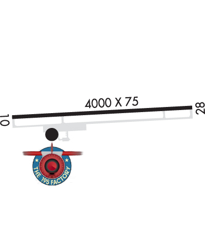
Runway Identifications
Runway Identification: 10/28
Length: 4000 ft
Width: 75 ft
Surface: ASPHALT-GOOD CONDITION
Edge lights: Medium Intensity

Treatment: NONE

 Runway: 10   Runway: 28
Mag heading: 103°Mag heading: 283°
Rwy Slope: .40% UpRwy Slope: -.40% Down
Approach: Approach:
Pattern: Left TrafficPattern: Left Traffic
Markings: NONPRECISION INSTRUMENTMarkings: NONPRECISION INSTRUMENT
Marking Condition: GOODMarking Condition: GOOD
Arresting Dev: Arresting Dev:
Lat & Long: N4259.9  W07420.2Lat. & Long.: N4259.9  W07419.3
Elev: 864.7 ft. MSLElev: 880.8 ft. MSL
TCH: 40 ft. AGLTCH: 40 ft. AGL
Visual Glide Path: 3.00 degreesVisual Glide Path: 3.00 degrees
Displaced Threshold: NoDisplaced Threshold: No
Touchdown Zone: YESTouchdown Zone: YES
Touchdown Elev.: 878.8 feetTouchdown Elev.: 880.8 feet
Visual Glide Slope: 2-Light PAPI on LEFT side of RunwayVisual Glide Slope: 2-Light PAPI on LEFT side of Runway
RVR Equipment: RVR Equipment:
RVV Equipment: NORVV Equipment: NO
Approach Lights: Approach Lights:
REIL: YESREIL: YES
Centerline Lights: NOCenterline Lights: NO
Touchdown lights: NOTouchdown lights: NO
Runway Category: Runway with a Non-precision ApproachRunway Category: Runway with a Non-precision Approach
Declared Distances: Declared Distances:
Obstructions: Obstructions: TREES
Marked: Marked: NOT Marked/Lighted
Clearance slope: 20:1Clearance slope: 7:1
Obstruction height: Obstruction height: 14 feet AGL
Dist. from runway: Dist. from runway: 310 feet
Centerline offset: Centerline offset: 216 feet right of centerline
Comments: Comments:
C:1/P: