Click here for more info on on SMS!

KN87

TRENTON-ROBBINSVILLE
ROBBINSVILLE
NJ
Time Zone: Eastern
Lat: N 4012.8
Long: W 07436.1
Elev: 118
Var: +13
Longest Runway: 4275
CTAF: 123.0

FBO & Flight Services info for KN87

FBOs: Update your Fuel Prices

TRENTON-ROBBINSPh: 609-937-0035
-
Freq: 123.0
Service
Jet
100LL
SAF
MoGas
Fuel Avail: 24/7
Full  6.35    Caution: Fuel prices have not been updated in 47 days.
Last Update: 03/04/2024 12:17

Self        
 Address: 106-B SHARON RD   ROBBINSVILLE, NJ 08691
If you are an FBO, call 1-203-262-1700 to update your info or email: FltPlan.Advertising@garmin.com
Advertise your FBO on FltPlan.com

Runway & Approach Info for KN87
Rwy
Length
Land Dist**
Approach*
  Rwy
Length
Land Dist**
Approach*
11
4275x75  3877'          
 
  
29
  4275x75  3975'          
 
 * only ILS, LOC, LDA, and SDF approaches to a specific runway are shown
** For any Declared Landing Distance Available, please see A/FD or Approach plates
Runway Weight Capability (lbs.) Help
Runway IDSingle WheelDouble WheelDouble Tandem WheelDual Double Wheel
11/2925,000N/AN/AN/A
These numbers are Advisory and are not limits.   The Airport Manager should have more accurate Weight Limits
Approach Charts
Approaches    
Current Weather/Notams
Customs Information Send updates to Support@FltPlan.com
Customs Not Available
Database effective 04/18/2024
Airport Diagram of KN87
Airport Diagram might not be current.

Facility Name: TRENTON-ROBBINSVILLE
City Name: ROBBINSVILLE
County: MERCER
State abbrev: NJ
State Name: NEW JERSEY
   
Ownership: PRIVATELY OWNED
Use: OPEN TO THE PUBLIC
Owner's Name: TRA INC.
Address: 106B SHARON ROAD
 ROBBINSVILLE, NJ 08691
Owner's Phone: 609-259-1059
  
Manager's Name: MICHAEL SANTERIAN
Address: 106B SHARON ROAD
 ROBBINSVILLE, NJ 08691
Phone: 609-259-1059
   
FAA Region: EASTERN
FAA Field Office: HAR


Sunrise / Sunset times for TRENTON-ROBBINSVILLE

DateSunriseSunset
04/19/24 Friday6:1319:42
04/20/24 Saturday6:1219:43
04/21/24 Sunday6:1019:44
04/22/24 Monday6:0919:45
04/23/24 Tuesday6:0819:46
04/24/24 Wednesday6:0619:47
04/25/24 Thursday6:0519:48
04/26/24 Friday6:0419:49
04/27/24 Saturday6:0219:50
04/28/24 Sunday6:0119:51
04/29/24 Monday6:0019:52
04/30/24 Tuesday5:5819:53
05/01/24 Wednesday5:5719:54
05/02/24 Thursday5:5619:55

Airport Facilities

Airport Attendance Schedule7 Days A Week 0800-1600
Airport Status OPERATIONAL (This Status can change at any time - please check NOTAMS)
Airport Lighting ScheduleACTVT MIRL RY 11/29 - 123.3.
Airport Storage AvailableTie Downs, Hanger
Extra Services AvailableCharter, Flight Instruction, Aircraft Rental
Wind IndicatorYES - (lighted)
Control TowerNO
CTAF Frequency123.000
Unicom Frequency123.000
Rotating Beacon ColorWG
Segmented CircleYES
Landing FeeNO

Airport Inspection Data

Airport InspectedSTATE - performed by STATE AERONAUTICAL PERSONNEL
Inspection Date05/26/2023

Airport Services

Type of Fuel AvailableGrade 100LL; -10SELF SVC FUEL SYS MID-FIELD APRON.
Airframe Repair ServiceMAJOR
Power Plant Repair ServiceMAJOR

Geographic Data

LatitudeN4012.8
LongitudeW07436.1 (ESTIMATED)
Arpt Elevation118ft (SURVEYED)
Magnetic Variation13W
1 miles Eof ROBBINSVILLE
Traffic Pattern Altitude
Sectional ChartNEW YORK

Aircraft Data

Operations (Reported)YearlyAvg. Daily
General Aviation Transient 855023
General Aviation Local 1795049
Air Taxi 00
Commerical 00
Commuter 00
Military 00
Aircraft based on Field
General Aviation Singles 31
General Aviation Multi 6
Jet Aircraft 0
General Aviation Helicopters 0
Military Aircraft 0
Gliders 0
Ultralights 0

FAA Services

FSS on field NO
FSS tie-in MILLVILLE
FSS Phone 1-800-WX-BRIEF
Who issues Notams MIV
Notam D service at airport YES
ARTCC Name WASHINGTON

Federal Status

Airport Certification
Aircraft Rescue & Firefighting IndexNone
Airport of EntryNo
Custom Landing RightsNo
Joint Civil/MilitaryNo
Military Landing rightsNo

Federal Agreements

NATIONAL PLAN OF INTEGRATED AIRPORT SYSTEMS (NPIAS)
GRANT AGREEMENTS UNDER FAAP/ADAP/AIP
ASSURANCES PURSUANT TO TITLE VI, CIVIL RIGHTS ACT OF 1964

Remarks

VFR DEP RY 29; FOR NOISE ABATEMEMT CLIMB STRAIGHT AHEAD UNTIL REACHING 700 FT AGL BEFORE TURNING.
VFR DEP RY 11 AVOID OVERFLIGHT OF SHARON ELEMENTARY SCHOOL .75 NM NORTHEAST.
FOR CD CTC MC GUIRE APCH AT 609-754-2767.
DEER & BIRDS ON & INVOF ARPT.
TWY & RAMP AREAS HAVE MULT TRANSVERSE AND PARL CRACKS.
RWY 11/2 9 NMRS TRANSVERSE & PARL CRACKS ALONG RWY.
Airport Communications & Frequencies:
CTAF Frequency:
123.000
Unicom Frequency:
123.000
MC GUIRE Primary Approach Frequencies:  
126.475
363.8
MC GUIRE Primary Departure Frequencies:  
126.475
363.8
Runway Identifications
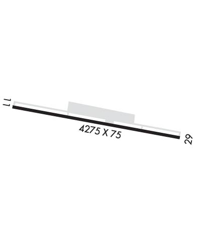
Runway Identification: 11/29
Length: 4275 ft
Width: 75 ft
Surface: ASPHALT-FAIR CONDITION
Edge lights: Medium Intensity

Treatment: NONE

 Runway: 11   Runway: 29
Mag heading: 109°Mag heading: 289°
Rwy Slope: .22% UpRwy Slope: -.22% Down
Approach: Approach:
Pattern: Left TrafficPattern: Right Traffic
Markings: NONPRECISION INSTRUMENTMarkings: NONPRECISION INSTRUMENT
Marking Condition: POOR; RUNWAY & TAXIWAY MARKINGS FADED.Marking Condition: POOR; RWY AND TWY MARKINGS FADED.
Arresting Dev: Arresting Dev:
Lat & Long: N4012.9  W07436.6Lat. & Long.: N4012.8  W07435.6
Elev: 105.9 ft. MSLElev: 115.1 ft. MSL
TCH: 46 ft. AGLTCH: 29 ft. AGL
Visual Glide Path: 4.50 degreesVisual Glide Path: 4.00 degrees
Displaced Threshold: 398 feetDisplaced Threshold: 300 feet
Touchdown Zone: YESTouchdown Zone: YES
Touchdown Elev.: 118.0 feetTouchdown Elev.: 118.0 feet
Visual Glide Slope: 2-Light PAPI on LEFT side of Runway; VGSI AND DESCENT ANGLES NOT COINCIDENT.Visual Glide Slope: 2-Light PAPI on LEFT side of Runway; VGSI AND DESCENT ANGLES NOT COINCIDENT.
RVR Equipment: RVR Equipment:
RVV Equipment: NORVV Equipment: NO
Approach Lights: Approach Lights:
REIL: NOREIL: NO
Centerline Lights: NOCenterline Lights: NO
Touchdown lights: NOTouchdown lights: NO
Runway Category: Runway with a Non-precision ApproachRunway Category: Runway with a Non-precision Approach
Declared Distances: Declared Distances:
Obstructions: TREESObstructions: TREES
Marked: NOT Marked/LightedMarked: NOT Marked/Lighted
Clearance slope: RWY 11 APCH SLOPE 8:1 TO DSPLCD THLD.Clearance slope:
Obstruction height: 74 feet AGLObstruction height: 60 feet AGL
Dist. from runway: 250 feetDist. from runway: 200 feet
Centerline offset: 195 left of centerlineCenterline offset: 176 feet left of centerline
Comments: Comments: RY 29 ROAD WITH 15 FT VEHICLES 40 FR FM RY END CROSSING CNTRLN.
C:1/P: