Current Weather/Notams (Metars, TAFs, Notams, NWS Forecast, PIREPS, and nearby weather)
Customs Information Send updates to Support@FltPlan.com
Customs Not Available
Database effective 04/18/2024
Airport Diagram might not be current.
|
| Facility Name: | NORTHUMBERLAND COUNTY |
| City Name: | SHAMOKIN |
| County: | NORTHUMBERLAND |
| State abbrev: | PA |
| State Name: | PENNSYLVANIA |
| | |
| Ownership: | PUBLICLY OWNED |
| Use: | OPEN TO THE PUBLIC |
| Owner's Name: | NORTHUMBERLAND CO APT AUTH |
| Address: | PO BOX 94 |
| | PAXINOS, PA 17860 |
| Owner's Phone: | 570-898-8588; AFTER HOURS 570-898-8588 |
| | |
| Manager's Name: | RON SMITH |
| Address: | PO BOX 94 |
| | PAXINOS, PA 17860 |
| Phone: | 570-898-8588 |
| | |
| FAA Region: | EASTERN |
| FAA Field Office: | HAR |
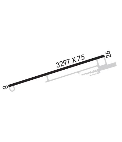
Runway Identifications
Runway Identification: 08/26Length: 3297 ft
Width: 75 ft
Surface: ASPHALT-FAIR CONDITION
Edge lights: Medium IntensityTreatment: NONE
| | Runway: 08 | | Runway: 26 |
| Mag heading: | 83° | Mag heading: | 263° |
| Rwy Slope: | .85% Up | Rwy Slope: | -.85% Down |
| Approach: | | Approach: | |
| Pattern: | Left Traffic | Pattern: | Left Traffic |
| Markings: | NONPRECISION INSTRUMENT | Markings: | NONPRECISION INSTRUMENT |
| Marking Condition: | FAIR | Marking Condition: | FAIR |
| Arresting Dev: | | Arresting Dev: | |
| Lat & Long: | N4050.1 W07633.5 | Lat. & Long.: | N4050.3 W07632.8 |
| Elev: | 852.5 ft. MSL | Elev: | 880.5 ft. MSL |
| TCH: | 40 ft. AGL | TCH: | 40 ft. AGL |
| Visual Glide Path: | 3.00 degrees | Visual Glide Path: | 3.00 degrees |
| Displaced Threshold: | No | Displaced Threshold: | No |
| Touchdown Zone: | YES | Touchdown Zone: | YES |
| Touchdown Elev.: | 878.5 feet | Touchdown Elev.: | 880.6 feet |
| Visual Glide Slope: | 2-Light PAPI on LEFT side of Runway | Visual Glide Slope: | 2-Light PAPI on LEFT side of Runway |
| RVR Equipment: | | RVR Equipment: | |
| RVV Equipment: | NO | RVV Equipment: | NO |
| Approach Lights: | | Approach Lights: | |
| REIL: | YES | REIL: | YES |
| Centerline Lights: | NO | Centerline Lights: | NO |
| Touchdown lights: | NO | Touchdown lights: | NO |
| Runway Category: | Runway with a Non-precision Approach | Runway Category: | Runway with a Non-precision Approach |
| Declared Distances: | | Declared Distances: | |
| Obstructions: | TREES | Obstructions: | |
| Marked: | NOT Marked/Lighted | Marked: | |
| Clearance slope: | 10:1 | Clearance slope: | 20:1 |
| Obstruction height: | 18 feet AGL | Obstruction height: | |
| Dist. from runway: | 395 feet | Dist. from runway: | |
| Centerline offset: | 257 left of centerline | Centerline offset: | |
| Comments: | RWY 08 TREES/BRUSH 165 L OF CNTRLN PARL TO RWY FROM THLD OUT TO 200 FT. | Comments: | |

