Current Weather/Notams (Metars, TAFs, Notams, NWS Forecast, PIREPS, and nearby weather)
Customs Information Send updates to Support@FltPlan.com
Customs Not Available
Database effective 05/16/2024
Airport Diagram might not be current.
|
| Facility Name: | ALBERT S NADER RGNL |
| City Name: | ONEONTA |
| County: | OTSEGO |
| State abbrev: | NY |
| State Name: | NEW YORK |
| | |
| Ownership: | PUBLICLY OWNED |
| Use: | OPEN TO THE PUBLIC |
| Owner's Name: | CITY OF ONEONTA |
| Address: | 258 MAIN STREET |
| | ONEONTA, NY 13820 |
| Owner's Phone: | 607-431-1076 |
| | |
| Manager's Name: | KERRIANN HARRINGTON |
| Address: | 391 AIRPORT RD |
| | ONEONTA, NY 13820 |
| Phone: | (607) 431-1076 |
| | |
| FAA Region: | EASTERN |
| FAA Field Office: | NYC |
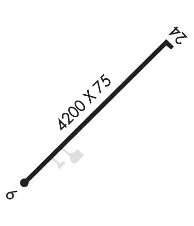
Runway Identifications
Runway Identification: 06/24Length: 4199 ft
Width: 75 ft
Surface: ASPHALT
Edge lights: Medium IntensityTreatment: NONE
| | Runway: 06 | | Runway: 24 |
| Mag heading: | 57° | Mag heading: | 237° |
| Rwy Slope: | -.30% Down | Rwy Slope: | .30% Up |
| Approach: | | Approach: | LOCALIZER |
| Pattern: | Left Traffic | Pattern: | Left Traffic |
| Markings: | NONPRECISION INSTRUMENT | Markings: | NONPRECISION INSTRUMENT |
| Marking Condition: | GOOD | Marking Condition: | GOOD |
| Arresting Dev: | | Arresting Dev: | |
| Lat & Long: | N4231.2 W07504.2 | Lat. & Long.: | N4231.7 W07503.5 |
| Elev: | 1762.8 ft. MSL | Elev: | 1750.1 ft. MSL |
| TCH: | 30 ft. AGL | TCH: | 51 ft. AGL |
| Visual Glide Path: | 3.00 degrees | Visual Glide Path: | 3.00 degrees |
| Displaced Threshold: | No | Displaced Threshold: | No |
| Touchdown Zone: | YES | Touchdown Zone: | YES |
| Touchdown Elev.: | 1763.3 feet | Touchdown Elev.: | 1758.4 feet |
| Visual Glide Slope: | 4-BOX VASI ON RIGHT SIDE OF RUNWAY | Visual Glide Slope: | 2-Light PAPI on LEFT side of Runway |
| RVR Equipment: | | RVR Equipment: | |
| RVV Equipment: | NO | RVV Equipment: | NO |
| Approach Lights: | | Approach Lights: | MALS - 1,400 foot medium intensity approach lighting system |
| REIL: | YES | REIL: | YES; RWY 24 REILS OTS |
| Centerline Lights: | NO | Centerline Lights: | NO |
| Touchdown lights: | NO | Touchdown lights: | NO |
| Runway Category: | Runway with a Non-precision Approach | Runway Category: | Runway with a Non-precision Approach |
| Declared Distances: | | Declared Distances: | |
| Obstructions: | TREE | Obstructions: | FENCE |
| Marked: | NOT Marked/Lighted | Marked: | MARKED |
| Clearance slope: | 9:1 | Clearance slope: | 18:1 |
| Obstruction height: | 68 feet AGL | Obstruction height: | 121 feet AGL |
| Dist. from runway: | 818 feet | Dist. from runway: | 2442 feet |
| Centerline offset: | 315 right of centerline | Centerline offset: | 518 feet left of centerline |
| Comments: | 7 FT BERM 150 FT RIGHT AND PARALLEL TO RY 6 PRIMARY SURFACE. | Comments: | |

