
| ||
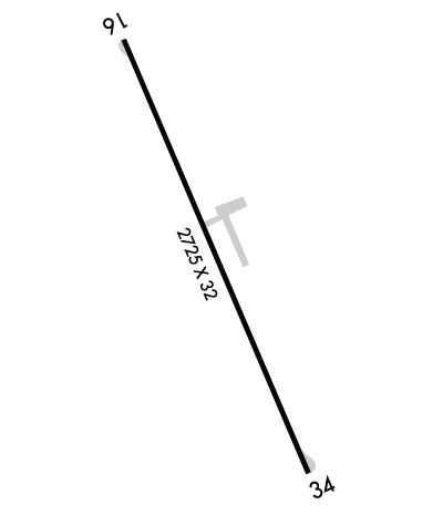
| Rwy | Rwy | |||||||
| 2725x32 | 2725' | 2725x32 | 2725' | |||||
| Runway ID | Single Wheel | Double Wheel | Double Tandem Wheel | Dual Double Wheel |
| 16/34 | N/A | N/A | N/A | N/A |
| These numbers are Advisory and are not limits. The Airport Manager should have more accurate Weight Limits | ||||
 Airport Diagram might not be current. | |
| Facility Name: | MEADOW BROOK FLD |
| City Name: | WALNUT COVE |
| County: | STOKES |
| State abbrev: | NC |
| State Name: | NORTH CAROLINA |
| Ownership: | PRIVATELY OWNED |
| Use: | OPEN TO THE PUBLIC |
| Owner's Name: | BIG CREEK PROPERTIES |
| Address: | 3653 NORTH PATTERSON AVE |
| WINSTON-SALEM, NC 27105 | |
| Owner's Phone: | 336-661-8032 |
| Manager's Name: | LOGAN FULP |
| Address: | 1060 AIRPORT ROAD |
| WALNUT COVE, NC 27052 | |
| Phone: | 336-413-3967 |
| FAA Region: | SOUTHERN |
| FAA Field Office: | MEM |
| Date | Sunrise | Sunset |
|---|---|---|
| 04/25/24 Thursday | 6:34 | 20:04 |
| 04/26/24 Friday | 6:32 | 20:05 |
| 04/27/24 Saturday | 6:31 | 20:06 |
| 04/28/24 Sunday | 6:30 | 20:06 |
| 04/29/24 Monday | 6:29 | 20:07 |
| 04/30/24 Tuesday | 6:28 | 20:08 |
| 05/01/24 Wednesday | 6:27 | 20:09 |
| 05/02/24 Thursday | 6:26 | 20:10 |
| 05/03/24 Friday | 6:25 | 20:11 |
| 05/04/24 Saturday | 6:24 | 20:12 |
| 05/05/24 Sunday | 6:22 | 20:12 |
| 05/06/24 Monday | 6:21 | 20:13 |
| 05/07/24 Tuesday | 6:21 | 20:14 |
| 05/08/24 Wednesday | 6:20 | 20:15 |
| Airport Attendance Schedule | IRREGULAR |
| Airport Status | OPERATIONAL (This Status can change at any time - please check NOTAMS) |
| Airport Lighting Schedule | ACTVT LIRL RWY 16/34 - CTAF. |
| Airport Storage Available | NONE |
| Extra Services Available | NONE |
| Wind Indicator | YES - (unlit) |
| Control Tower | NO |
| CTAF Frequency | 123.000 |
| Unicom Frequency | 123.000 |
| Rotating Beacon Color | |
| Segmented Circle | NO |
| Landing Fee | NO |
| Airport Inspected | STATE - performed by STATE AERONAUTICAL PERSONNEL |
| Inspection Date | 04/20/2022 |
| Type of Fuel Available | Grade 100LL; -10100LL SELF SVC AVBL BY FULP'S AVIATION. |
| Airframe Repair Service | NONE |
| Power Plant Repair Service | NONE |
| Latitude | N3618.1 |
| Longitude | W08008.9 (ESTIMATED) |
| Arpt Elevation | 631ft (SURVEYED) |
| Magnetic Variation | 06W |
| 1 miles NW | of WALNUT COVE |
| Traffic Pattern Altitude | |
| Sectional Chart | CINCINNATI |
| Operations (Reported) | Yearly | Avg. Daily |
|---|---|---|
| General Aviation Transient | 50 | 0 |
| General Aviation Local | 12000 | 33 |
| Air Taxi | 0 | 0 |
| Commerical | 0 | 0 |
| Commuter | 0 | 0 |
| Military | 0 | 0 |
| Aircraft based on Field | |
|---|---|
| General Aviation Singles | 4 |
| General Aviation Multi | 6 |
| Jet Aircraft | 0 |
| General Aviation Helicopters | 0 |
| Military Aircraft | 0 |
| Gliders | 0 |
| Ultralights | 0 |
| FSS on field | NO |
| FSS tie-in | RALEIGH |
| FSS Phone | 1-800-WX-BRIEF |
| Who issues Notams | RDU |
| Notam D service at airport | YES |
| ARTCC Name | ATLANTA |
| Airport Certification | |
| Aircraft Rescue & Firefighting Index | None |
| Airport of Entry | No |
| Custom Landing Rights | No |
| Joint Civil/Military | No |
| Military Landing rights | No |
| HIGH TRRN IN ALL QUADS. |
| NO TSNT TFC BEFORE DALGT OR AFT DARK. |
| ED'S FLYING SERVICE IS NO LONGER THE FBO IT IS NOW FULP'S AVIATION LLC. |
| +65 FT TREES WITHIN 110 FT OF CNTRLN EAST OF RWY. |
| FENCING IN THE CLEAR ZONE RWYS 16 & 34. |
| +8 FT DROP-OFF AER RWY 16. |
| ARPT CLSD TO TSNTS EXCP PPR CALL 336-403-1796. |
| DO NOT LAND ON GRASS ADJ TO RWY. DEEP DITCHES. |
| FOR CD CTC GREENSBORO APCH AT 336-333-5119. |
| NO HEAVY TRNG TFC NO MORE THAN TWO TOUCH AND GOES AT ONE GIVEN TIME. |
| RWY 16/3 4 NSTD LIRL; LGTS 30 FT EITHER SIDE OF ASPH ALONG OLD TURF RWY. NSTD THR LGTS WITH GREEN, RED, CLEAR AND BI-DIRECTIONAL LENS. |
Airport Communications & Frequencies:
| ||||||||||||||
| Runway: 16 | Runway: 34 | ||
| Mag heading: | 166° | Mag heading: | 346° |
| Rwy Slope: | .00% | Rwy Slope: | .00% |
| Approach: | Approach: | ||
| Pattern: | Left Traffic | Pattern: | Left Traffic |
| Markings: | NONSTANDARD | Markings: | NONSTANDARD |
| Marking Condition: | FAIR; RWY MKNG SMALLER THAN NORMAL AND FADED. | Marking Condition: | FAIR; RWY MKNG SMALLER THAN NORMAL AND FADED; CNTRLN NSTD. |
| Arresting Dev: | Arresting Dev: | ||
| Lat & Long: | N3618.3 W08009.0 | Lat. & Long.: | N3617.9 W08008.8 |
| Elev: | 631.0 ft. MSL | Elev: | 631.0 ft. MSL |
| TCH: | TCH: | ||
| Visual Glide Path: | Visual Glide Path: | ||
| Displaced Threshold: | No | Displaced Threshold: | No |
| Touchdown Zone: | YES | Touchdown Zone: | YES |
| Touchdown Elev.: | 631.0 feet | Touchdown Elev.: | 631.0 feet |
| Visual Glide Slope: | Visual Glide Slope: | ||
| RVR Equipment: | RVR Equipment: | ||
| RVV Equipment: | NO | RVV Equipment: | NO |
| Approach Lights: | Approach Lights: | ||
| REIL: | NO | REIL: | NO |
| Centerline Lights: | NO | Centerline Lights: | NO |
| Touchdown lights: | NO | Touchdown lights: | NO |
| Runway Category: | Runway with a Visual Approach | Runway Category: | Runway with a Non-precision Approach |
| Declared Distances: | Declared Distances: | ||
| Obstructions: | TREES | Obstructions: | TREES |
| Marked: | NOT Marked/Lighted | Marked: | NOT Marked/Lighted |
| Clearance slope: | 4:1 | Clearance slope: | 7:1 |
| Obstruction height: | 29 feet AGL | Obstruction height: | 25 feet AGL |
| Dist. from runway: | 336 feet | Dist. from runway: | 377 feet |
| Centerline offset: | 92 right of centerline | Centerline offset: | 34 feet left of centerline |
| Comments: | SCRUB TREES RANGING FROM 6 FT - 35 FT LCTD 0-200 FT FM THR OFFSET 100 FT RIGHT OF CNTRLN. | Comments: | +3 FT FENCE 30 FT FM THR BOTH SIDES OF CNTRLN. |
