Current Weather/Notams (Metars, TAFs, Notams, NWS Forecast, PIREPS, and nearby weather)
Customs Information Send updates to Support@FltPlan.com
Customs Not Available
Database effective 04/18/2024
Airport Diagram might not be current.
|
| Facility Name: | POTTSTOWN MUNI |
| City Name: | POTTSTOWN |
| County: | MONTGOMERY |
| State abbrev: | PA |
| State Name: | PENNSYLVANIA |
| | |
| Ownership: | PUBLICLY OWNED |
| Use: | OPEN TO THE PUBLIC |
| Owner's Name: | BOROUGH OF POTTSTOWN |
| Address: | 100 E HIGH ST |
| | POTTSTOWN, PA 19464 |
| Owner's Phone: | (610) 970-6511 |
| | |
| Manager's Name: | CURTIS MEYER |
| Address: | 1149 GLASGOW ST |
| | POTTSTOWN, PA 19464 |
| Phone: | 267-643-9958 |
| | |
| FAA Region: | EASTERN |
| FAA Field Office: | HAR |
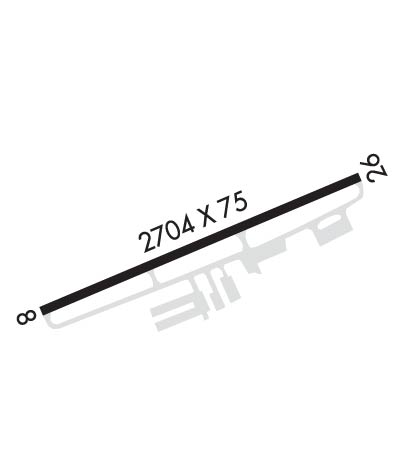
Runway Identifications
Runway Identification: 08/26Length: 2704 ft
Width: 75 ft
Surface: ASPHALT-GOOD CONDITION
Edge lights: Medium IntensityTreatment: NONE
| | Runway: 08 | | Runway: 26 |
| Mag heading: | 79° | Mag heading: | 259° |
| Rwy Slope: | -.38% Down | Rwy Slope: | .38% Up |
| Approach: | | Approach: | |
| Pattern: | Left Traffic | Pattern: | Left Traffic |
| Markings: | BASIC | Markings: | NONPRECISION INSTRUMENT |
| Marking Condition: | FAIR | Marking Condition: | FAIR |
| Arresting Dev: | | Arresting Dev: | |
| Lat & Long: | N4015.5 W07540.5 | Lat. & Long.: | N4015.7 W07540.0 |
| Elev: | 254.3 ft. MSL | Elev: | 244.0 ft. MSL |
| TCH: | | TCH: | 30 ft. AGL |
| Visual Glide Path: | | Visual Glide Path: | 3.75 degrees |
| Displaced Threshold: | 380 feet | Displaced Threshold: | No |
| Touchdown Zone: | YES | Touchdown Zone: | YES |
| Touchdown Elev.: | 255.6 feet | Touchdown Elev.: | 255.6 feet |
| Visual Glide Slope: | | Visual Glide Slope: | 2-Light PAPI on LEFT side of Runway |
| RVR Equipment: | | RVR Equipment: | |
| RVV Equipment: | NO | RVV Equipment: | NO |
| Approach Lights: | | Approach Lights: | |
| REIL: | YES | REIL: | YES |
| Centerline Lights: | NO | Centerline Lights: | NO |
| Touchdown lights: | NO | Touchdown lights: | NO |
| Runway Category: | Runway with a Visual Approach | Runway Category: | Runway with a Non-precision Approach |
| Declared Distances: | | Declared Distances: | |
| Obstructions: | TREE | Obstructions: | TREE |
| Marked: | NOT Marked/Lighted | Marked: | NOT Marked/Lighted |
| Clearance slope: | 13:1; APCH SLOPE 22:1 TO 380 FT DTHR. | Clearance slope: | 8:1 |
| Obstruction height: | 68 feet AGL | Obstruction height: | 62 feet AGL |
| Dist. from runway: | 1119 feet | Dist. from runway: | 718 feet |
| Centerline offset: | 78 right of centerline | Centerline offset: | 305 feet left of centerline |
| Comments: | | Comments: | 31 FT TREE 106 FT FM RWY END, 238 FT RIGHT. |

