Current Weather/Notams (Metars, TAFs, Notams, NWS Forecast, PIREPS, and nearby weather)
Customs Information Send updates to Support@FltPlan.com
Customs Not Available
Database effective 04/18/2024
Airport Diagram might not be current.
|
| Facility Name: | PUNXSUTAWNEY MUNI |
| City Name: | PUNXSUTAWNEY |
| County: | JEFFERSON |
| State abbrev: | PA |
| State Name: | PENNSYLVANIA |
| | |
| Ownership: | PUBLICLY OWNED |
| Use: | OPEN TO THE PUBLIC |
| Owner's Name: | PUNXSUTAWNEY AIRPORT AUTH |
| Address: | PO BOX 365 |
| | PUNXSUTAWNEY, PA 15767 |
| Owner's Phone: | (814) 590-1137 |
| | |
| Manager's Name: | RICK YOUNG |
| Address: | PO BOX 365 |
| | PUNXSUTAWNEY, PA 15767 |
| Phone: | (814) 590-1137 |
| | |
| FAA Region: | EASTERN |
| FAA Field Office: | HAR |
Runway Identifications
Runway Identification: 01/19Length: 2200 ft
Width: 100 ft
Surface: GRASS-FAIR CONDITION
Edge lights: Medium IntensityTreatment: NONE
| | Runway: 01 | | Runway: 19 |
| Mag heading: | 10° | Mag heading: | 190° |
| Rwy Slope: | .40% Up | Rwy Slope: | -.40% Down |
| Approach: | | Approach: | |
| Pattern: | Left Traffic | Pattern: | Left Traffic |
| Markings: | NONSTANDARD | Markings: | NONSTANDARD |
| Marking Condition: | GOOD; RWY MARKED WITH ORANGE CONES. | Marking Condition: | GOOD; RWY MARKED WITH ORANGE CONES. |
| Arresting Dev: | | Arresting Dev: | |
| Lat & Long: | N4057.8 W07855.6 | Lat. & Long.: | N4058.2 W07855.6 |
| Elev: | 1436.0 ft. MSL | Elev: | 1444.8 ft. MSL |
| TCH: | | TCH: | |
| Visual Glide Path: | | Visual Glide Path: | |
| Displaced Threshold: | No | Displaced Threshold: | No |
| Touchdown Zone: | YES | Touchdown Zone: | YES |
| Touchdown Elev.: | 1439.0 feet | Touchdown Elev.: | 1439.0 feet |
| Visual Glide Slope: | | Visual Glide Slope: | |
| RVR Equipment: | | RVR Equipment: | |
| RVV Equipment: | NO | RVV Equipment: | NO |
| Approach Lights: | | Approach Lights: | |
| REIL: | YES | REIL: | YES |
| Centerline Lights: | NO | Centerline Lights: | NO |
| Touchdown lights: | NO | Touchdown lights: | NO |
| Runway Category: | Runway with a Visual Approach | Runway Category: | Runway with a Visual Approach |
| Declared Distances: | | Declared Distances: | |
| Obstructions: | TREES | Obstructions: | ROAD |
| Marked: | NOT Marked/Lighted | Marked: | NOT Marked/Lighted |
| Clearance slope: | 16:1 | Clearance slope: | 17:1 |
| Obstruction height: | 59 feet AGL | Obstruction height: | 21 feet AGL |
| Dist. from runway: | 975 feet | Dist. from runway: | 360 feet |
| Centerline offset: | 167 left of centerline | Centerline offset: | |
| Comments: | | Comments: | |
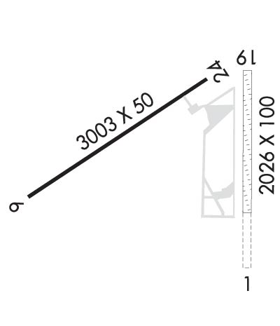
Runway Identification: 06/24Length: 3003 ft
Width: 50 ft
Surface: ASPHALT-GOOD CONDITION
Edge lights: Medium IntensityTreatment: NONE
| | Runway: 06 | | Runway: 24 |
| Mag heading: | 67° | Mag heading: | 247° |
| Rwy Slope: | .90% Up | Rwy Slope: | -.90% Down |
| Approach: | | Approach: | |
| Pattern: | Left Traffic | Pattern: | Left Traffic |
| Markings: | NONPRECISION INSTRUMENT | Markings: | NONPRECISION INSTRUMENT |
| Marking Condition: | GOOD | Marking Condition: | GOOD |
| Arresting Dev: | | Arresting Dev: | |
| Lat & Long: | N4057.9 W07856.2 | Lat. & Long.: | N4058.1 W07855.7 |
| Elev: | 1410.0 ft. MSL | Elev: | 1437.0 ft. MSL |
| TCH: | 45 ft. AGL | TCH: | 40 ft. AGL |
| Visual Glide Path: | 4.00 degrees | Visual Glide Path: | 4.00 degrees |
| Displaced Threshold: | No | Displaced Threshold: | No |
| Touchdown Zone: | YES | Touchdown Zone: | YES |
| Touchdown Elev.: | 1439.0 feet | Touchdown Elev.: | 1439.0 feet |
| Visual Glide Slope: | 2-Light PAPI on LEFT side of Runway | Visual Glide Slope: | 2-Light PAPI on LEFT side of Runway |
| RVR Equipment: | | RVR Equipment: | |
| RVV Equipment: | NO | RVV Equipment: | NO |
| Approach Lights: | | Approach Lights: | |
| REIL: | YES | REIL: | YES |
| Centerline Lights: | NO | Centerline Lights: | NO |
| Touchdown lights: | NO | Touchdown lights: | NO |
| Runway Category: | Runway with a Visual Approach | Runway Category: | Runway with a Non-precision Approach |
| Declared Distances: | | Declared Distances: | |
| Obstructions: | TREES | Obstructions: | ROAD |
| Marked: | NOT Marked/Lighted | Marked: | NOT Marked/Lighted |
| Clearance slope: | 3:1 | Clearance slope: | 15:1 |
| Obstruction height: | 26 feet AGL | Obstruction height: | 28 feet AGL |
| Dist. from runway: | 296 feet | Dist. from runway: | 634 feet |
| Centerline offset: | 252 right of centerline | Centerline offset: | |
| Comments: | RWY 06 30 FT POLE, 103 FT FM RWY END, 227 FT RIGHT. | Comments: | |

