Current Weather/Notams (Metars, TAFs, Notams, NWS Forecast, PIREPS, and nearby weather)
Customs Information Send updates to Support@FltPlan.com
Customs Not Available
Database effective 05/16/2024
Airport Diagram might not be current.
|
| Facility Name: | BLUE RIDGE |
| City Name: | MARTINSVILLE |
| County: | HENRY |
| State abbrev: | VA |
| State Name: | VIRGINIA |
| | |
| Ownership: | PUBLICLY OWNED |
| Use: | OPEN TO THE PUBLIC |
| Owner's Name: | BLUE RIDGE ARPT AUTH |
| Address: | 525 AIRPORT ROAD |
| | MARTINSVILLE, VA 24112 |
| Owner's Phone: | 276-957-2291 |
| | |
| Manager's Name: | JASON DAVIS |
| Address: | 525 AIRPORT ROAD |
| | MARTINSVILLE, VA 24112 |
| Phone: | 276-957-2291; MANAGER CELL: 276-358-0749. |
| | |
| FAA Region: | EASTERN |
| FAA Field Office: | DCA |
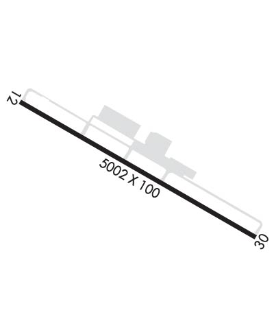
Runway Identifications
Runway Identification: 13/31Length: 5002 ft
Width: 100 ft
Surface: ASPHALT-GOOD CONDITION
Edge lights: Medium IntensityTreatment: GROOVED
| | Runway: 13 | | Runway: 31 |
| Mag heading: | 125° | Mag heading: | 305° |
| Rwy Slope: | -.58% Down | Rwy Slope: | .58% Up |
| Approach: | | Approach: | LOC/DME |
| Pattern: | Left Traffic | Pattern: | Left Traffic |
| Markings: | NONPRECISION INSTRUMENT | Markings: | NONPRECISION INSTRUMENT |
| Marking Condition: | GOOD | Marking Condition: | GOOD |
| Arresting Dev: | | Arresting Dev: | |
| Lat & Long: | N3638.0 W08001.6 | Lat. & Long.: | N3637.7 W08000.6 |
| Elev: | 940.9 ft. MSL | Elev: | 911.9 ft. MSL |
| TCH: | 40 ft. AGL | TCH: | 47 ft. AGL |
| Visual Glide Path: | 3.00 degrees | Visual Glide Path: | 3.00 degrees |
| Displaced Threshold: | No | Displaced Threshold: | No |
| Touchdown Zone: | YES | Touchdown Zone: | YES |
| Touchdown Elev.: | 940.9 feet | Touchdown Elev.: | 925.1 feet |
| Visual Glide Slope: | 4-Light PAPI on LEFT side of Runway; UNUSBL BYD 9 DEG RIGHT OF CNTRLN. | Visual Glide Slope: | 4-Light PAPI on LEFT side of Runway |
| RVR Equipment: | | RVR Equipment: | |
| RVV Equipment: | NO | RVV Equipment: | NO |
| Approach Lights: | | Approach Lights: | ODALS - omnidirectional approach lighting system |
| REIL: | YES | REIL: | YES |
| Centerline Lights: | NO | Centerline Lights: | NO |
| Touchdown lights: | NO | Touchdown lights: | NO |
| Runway Category: | Runway with a Non-precision Approach having visibility minimums greater than 3/4 mile | Runway Category: | Runway with a Non-precision Approach having visibility minimums greater than 3/4 mile |
| Declared Distances: | | Declared Distances: | |
| Obstructions: | TREE | Obstructions: | TREE |
| Marked: | MARKED and LIGHTED | Marked: | NOT Marked/Lighted |
| Clearance slope: | 33:1 | Clearance slope: | 36:1 |
| Obstruction height: | 97 feet AGL | Obstruction height: | 25 feet AGL |
| Dist. from runway: | 3494 feet | Dist. from runway: | 1104 feet |
| Centerline offset: | 639 left of centerline | Centerline offset: | 297 feet right of centerline |
| Comments: | | Comments: | |

