Click here for more info on on SMS!

KMPJ

PETIT JEAN PARK
MORRILTON
AR
Time Zone: Central
Lat: N 3508.3
Long: W 09254.6
Elev: 923
Var: -03
Longest Runway: 5852
CTAF: 122.9

FBO & Flight Services info for KMPJ

FBOs: Update your Fuel Prices

PETIT JEAN PARKPh: 501-727-6504
-
Freq: 122.9

If you are an FBO, call 1-203-262-1700 to update your info or email: FltPlan.Advertising@garmin.com
Advertise your FBO on FltPlan.com

Runway & Approach Info for KMPJ
Rwy
Length
Land Dist**
Approach*
  Rwy
Length
Land Dist**
Approach*
03
5852x75  5414'          
 
  
21
  5852x75  5662'          
 
 * only ILS, LOC, LDA, and SDF approaches to a specific runway are shown
** For any Declared Landing Distance Available, please see A/FD or Approach plates
Runway Weight Capability (lbs.) Help
Runway IDSingle WheelDouble WheelDouble Tandem WheelDual Double Wheel
03/2117,000N/AN/AN/A
These numbers are Advisory and are not limits.   The Airport Manager should have more accurate Weight Limits
Approach Charts
Approaches    
Current Weather/Notams
Customs Information Send updates to Support@FltPlan.com
Customs Not Available
Database effective 04/18/2024
Airport Diagram of KMPJ
Airport Diagram might not be current.

Facility Name: PETIT JEAN PARK
City Name: MORRILTON
County: CONWAY
State abbrev: AR
State Name: ARKANSAS
   
Ownership: PUBLICLY OWNED
Use: OPEN TO THE PUBLIC
Owner's Name: STATE OF ARKANSAS
Address: ONE CAPITOL MALL
 LITTLE ROCK, AR 72201
Owner's Phone: (501) 727-5441
  
Manager's Name: JOE BUCKLEY
Address: 1285 PETIT JEAN MOUNTAIN RD.
 MORRILTON, AR 72110
Phone: 501-727-5441
   
FAA Region: SOUTHWEST
FAA Field Office: AOK


Sunrise / Sunset times for PETIT JEAN PARK

DateSunriseSunset
04/19/24 Friday6:3319:48
04/20/24 Saturday6:3219:49
04/21/24 Sunday6:3119:50
04/22/24 Monday6:3019:51
04/23/24 Tuesday6:2919:51
04/24/24 Wednesday6:2719:52
04/25/24 Thursday6:2619:53
04/26/24 Friday6:2519:54
04/27/24 Saturday6:2419:55
04/28/24 Sunday6:2319:56
04/29/24 Monday6:2219:56
04/30/24 Tuesday6:2119:57
05/01/24 Wednesday6:2019:58
05/02/24 Thursday6:1919:59

Airport Facilities

Airport Attendance ScheduleUNATTENDED; FOR SERVICE CALL 501-727-5441
Airport Status OPERATIONAL (This Status can change at any time - please check NOTAMS)
Airport Lighting ScheduleACTVT PAPI RWY 03 & 21; MIRL RWY 03/21 - CTAF. PAPI RWY 03 & 21 UNAVBL 2200-0400.; ACTVT ROTG BCN - CTAF. BCN UNAVBL 2200-0400.
Airport Storage AvailableTie Downs
Extra Services AvailableNONE
Wind IndicatorYES - (unlit)
Control TowerNO
CTAF Frequency122.900
Unicom Frequency
Rotating Beacon ColorWG
Segmented CircleNO
Landing FeeNO

Airport Inspection Data

Airport InspectedSTATE - performed by STATE AERONAUTICAL PERSONNEL
Inspection Date03/04/2022

Airport Services

Type of Fuel AvailableGrade 100LL, JET A (freeze point -40C); -10SELF SVC FUEL AVBL 24 HR WITH CREDIT CARD (100LL & JET A).
Airframe Repair ServiceNone
Power Plant Repair ServiceNone

Geographic Data

LatitudeN3508.3
LongitudeW09254.6 (ESTIMATED)
Arpt Elevation923ft (SURVEYED)
Magnetic Variation03E
8 miles Wof MORRILTON
Traffic Pattern Altitude
Sectional ChartMEMPHIS

Aircraft Data

Operations (Reported)YearlyAvg. Daily
General Aviation Transient 25007
General Aviation Local 00
Air Taxi 00
Commerical 00
Commuter 00
Military 500
Aircraft based on Field
General Aviation Singles 0
General Aviation Multi 0
Jet Aircraft 0
General Aviation Helicopters 0
Military Aircraft 0
Gliders 0
Ultralights 0

FAA Services

FSS on field NO
FSS tie-in JONESBORO
FSS Phone 1-800-WX-BRIEF
Who issues Notams JBR
Notam D service at airport YES
ARTCC Name MEMPHIS

Federal Status

Airport Certification
Aircraft Rescue & Firefighting IndexNone
Airport of EntryNo
Custom Landing RightsNo
Joint Civil/MilitaryNo
Military Landing rightsYES

Federal Agreements

NATIONAL PLAN OF INTEGRATED AIRPORT SYSTEMS (NPIAS)
GRANT AGREEMENT HAS EXPIRED; HOWEVER, AGREEMENT REMAINS IN EFFECT FOR THIS FACILITY AS LONG AS IT IS PUBLIC USE.

Remarks

ULTRALIGHT ACTIVITY ON & INVOF ARPT
DEER & MIGRATORY BIRDS ON & INVOF ARPT.
FOR CD CTC MEMPHIS ARTCC AT 901-368-8453/8449.
RWY 03/2 1 MIRL RWY 03/21 OTS INDEFLY.
Airport Communications & Frequencies:
CTAF Frequency:
122.900
Remarks
  • APCH/DEP SVC PRVDD BY MEMPHIS ARTCC ON FREQS 128.475/377.15 (RUSSELLVILLE RCAG).
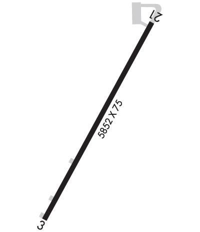
  • Runway Identifications
    Runway Identification: 03/21
    Length: 5852 ft
    Width: 75 ft
    Surface: ASPHALT-FAIR CONDITION
    Edge lights: Medium Intensity

    Treatment: NONE

     Runway: 03   Runway: 21
    Mag heading: 26°Mag heading: 206°
    Rwy Slope: .58% UpRwy Slope: -.58% Down
    Approach: Approach:
    Pattern: Left TrafficPattern: Left Traffic
    Markings: NONPRECISION INSTRUMENTMarkings: BASIC
    Marking Condition: FAIR; RWY 03 NR IS FADED.Marking Condition: FAIR; RWY 21 NR IS FADED.
    Arresting Dev: Arresting Dev:
    Lat & Long: N3507.9  W09254.8Lat. & Long.: N3508.8  W09254.3
    Elev: 888.8 ft. MSLElev: 923.0 ft. MSL
    TCH: 50 ft. AGLTCH: 44 ft. AGL
    Visual Glide Path: 4.00 degreesVisual Glide Path: 4.00 degrees
    Displaced Threshold: 438 feetDisplaced Threshold: 190 feet
    Touchdown Zone: YESTouchdown Zone: YES
    Touchdown Elev.: 902.2 feetTouchdown Elev.: 922.1 feet
    Visual Glide Slope: 2-Light PAPI on RIGHT side of Runway; PAPI RWY 03/21 OTS INDEFLY.Visual Glide Slope: 2-Light PAPI on LEFT side of Runway
    RVR Equipment: RVR Equipment:
    RVV Equipment: NORVV Equipment: NO
    Approach Lights: Approach Lights:
    REIL: NOREIL: NO
    Centerline Lights: NOCenterline Lights: NO
    Touchdown lights: NOTouchdown lights: NO
    Runway Category: Runway with a Non-precision Approach having visibility minimums greater than 3/4 mileRunway Category: Runway with a Visual Approach
    Declared Distances: Declared Distances:
    Obstructions: TREESObstructions: TREES
    Marked: NOT Marked/LightedMarked: NOT Marked/Lighted
    Clearance slope: 14:1; APCH RATIO 20:1 FM DSPLCD THLD.Clearance slope: 4:1; APCH RATIO 13:1 FM DSPLCD THLD.
    Obstruction height: 95 feet AGLObstruction height: 40 feet AGL
    Dist. from runway: 1530 feetDist. from runway: 360 feet
    Centerline offset: Centerline offset: 200 feet right of centerline
    Comments: 3 FT FENCE 50 FT FM RWY END.Comments:
    C:/P: