Approach Charts
| FltPlan does not have IFR approach charts available for KMLD. |
Current Weather/Notams (Metars, TAFs, Notams, NWS Forecast, PIREPS, and nearby weather)
Customs Information Send updates to Support@FltPlan.com
Customs Not Available
Database effective 05/16/2024
Airport Diagram might not be current.
|
| Facility Name: | MALAD CITY |
| City Name: | MALAD CITY |
| County: | ONEIDA |
| State abbrev: | ID |
| State Name: | IDAHO |
| | |
| Ownership: | PUBLICLY OWNED |
| Use: | OPEN TO THE PUBLIC |
| Owner's Name: | ONEIDA COUNTY |
| Address: | 10 COURT ST |
| | MALAD CITY, ID 83252 |
| Owner's Phone: | 208-766-4116 |
| | |
| Manager's Name: | CHASE ALBRETSEN; ROXANNE@HESSPUMICE.COM |
| Address: | 368 N MAIN ST |
| | MALAD CITY, ID 83252 |
| Phone: | 208-604-3680 |
| | |
| FAA Region: | NORTHWEST MOUNTAIN |
| FAA Field Office: | HLN |
Runway Identifications
Runway Identification: 08/26Length: 3918 ft
Width: 75 ft
Surface: GRASS NATURAL SOIL
Edge lights: Treatment: NONE
| | Runway: 08 | | Runway: 26 |
| Mag heading: | N/A | Mag heading: | N/A |
| Rwy Slope: | .00% | Rwy Slope: | .00% |
| Approach: | | Approach: | |
| Pattern: | Left Traffic | Pattern: | Left Traffic |
| Markings: | | Markings: | |
| Marking Condition: | | Marking Condition: | |
| Arresting Dev: | | Arresting Dev: | |
| Lat & Long: | N4210.2 W11218.3 | Lat. & Long.: | N4210.2 W11217.4 |
| Elev: | 4490.0 ft. MSL | Elev: | 4490.0 ft. MSL |
| TCH: | | TCH: | |
| Visual Glide Path: | | Visual Glide Path: | |
| Displaced Threshold: | No | Displaced Threshold: | No |
| Touchdown Zone: | NO | Touchdown Zone: | NO |
| Touchdown Elev.: | | Touchdown Elev.: | |
| Visual Glide Slope: | | Visual Glide Slope: | |
| RVR Equipment: | | RVR Equipment: | |
| RVV Equipment: | NO | RVV Equipment: | NO |
| Approach Lights: | | Approach Lights: | |
| REIL: | NO | REIL: | NO |
| Centerline Lights: | NO | Centerline Lights: | NO |
| Touchdown lights: | NO | Touchdown lights: | NO |
| Runway Category: | Runway with a Visual Approach | Runway Category: | Runway with a Visual Approach |
| Declared Distances: | | Declared Distances: | |
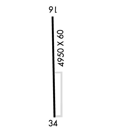
Runway Identification: 16/34Length: 4946 ft
Width: 60 ft
Surface: ASPHALT
Edge lights: Medium IntensityTreatment: NONE
| | Runway: 16 | | Runway: 34 |
| Mag heading: | N/A | Mag heading: | N/A |
| Rwy Slope: | -.57% Down | Rwy Slope: | .57% Up |
| Approach: | | Approach: | |
| Pattern: | Left Traffic | Pattern: | Left Traffic |
| Markings: | BASIC | Markings: | BASIC |
| Marking Condition: | GOOD | Marking Condition: | GOOD |
| Arresting Dev: | | Arresting Dev: | |
| Lat & Long: | N4210.6 W11217.4 | Lat. & Long.: | N4209.8 W11217.4 |
| Elev: | 4503.0 ft. MSL | Elev: | 4475.0 ft. MSL |
| TCH: | | TCH: | |
| Visual Glide Path: | | Visual Glide Path: | |
| Displaced Threshold: | No | Displaced Threshold: | No |
| Touchdown Zone: | NO | Touchdown Zone: | NO |
| Touchdown Elev.: | | Touchdown Elev.: | |
| Visual Glide Slope: | | Visual Glide Slope: | |
| RVR Equipment: | | RVR Equipment: | |
| RVV Equipment: | NO | RVV Equipment: | NO |
| Approach Lights: | | Approach Lights: | |
| REIL: | NO | REIL: | NO |
| Centerline Lights: | NO | Centerline Lights: | NO |
| Touchdown lights: | NO | Touchdown lights: | NO |
| Runway Category: | Runway with a Visual Approach | Runway Category: | Runway with a Visual Approach |
| Declared Distances: | | Declared Distances: | |
| Obstructions: | OTHER; PERMANENT +20 FT SPRINKLER LINE. | Obstructions: | PLINE |
| Marked: | NOT Marked/Lighted | Marked: | NOT Marked/Lighted |
| Clearance slope: | 35:1 | Clearance slope: | 46:1 |
| Obstruction height: | 20 feet AGL | Obstruction height: | 45 feet AGL |
| Dist. from runway: | 900 feet | Dist. from runway: | 2300 feet |
| Centerline offset: | | Centerline offset: | |
| Comments: | RWY 16 + 3 FT FENCE AT 100 FT & 180 FT ON CNTRLN; 15 FT ROAD AT 160 FT ON CNTRLN. | Comments: | +4' FENCE AT 60' ON CNTRLN; 15' ROAD AT 80' ON CNTRLN. |

