Click here for more info on on SMS!

KMHV

MOJAVE
MOJAVE
CA
Time Zone: Pacific
Lat: N 3503.5
Long: W 11809.0
Elev: 2801
Var: -14
Longest Runway: 12503
AWOS: 132.22
Ground: 123.9
Tower: 127.6

FBO & Flight Services info for KMHV

FBOs: Update your Fuel Prices

MOJAVE ARPTPh: 661-824-2433 Fax: 661-824-3341
-
Service
Jet
100LL
SAF
MoGas
Fuel Avail: PRIST+$0.05/gal. Cash discount available
Full4.575.53    Last Update: 04/07/2024 14:01

Self        
 Address: 1434 FLIGHTLINE RD   MOJAVE, CA 93501
AWOSPh: 661-824-5218
-
Freq: 132.22  
If you are an FBO, call 1-203-262-1700 to update your info or email: FltPlan.Advertising@garmin.com
Advertise your FBO on FltPlan.com

Runway & Approach Info for KMHV
Rwy
Length
Land Dist**
Approach*
  Rwy
Length
Land Dist**
Approach*
04
4747x60  4747'          
 
  
22
  4747x60  4747'          
 
08
7049x100  7049'          
 
  
26
  7049x100  7049'          
 
12
12503x200  11903'          
 
  
30
  12503x200  11603'          
 
 * only ILS, LOC, LDA, and SDF approaches to a specific runway are shown
** For any Declared Landing Distance Available, please see A/FD or Approach plates
Runway Weight Capability (lbs.) Help
Runway IDSingle WheelDouble WheelDouble Tandem WheelDual Double Wheel
04/2240,00060,00060,000N/A
08/2640,00060,00088,000N/A
12/30120,000150,000450,000N/A
These numbers are Advisory and are not limits.   The Airport Manager should have more accurate Weight Limits
Approach Charts
Approaches    
Current Weather/Notams
Customs Information Send updates to Support@FltPlan.com
Customs Not Available
Database effective 05/16/2024
Airport Diagram of KMHV
Airport Diagram might not be current.

Facility Name: MOJAVE AIR & SPACE PORT/RUTAN FLD
City Name: MOJAVE
County: KERN
State abbrev: CA
State Name: CALIFORNIA
   
Ownership: PUBLICLY OWNED
Use: OPEN TO THE PUBLIC
Owner's Name: MOJAVE AIR AND SPACE PORT
Address: 1434 FLIGHTLINE
 MOJAVE, CA 93501
Owner's Phone: 661-824-2433
  
Manager's Name: TIM REID
Address: 1434 FLIGHTLINE
 MOJAVE, CA 93501
Phone: 661-824-2433
   
FAA Region: WESTERN-PACIFIC
FAA Field Office: LAX


Sunrise / Sunset times for MOJAVE AIR & SPACE PORT/RUTAN FLD

DateSunriseSunset
04/24/24 Wednesday6:0819:33
04/25/24 Thursday6:0719:34
04/26/24 Friday6:0619:35
04/27/24 Saturday6:0519:36
04/28/24 Sunday6:0419:36
04/29/24 Monday6:0319:37
04/30/24 Tuesday6:0219:38
05/01/24 Wednesday6:0119:39
05/02/24 Thursday6:0019:40
05/03/24 Friday5:5919:41
05/04/24 Saturday5:5819:41
05/05/24 Sunday5:5719:42
05/06/24 Monday5:5619:43
05/07/24 Tuesday5:5519:44

Airport Facilities

Airport Attendance ScheduleCONTINUOUS
Airport Status OPERATIONAL (This Status can change at any time - please check NOTAMS)
Airport Lighting ScheduleACTVT REIL RWYS 12 & 30; MIRL RWYS 08/26 & 04/22; HIRL RWY 12/30 - CTAF.
Airport Storage AvailableTie Downs
Extra Services AvailableAvionics, Flight Instruction
Wind IndicatorYES - (lighted)
Control TowerYES
CTAF Frequency127.600
Unicom Frequency
Rotating Beacon ColorWG
Segmented CircleYES
Landing FeeNO

Airport Inspection Data

Airport InspectedSTATE - performed by STATE AERONAUTICAL PERSONNEL
Inspection Date05/25/2023

Airport Services

Type of Fuel AvailableGrade 100LL, JET A (freeze point -40C), JET A; -10FUEL AVBL 0700-1700, MON-SAT. OTR TIMES CTC ARPT SECURITY ON CTAF OR CALL 661-824-2434; FEE CHARGED.; -A+FUEL AVBL 0700-1700, MON-SAT. OTR TIMES CTC ARPT SECURITY ON CTAF OR CALL 661-824-2434; FEE CHARGED.
Airframe Repair ServiceMAJOR
Power Plant Repair ServiceMAJOR

Geographic Data

LatitudeN3503.5
LongitudeW11809.0 (ESTIMATED)
Arpt Elevation2801ft (SURVEYED)
Magnetic Variation14E
1 miles Eof MOJAVE
Traffic Pattern AltitudeCAT C/D & ALL TBJT ACFT TPA 4301 FT MSL (1500 FT AGL); CAT A/B ACFT TPA 3801 FT MSL (1000 FT AGL); HEL TPA 3301 FT MSL (500 FT AGL) AND USE SOUTH ENTRY AND DEP.
Sectional ChartLOS ANGELES

Aircraft Data

Operations (Reported)YearlyAvg. Daily
General Aviation Transient 971827
General Aviation Local 842623
Air Taxi 60
Commerical 330
Commuter 00
Military 31199
Aircraft based on Field
General Aviation Singles 27
General Aviation Multi 4
Jet Aircraft 15
General Aviation Helicopters 9
Military Aircraft 12
Gliders 3
Ultralights 0

FAA Services

FSS on field NO
FSS tie-in RIVERSIDE
FSS Phone 1-800-WX-BRIEF
Who issues Notams MHV
Notam D service at airport YES
ARTCC Name LOS ANGELES

Federal Status

Airport Certification
Aircraft Rescue & Firefighting IndexNone
Airport of EntryNo
Custom Landing RightsNo
Joint Civil/MilitaryNo
Military Landing rightsYES

Federal Agreements

NATIONAL PLAN OF INTEGRATED AIRPORT SYSTEMS (NPIAS)
GRANT AGREEMENTS UNDER FAAP/ADAP/AIP
SURPLUS PROPERTY AGREEMENT UNDER PUBLIC LAW 289
ASSURANCES PURSUANT TO TITLE VI, CIVIL RIGHTS ACT OF 1964
AGREEMENT UNDER DLAND OR DCLA HAS EXPIRED.

Remarks

BE ALERT TO HIGH SPEED ACTIVITY INVOF ARPT.
DUE TO RAPIDLY RISING TERRAIN AND WIND TURBINES W - NW OF ARPT, CAT C/D & ALL TURBOJET ACFT LDG RWY 8 MUST REMAIN AT OR ABOVE 4301 FT MSL UNTIL COMMENCING BASE LEG TURN AND AT OR ABOVE 3800 FT MSL UNTIL ESTABLISHED ON A 2.25 NM FINAL.
TWY F IS CLSD WEST OF TWY A.
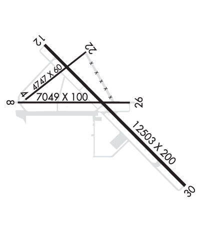
RWY 08/2 6 300 FT PAVED OVERRUN EAST END OF RY; 300 FT PAVED OVERRUN WEST END OF RY.
Airport Communications & Frequencies:
MOJAVE Tower Frequencies:   Hours(local) of operation: 0700-1700 MON-FRI   
127.6
288.35
MOJAVE Ground Frequencies:
123.9
CTAF Frequency:
127.600
Remarks
  • ATCT OWNED BY EAST KERN COUNTY & OPERATED BY BARTON ATC INC.
  • JOSHUA Primary Approach Frequencies:  
    133.65
    348.7
    JOSHUA Primary Departure Frequencies:  
    133.65
    348.7
    Runway Identifications
    Runway Identification: 04/22
    Length: 4747 ft
    Width: 60 ft
    Surface: ASPHALT
    Edge lights: Medium Intensity

    Treatment: NONE

     Runway: 04   Runway: 22
    Mag heading: 38°Mag heading: 218°
    Rwy Slope: -.02% DownRwy Slope: .02% Up
    Approach: Approach:
    Pattern: Left TrafficPattern: Right Traffic
    Markings: NONPRECISION INSTRUMENTMarkings: NONPRECISION INSTRUMENT
    Marking Condition: GOODMarking Condition: GOOD
    Arresting Dev: Arresting Dev:
    Lat & Long: N3503.6  W11809.9Lat. & Long.: N3504.1  W11809.1
    Elev: 2779.9 ft. MSLElev: 2779.1 ft. MSL
    TCH: 39 ft. AGLTCH: 40 ft. AGL
    Visual Glide Path: 4.00 degreesVisual Glide Path: 3.00 degrees
    Displaced Threshold: NoDisplaced Threshold: No
    Touchdown Zone: YESTouchdown Zone: YES
    Touchdown Elev.: 2780.0 feetTouchdown Elev.: 2780.2 feet
    Visual Glide Slope: 2-Light PAPI on LEFT side of RunwayVisual Glide Slope: 2-Light PAPI on LEFT side of Runway
    RVR Equipment: RVR Equipment:
    RVV Equipment: NORVV Equipment: NO
    Approach Lights: Approach Lights:
    REIL: NOREIL: NO
    Centerline Lights: NOCenterline Lights: NO
    Touchdown lights: NOTouchdown lights: NO
    Runway Category: Runway with a Non-precision ApproachRunway Category: Runway with a Non-precision Approach
    Declared Distances: Declared Distances:
    Obstructions: POLEObstructions:
    Marked: NOT Marked/LightedMarked:
    Clearance slope: 45:1Clearance slope: 50:1
    Obstruction height: 44 feet AGLObstruction height:
    Dist. from runway: 2200 feetDist. from runway:
    Centerline offset: Centerline offset:
    Comments: Comments:
    Runway Identification: 08/26
    Length: 7049 ft
    Width: 100 ft
    Surface: ASPHALT-GOOD CONDITION
    Edge lights: Medium Intensity

    Treatment: NONE

     Runway: 08   Runway: 26
    Mag heading: 76°Mag heading: 256°
    Rwy Slope: -.65% DownRwy Slope: .65% Up
    Approach: Approach:
    Pattern: Left TrafficPattern: Right Traffic
    Markings: NONPRECISION INSTRUMENTMarkings: NONPRECISION INSTRUMENT
    Marking Condition: GOODMarking Condition: GOOD
    Arresting Dev: Arresting Dev:
    Lat & Long: N3503.6  W11810.0Lat. & Long.: N3503.5  W11808.6
    Elev: 2780.4 ft. MSLElev: 2734.9 ft. MSL
    TCH: 55 ft. AGLTCH: 52 ft. AGL
    Visual Glide Path: 4.00 degreesVisual Glide Path: 3.00 degrees
    Displaced Threshold: NoDisplaced Threshold: No
    Touchdown Zone: YESTouchdown Zone: YES
    Touchdown Elev.: 2780.4 feetTouchdown Elev.: 2756.9 feet
    Visual Glide Slope: 2-Light PAPI on LEFT side of RunwayVisual Glide Slope: 2-Light PAPI on LEFT side of Runway
    RVR Equipment: RVR Equipment:
    RVV Equipment: NORVV Equipment: NO
    Approach Lights: Approach Lights:
    REIL: NOREIL: NO
    Centerline Lights: NOCenterline Lights: NO
    Touchdown lights: NOTouchdown lights: NO
    Runway Category: Runway with a Visual ApproachRunway Category: Runway with a Visual Approach
    Declared Distances: Declared Distances:
    Runway Identification: 12/30
    Length: 12503 ft
    Width: 200 ft
    Surface: ASPHALT
    Edge lights: High Intensity

    Treatment: NONE

     Runway: 12   Runway: 30
    Mag heading: 121°Mag heading: 301°
    Rwy Slope: -.97% DownRwy Slope: .97% Up
    Approach: Approach:
    Pattern: Left TrafficPattern: Right Traffic
    Markings: NONPRECISION INSTRUMENTMarkings: NONPRECISION INSTRUMENT
    Marking Condition: FAIRMarking Condition: FAIR
    Arresting Dev: Arresting Dev:
    Lat & Long: N3504.1  W11809.6Lat. & Long.: N3502.7  W11807.9
    Elev: 2801.3 ft. MSLElev: 2680.2 ft. MSL
    TCH: 82 ft. AGLTCH: 62 ft. AGL
    Visual Glide Path: 3.50 degreesVisual Glide Path: 3.00 degrees
    Displaced Threshold: 600 feetDisplaced Threshold: 900 feet
    Touchdown Zone: YESTouchdown Zone: YES
    Touchdown Elev.: 2794.8 feetTouchdown Elev.: 2712.3 feet
    Visual Glide Slope: 4-Light PAPI on LEFT side of Runway; PAPI UNUSBL BYD 2.5 NM.Visual Glide Slope: 4-Light PAPI on LEFT side of Runway
    RVR Equipment: RVR Equipment:
    RVV Equipment: NORVV Equipment: NO
    Approach Lights: Approach Lights:
    REIL: YESREIL: YES
    Centerline Lights: NOCenterline Lights: NO
    Touchdown lights: NOTouchdown lights: NO
    Runway Category: Runway with a Visual ApproachRunway Category: Runway with a Non-precision Approach
    Declared Distances: Declared Distances:
    Obstructions: OTHER; WIND TURBINEObstructions:
    Marked: NOT Marked/LightedMarked:
    Clearance slope: 37:1; APPROACH SLOPE 40:1 TO THE DSPLCD THR.Clearance slope: 20:1
    Obstruction height: 375 feet AGLObstruction height:
    Dist. from runway: 14400 feetDist. from runway:
    Centerline offset: 250 left of centerlineCenterline offset:
    Comments: Comments:
    C:6/P: