Current Weather/Notams (Metars, TAFs, Notams, NWS Forecast, PIREPS, and nearby weather)
Customs Information Send updates to Support@FltPlan.com
Customs Not Available
Database effective 05/16/2024
Airport Diagram might not be current.
|
| Facility Name: | MOORELAND MUNI |
| City Name: | MOORELAND |
| County: | WOODWARD |
| State abbrev: | OK |
| State Name: | OKLAHOMA |
| | |
| Ownership: | PUBLICLY OWNED |
| Use: | OPEN TO THE PUBLIC |
| Owner's Name: | CITY OF MOORELAND |
| Address: | 214 S. MAIN, PO BOX 157 |
| | MOORELAND, OK 73852 |
| Owner's Phone: | 580-994-5924 |
| | |
| Manager's Name: | BOBBY KEHN; CITY MANAGER. |
| Address: | 214 S. MAIN, PO BOX 157, PO BOX 157 |
| | MOORELAND, OK 73852 |
| Phone: | 580-994-5924 |
| | |
| FAA Region: | SOUTHWEST |
| FAA Field Office: | AOK |
Runway Identifications
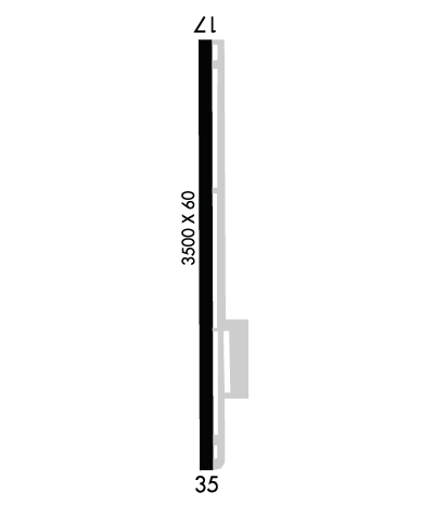
Runway Identification: 17/35Length: 3500 ft
Width: 60 ft
Surface: ASPHALT-FAIR CONDITION
Edge lights: Medium IntensityTreatment: NONE
| | Runway: 17 | | Runway: 35 |
| Mag heading: | 172° | Mag heading: | 352° |
| Rwy Slope: | -.11% Down | Rwy Slope: | .11% Up |
| Approach: | | Approach: | |
| Pattern: | Left Traffic | Pattern: | Left Traffic |
| Markings: | NONPRECISION INSTRUMENT | Markings: | NONPRECISION INSTRUMENT |
| Marking Condition: | GOOD | Marking Condition: | GOOD |
| Arresting Dev: | | Arresting Dev: | |
| Lat & Long: | N3629.4 W09911.6 | Lat. & Long.: | N3628.8 W09911.7 |
| Elev: | 1970.0 ft. MSL | Elev: | 1966.0 ft. MSL |
| TCH: | | TCH: | |
| Visual Glide Path: | | Visual Glide Path: | |
| Displaced Threshold: | No | Displaced Threshold: | No |
| Touchdown Zone: | YES | Touchdown Zone: | NO |
| Touchdown Elev.: | 1970.0 feet | Touchdown Elev.: | |
| Visual Glide Slope: | | Visual Glide Slope: | |
| RVR Equipment: | | RVR Equipment: | |
| RVV Equipment: | NO | RVV Equipment: | NO |
| Approach Lights: | | Approach Lights: | |
| REIL: | NO | REIL: | NO |
| Centerline Lights: | NO | Centerline Lights: | NO |
| Touchdown lights: | NO | Touchdown lights: | NO |
| Runway Category: | Runway with a Non-precision Approach | Runway Category: | Runway with a Visual Approach |
| Declared Distances: | | Declared Distances: | |
| Obstructions: | | Obstructions: | TREES |
| Marked: | | Marked: | NOT Marked/Lighted |
| Clearance slope: | 20:1 | Clearance slope: | 2:1 |
| Obstruction height: | | Obstruction height: | 34 feet AGL |
| Dist. from runway: | | Dist. from runway: | 288 feet |
| Centerline offset: | | Centerline offset: | 202 feet left of centerline |
| Comments: | | Comments: | 34 FT TREES 288 FT FM RWY END, 202 FT LEFT OF CNTRLN. |

