Click here for more info on on SMS!

KM95

RICHARD ARTHUR FIELD
FAYETTE
AL
Time Zone: Central
Lat: N 3342.5
Long: W 08748.9
Elev: 357
Var: +03
Longest Runway: 5009
CTAF: 122.8

FBO & Flight Services info for KM95

FBOs: Update your Fuel Prices

CITY OF FAYETTEPh: 205-275-0255
-
Freq: 122.8
Service
Jet
100LL
SAF
MoGas
Fuel Avail: Full service given during FBO operating hours.
Full        Last Update: 04/25/2024 10:57
PRICES GUARANTEED by FBO.
Self3.995.13    
 Address: 100 21ST STREET NE   FAYETTE, AL 35555
If you are an FBO, call 1-203-262-1700 to update your info or email: FltPlan.Advertising@garmin.com
Advertise your FBO on FltPlan.com

Runway & Approach Info for KM95
Rwy
Length
Land Dist**
Approach*
  Rwy
Length
Land Dist**
Approach*
01
5009x80  5009'          
 
  
19
  5009x80  5009'          
 
 * only ILS, LOC, LDA, and SDF approaches to a specific runway are shown
** For any Declared Landing Distance Available, please see A/FD or Approach plates
Runway Weight Capability (lbs.) Help
Runway IDSingle WheelDouble WheelDouble Tandem WheelDual Double Wheel
01/1915,000N/AN/AN/A
These numbers are Advisory and are not limits.   The Airport Manager should have more accurate Weight Limits
Approach Charts
Approaches    
Current Weather/Notams
Customs Information Send updates to Support@FltPlan.com
Customs Not Available
Database effective 05/16/2024
Airport Diagram of KM95
Airport Diagram might not be current.

Facility Name: RICHARD ARTHUR FLD
City Name: FAYETTE
County: FAYETTE
State abbrev: AL
State Name: ALABAMA
   
Ownership: PUBLICLY OWNED
Use: OPEN TO THE PUBLIC
Owner's Name: CITY OF FAYETTE
Address: 203 TEMPLE AVE NORTH
 FAYETTE, AL 35555
Owner's Phone: 205-932-5367
  
Manager's Name: KIP MADISON
Address: 100 21ST STREET NORTH EAST
 FAYETTE, AL 35555
Phone: 205-932-3819
   
FAA Region: SOUTHERN
FAA Field Office: JAN


Sunrise / Sunset times for RICHARD ARTHUR FLD

DateSunriseSunset
04/25/24 Thursday6:0819:31
04/26/24 Friday6:0719:31
04/27/24 Saturday6:0619:32
04/28/24 Sunday6:0519:33
04/29/24 Monday6:0419:34
04/30/24 Tuesday6:0319:34
05/01/24 Wednesday6:0219:35
05/02/24 Thursday6:0119:36
05/03/24 Friday6:0019:37
05/04/24 Saturday5:5919:37
05/05/24 Sunday5:5819:38
05/06/24 Monday5:5719:39
05/07/24 Tuesday5:5619:40
05/08/24 Wednesday5:5519:41

Airport Facilities

Airport Attendance ScheduleMON-FRI 0900-1300
Airport Status OPERATIONAL (This Status can change at any time - please check NOTAMS)
Airport Lighting ScheduleACTVT MIRL RWY 01/19; TWY LGTS - CTAF. PAPI RWY 01 & 19 OPR CONSLY.
Airport Storage AvailableTie Downs
Extra Services AvailableFlight Instruction
Wind IndicatorYES - (lighted)
Control TowerNO
CTAF Frequency122.800
Unicom Frequency122.800
Rotating Beacon ColorWG
Segmented CircleYES
Landing FeeNO

Airport Inspection Data

Airport InspectedSTATE - performed by STATE AERONAUTICAL PERSONNEL
Inspection Date10/04/2021

Airport Services

Type of Fuel AvailableGrade 100LL, JET A
Airframe Repair ServiceNone
Power Plant Repair ServiceNone

Geographic Data

LatitudeN3342.5
LongitudeW08748.9 (ESTIMATED)
Arpt Elevation357ft (SURVEYED)
Magnetic Variation03W
3 miles NEof FAYETTE
Traffic Pattern Altitude
Sectional ChartATLANTA

Aircraft Data

Operations (Reported)YearlyAvg. Daily
General Aviation Transient 1300036
General Aviation Local 23006
Air Taxi 00
Commerical 00
Commuter 00
Military 00
Aircraft based on Field
General Aviation Singles 9
General Aviation Multi 0
Jet Aircraft 0
General Aviation Helicopters 1
Military Aircraft 0
Gliders 0
Ultralights 0

FAA Services

FSS on field NO
FSS tie-in ANNISTON
FSS Phone 1-800-WX-BRIEF
Who issues Notams ANB
Notam D service at airport YES
ARTCC Name MEMPHIS

Federal Status

Airport Certification
Aircraft Rescue & Firefighting IndexNone
Airport of EntryNo
Custom Landing RightsNo
Joint Civil/MilitaryNo
Military Landing rightsYES

Federal Agreements

NATIONAL PLAN OF INTEGRATED AIRPORT SYSTEMS (NPIAS)
GRANT AGREEMENT HAS EXPIRED; HOWEVER, AGREEMENT REMAINS IN EFFECT FOR THIS FACILITY AS LONG AS IT IS PUBLIC USE.

Remarks

TWY LGTS FOR TWY TURNOFF ONLY.
DEER ON & INVOF ARPT.
FOR CD CTC COLUMBUS APCH AT 662-434-3044.
Airport Communications & Frequencies:
CTAF Frequency:
122.800
Unicom Frequency:
122.800
Remarks
  • APCH/DEP SVC PRVDD BY MEMPHIS ARTCC ON FREQS 127.1/269.4 (COLUMBUS RCAG) WHEN COLUMBUS APCH CTL CLSD.
  • COLUMBUS Primary Approach Frequencies:  
    126.075
    239.25
    COLUMBUS Primary Departure Frequencies:  
    126.075
    239.25
    Runway Identifications
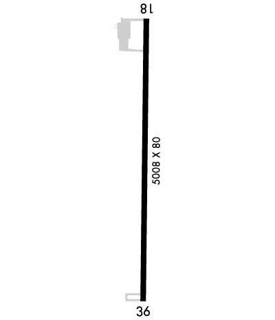
    Runway Identification: 01/19
    Length: 5009 ft
    Width: 80 ft
    Surface: ASPHALT-GOOD CONDITION
    Edge lights: Medium Intensity

    Treatment: GROOVED
    Weight: PCN 10 /F/C/X/T

     Runway: 01   Runway: 19
    Mag heading: Mag heading: 186°
    Rwy Slope: .53% UpRwy Slope: -.53% Down
    Approach: Approach:
    Pattern: Left TrafficPattern: Left Traffic
    Markings: NONPRECISION INSTRUMENTMarkings: NONPRECISION INSTRUMENT
    Marking Condition: GOODMarking Condition: GOOD
    Arresting Dev: Arresting Dev:
    Lat & Long: N3342.1  W08748.9Lat. & Long.: N3343.0  W08748.9
    Elev: 330.9 ft. MSLElev: 357.4 ft. MSL
    TCH: 45 ft. AGLTCH: 45 ft. AGL
    Visual Glide Path: 3.00 degreesVisual Glide Path: 3.00 degrees
    Displaced Threshold: NoDisplaced Threshold: No
    Touchdown Zone: YESTouchdown Zone: YES
    Touchdown Elev.: 345.9 feetTouchdown Elev.: 357.4 feet
    Visual Glide Slope: 2-Light PAPI on LEFT side of RunwayVisual Glide Slope: 2-Light PAPI on LEFT side of Runway
    RVR Equipment: RVR Equipment:
    RVV Equipment: NORVV Equipment: NO
    Approach Lights: Approach Lights:
    REIL: NOREIL: NO
    Centerline Lights: NOCenterline Lights: NO
    Touchdown lights: NOTouchdown lights: NO
    Runway Category: Runway with a Visual ApproachRunway Category: Runway with a Visual Approach
    Declared Distances: Declared Distances:
    Obstructions: TREESObstructions: TREES
    Marked: NOT Marked/LightedMarked: NOT Marked/Lighted
    Clearance slope: 30:1Clearance slope: 12:1
    Obstruction height: 33 feet AGLObstruction height: 85 feet AGL
    Dist. from runway: 1217 feetDist. from runway: 1301 feet
    Centerline offset: 187 right of centerlineCenterline offset: 191 feet left of centerline
    Comments: Comments:
    C:1/P: