
| ||||||||||||||||||||||||||||||||
| ||||||||||||||||||||||||||||||||
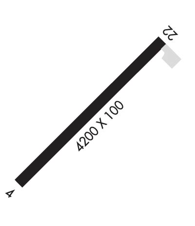
| Rwy | Rwy | |||||||
| 4200x100 | 4200' | 4200x100 | 4200' | |||||
| Runway ID | Single Wheel | Double Wheel | Double Tandem Wheel | Dual Double Wheel |
| 04/22 | 30,000 | N/A | N/A | N/A |
| These numbers are Advisory and are not limits. The Airport Manager should have more accurate Weight Limits | ||||
| FltPlan does not have IFR approach charts available for KM50. |
 Airport Diagram might not be current. | |
| Facility Name: | BOARDMAN |
| City Name: | BOARDMAN |
| County: | MORROW |
| State abbrev: | OR |
| State Name: | OREGON |
| Ownership: | PUBLICLY OWNED |
| Use: | OPEN TO THE PUBLIC |
| Owner's Name: | PORT OF MORROW |
| Address: | P.O. BOX 200 |
| BOARDMAN, OR 97818 | |
| Owner's Phone: | 541-481-7678 |
| Manager's Name: | LISA MITTELSDORF |
| Address: | PORT OF MORROW BOX 200 |
| BOARDMAN, OR 97818 | |
| Phone: | 541-481-7678 |
| FAA Region: | NORTHWEST MOUNTAIN |
| FAA Field Office: | SEA |
| Date | Sunrise | Sunset |
|---|---|---|
| 04/25/24 Thursday | 5:55 | 20:00 |
| 04/26/24 Friday | 5:53 | 20:02 |
| 04/27/24 Saturday | 5:52 | 20:03 |
| 04/28/24 Sunday | 5:50 | 20:04 |
| 04/29/24 Monday | 5:48 | 20:05 |
| 04/30/24 Tuesday | 5:47 | 20:07 |
| 05/01/24 Wednesday | 5:45 | 20:08 |
| 05/02/24 Thursday | 5:44 | 20:09 |
| 05/03/24 Friday | 5:42 | 20:10 |
| 05/04/24 Saturday | 5:41 | 20:12 |
| 05/05/24 Sunday | 5:39 | 20:13 |
| 05/06/24 Monday | 5:38 | 20:14 |
| 05/07/24 Tuesday | 5:37 | 20:16 |
| 05/08/24 Wednesday | 5:35 | 20:17 |
| Airport Attendance Schedule | UNATTENDED |
| Airport Status | OPERATIONAL (This Status can change at any time - please check NOTAMS) |
| Airport Lighting Schedule | ACTVT MIRL RY 04/22 - 122.900. |
| Airport Storage Available | Tie Downs |
| Extra Services Available | NONE |
| Wind Indicator | YES - (lighted) |
| Control Tower | NO |
| CTAF Frequency | 122.900 |
| Unicom Frequency | |
| Rotating Beacon Color | WG |
| Segmented Circle | YES; MARKED WITH WHITE TIRES. |
| Landing Fee | NO |
| Airport Inspected | STATE - performed by STATE AERONAUTICAL PERSONNEL |
| Inspection Date | 11/08/2021 |
| Type of Fuel Available | None |
| Airframe Repair Service | NONE |
| Power Plant Repair Service | NONE |
| Latitude | N4548.9 |
| Longitude | W11949.2 (ESTIMATED) |
| Arpt Elevation | 395ft (SURVEYED) |
| Magnetic Variation | 19E |
| 4 miles SW | of BOARDMAN |
| Traffic Pattern Altitude | |
| Sectional Chart | SEATTLE |
| Operations (Reported) | Yearly | Avg. Daily |
|---|---|---|
| General Aviation Transient | 1200 | 3 |
| General Aviation Local | 250 | 1 |
| Air Taxi | 50 | 0 |
| Commerical | 0 | 0 |
| Commuter | 0 | 0 |
| Military | 0 | 0 |
| Aircraft based on Field | |
|---|---|
| General Aviation Singles | 0 |
| General Aviation Multi | 0 |
| Jet Aircraft | 0 |
| General Aviation Helicopters | 0 |
| Military Aircraft | 0 |
| Gliders | 0 |
| Ultralights | 0 |
| FSS on field | NO |
| FSS tie-in | MC MINNVILLE |
| FSS Phone | 1-800-WX-BRIEF |
| Who issues Notams | MMV |
| Notam D service at airport | YES |
| ARTCC Name | SEATTLE |
| Airport Certification | |
| Aircraft Rescue & Firefighting Index | None |
| Airport of Entry | No |
| Custom Landing Rights | No |
| Joint Civil/Military | No |
| Military Landing rights | No |
| NATIONAL PLAN OF INTEGRATED AIRPORT SYSTEMS (NPIAS) |
| GRANT AGREEMENTS UNDER FAAP/ADAP/AIP |
| ASSURANCES PURSUANT TO TITLE VI, CIVIL RIGHTS ACT OF 1964 |
| THIS AIRPORT HAS BEEN SURVEYED BY THE NATIONAL GEODETIC SURVEY. |
| TELEPHONE AVBL. |
| TRIPLE PLINE RUNS EAST-WEST 3000 FT N OF ARPT. |
| TAXIWAY EDGE MARKED WITH BLUE REFLECTORS. |
| FOR CD CTC SEATTLE ARTCC AT 253-351-3694. |
| Runway: 04 | Runway: 22 | ||
| Mag heading: | 43° | Mag heading: | 223° |
| Rwy Slope: | -.70% Down | Rwy Slope: | .70% Up |
| Approach: | Approach: | ||
| Pattern: | Left Traffic | Pattern: | Right Traffic |
| Markings: | BASIC | Markings: | BASIC |
| Marking Condition: | GOOD; RWY CNTRLN IN POOR COND DUE TO FADING. | Marking Condition: | GOOD; RWY CNTRLN IN POOR COND DUE TO FADING. |
| Arresting Dev: | Arresting Dev: | ||
| Lat & Long: | N4548.7 W11949.7 | Lat. & Long.: | N4549.1 W11948.8 |
| Elev: | 395.5 ft. MSL | Elev: | 366.3 ft. MSL |
| TCH: | TCH: | ||
| Visual Glide Path: | Visual Glide Path: | ||
| Displaced Threshold: | No | Displaced Threshold: | No |
| Touchdown Zone: | YES | Touchdown Zone: | YES |
| Touchdown Elev.: | 395.5 feet | Touchdown Elev.: | 387.2 feet |
| Visual Glide Slope: | Visual Glide Slope: | ||
| RVR Equipment: | RVR Equipment: | ||
| RVV Equipment: | NO | RVV Equipment: | NO |
| Approach Lights: | Approach Lights: | ||
| REIL: | NO | REIL: | NO |
| Centerline Lights: | NO | Centerline Lights: | NO |
| Touchdown lights: | NO | Touchdown lights: | NO |
| Runway Category: | Runway with a Visual Approach | Runway Category: | Runway with a Visual Approach |
| Declared Distances: | Declared Distances: |
